Refine your search for walks in Chilly (Haute-Savoie)
Chilly (Haute-Savoie) walks


 Chilly circular loop via Curnillex
 Visorando Member
 3.84 mi
 +482 ft
 -479 ft
 2h 10
 Easy
 Departure from Chilly (Haute-Savoie) (Haute-Savoie)
This pleasant circular walk starting from Chilly allows you to explore the surrounding countryside via Curnillex. The route mainly follows paths, with lovely stretches through the forest and peaceful natural surroundings. A varied walk, ideal for enjoying the tranquillity of the countryside and discovering the landscapes of this part of Haute-Savoie.
From Clermont to the Comte farm via the hills above Seyssel
 8.86 mi
+1,755 ft
-1,759 ft
5h 35
 Moderate
Departure from Clermont (Haute-Savoie) (Haute-Savoie)
This walk takes you across the Clermont-Droisy plateau before joining the Way of St James via the heights of Seyssel overlooking the Rhône. The climb towards the Comte farm takes place through woodland.
The view over the Albanais region may not be as picturesque as that on the Rhône side, but it does allow you to make out the many villages in the area.
The Vuache from Chaumont
 4.65 mi
+1,673 ft
-1,663 ft
3h 35
Moderate
Departure from Chaumont (Haute-Savoie) (Haute-Savoie)
An easy walk with magnificent views of the Retord, Lake Geneva, Mont Blanc and the mountains around Lake Annecy.
The Plateau des Daines
 Tourist office
 4.70 mi
+942 ft
-951 ft
3h 00
Moderate
Departure from Chaumont (Haute-Savoie) (Haute-Savoie)
This moderate-difficulty circular walk takes you across the Plateau des Daines. During the walk, you’ll discover the Frangy vineyards with their iconic grape variety: the Roussette.
The Chaumont Circuit
 2.00 mi
+446 ft
-440 ft
1h 20
Easy
Departure from Chaumont (Haute-Savoie) (Haute-Savoie)
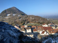
This circular walk, which winds its way along the foot of the Vuache, will introduce you to the natural (Rocher Bataillard, sharp limestone pavement, cliffs) and historical heritage of the area around Chaumont. Don’t forget to make a round trip to the ruins of Chaumont Castle and enjoy the panoramic view.
Around Bornachon
 4.36 mi
+630 ft
-640 ft
2h 35
Easy
Departure from Sillingy (Haute-Savoie)
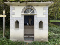
Route above Combe de Sillingy offering a 360° view of the Vuache, Bornes and Bauges mountain ranges. The Bornachon orientation table is an exceptional location for viewing all these mountain ranges.
The Marlioz Hill, from Chez les Gay to Pierre 33
6.38 mi
+909 ft
-909 ft
3h 45
Moderate
Departure from Marlioz (Haute-Savoie)
Circular walk starting from Les Usses, at the hamlet of Chez les Gay. Climb via Le Muralet, passing by Marlioz Castle, the forest and its chapel, then on to Le Sion. Arrival at Pierre 33, descent to Minzier, and return via the Route de la Forêt and the Chemin du Muralet. A fairly easy walk, even though the climbs are quite steep; the paths are passable, although sometimes muddy.
The Mont des Princes loop
 4.23 mi
+1,030 ft
-1,040 ft
2h 50
Easy
Departure from Droisy (Haute-Savoie) (Haute-Savoie)
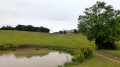
At the crossroads between Ain, Savoie and Haute-Savoie, overlooking the Val de Fier, the Albanais plain and the Rhône valley from its height of 934 metres, the Mont des Princes, a historic site of resistance against the Italian-German occupation, is a must-see in the region. Among the many existing routes, this loop starting from Droisy offers easy access and shade, with well-paved paths that are accessible in all weather conditions. On a clear day, the sweeping view of the Alps is well worth the climb.
Double circular between Droisy and Clermont
 5.15 mi
+364 ft
-390 ft
2h 40
Easy
Departure from Droisy (Haute-Savoie) (Haute-Savoie)
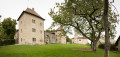
This family walk with very little elevation gain will allow you to discover the agricultural plateau of Droisy and Clermont. In addition to discovering this plateau and the various views it offers of the Jura, the Vuache and, of course, Mont Blanc, this hike is an opportunity to visit the Château de Clermont (16th century).
Vineyard Circuit in Versonnex
 5.81 mi
+692 ft
-705 ft
3h 15
Easy
Departure from Versonnex (Haute-Savoie) (Haute-Savoie)
Circuit through the Albanais countryside. It allows you to see the course of the Fier river from a south-facing hillside. In the past, vineyards were present on these south-facing terrains.
Val du Fier viewpoint from Chavanne d'en Bas
 5.02 mi
+1,617 ft
-1,637 ft
3h 45
Moderate
Departure from Val-de-Fier (Haute-Savoie)
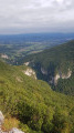
Nice looped hiking trail mostly in the undergrowth where you can see pretty views like Val du Fier's canyon, the river Rhône downstream Seyssel or the lovely ruined Saint André's chapel overlooking Albanais' plains.
Angely trails
5.61 mi
+797 ft
-823 ft
3h 15
Moderate
Departure from Vaulx (Haute-Savoie) (Haute-Savoie)
This route is an adaptation of the “Les Chemins d’Angely” trail, adding 1 km to the distance and 10 m of additional elevation gain. It offers panoramic views of all the surrounding mountain ranges: Bornes, Aravis, Bauges, Jura, Chartreuse and Belledonne, like a 360° panorama. And on a clear day, Mont Blanc watches over your entire route.
The paths of Angely
 5.15 mi
+764 ft
-748 ft
3h 00
Easy
Departure from Vaulx (Haute-Savoie) (Haute-Savoie)
An easy family walk through the valleys around the commune of Vaulx. On a clear day, Mont Blanc is omnipresent and the walk offers a wide view of most of the Savoyard massifs (Bornes, Aravis, Bauges) as well as the southern Jura (Colombier massif) and further south towards the Chartreuse and the Belledonne range.
The Mandallaz peak loop from La Balme-de-Sillingy
 4.73 mi
+1,312 ft
-1,312 ft
3h 20
Easy
Departure from La Balme-de-Sillingy (Haute-Savoie)
On the north-western edge of the Annecy conurbation and a stone's throw from the Épagny shopping area, this well-marked forest trail offers a refreshing change of scenery. From the summit, you can enjoy a magnificent view of the lake, the mountains and the Fier valley as it winds its way through the countryside.
 Route between Albanais and Vuache
37.17 mi
+3,940 ft
-3,963 ft
4 hrs
 Difficult
Departure from Sillingy (Haute-Savoie)
This route, starting from Sillingy, begins in the north of the Albanais region, passes through Copponex in the Vuache valley, then goes via the Pont de la Caille in Allonzier. The return route takes you through the village of Rossy and past its small château. This route is very hilly.
At the source of the Parnant
 Local authority
 5.07 mi
+538 ft
-535 ft
2h 50
Easy
Departure from Clarafond-Arcine (Haute-Savoie)
A lovely circular route, skirting the headwaters of the Parnant (a small tributary of the Rhône) and offering varied routes through farmland, woodland or across an ancient glacial moraine where the views are stunning.
Moderator’s note -problem in (2), see reviews 02/08/2022
Nonglard circular loop via the Champ du Loup
 5.99 mi
+653 ft
-663 ft
3h 20
Easy
Departure from Nonglard (Haute-Savoie)
A circular hike starting from the village of Nonglard, passing through the hamlets of Vaux to reach the Col d'Angely. The descent towards Sillingy offers a beautiful view of the Annecy basin and, beyond, the Aravis and Mont Blanc massifs. Le Champ du Loup is the halfway point of this hike, which then returns to Nonglard via the hamlet of Quincy.
Tower in the woods of Loye
3.01 mi
+282 ft
-256 ft
1h 40
Easy
Departure from Nonglard (Haute-Savoie)
A very family-friendly, rural hike through fields and woods. No particular difficulty. Lots of variations in the woods. Can also be done by mountain bike, but be careful as there may be fallen trees.
Beautiful views of the Montagne d'Âge, the Mandallaz and the Montagne du Gros Foug, which separates us from the Rhône valley.
Circuit des Onges from Hauteville-sur-Fier
6.73 mi
+879 ft
-860 ft
3h 50
Moderate
Departure from Hauteville-sur-Fier (Haute-Savoie)
The route passes through the countryside, following little-used paths and roads, and is extremely well signposted. You can't go wrong if you follow the signs.
Lovely view of La Tournette when arriving and leaving Vaulx (highest point of the route).
Seyssel loop
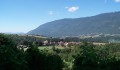 5.74 mi
+866 ft
-866 ft
3h 25
Moderate
Departure from Seyssel (Ain)
This loop allows you to enjoy the banks of the Rhône and its history linked to Seyssel. It takes you up high, through hamlets, vineyards and fields, where you can appreciate the beauty of the Rhône valley nestled between the Gros Foug mountain and Mont Colombier.
The Nant en Rhône stream trail
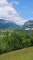 7.86 mi
+1,519 ft
-1,496 ft
4h 55
Moderate
Departure from Clarafond-Arcine (Haute-Savoie)
Featuring 16 information panels, this route introduces you to the region’s flora, fauna, geology and history.
The Chosal and Copponex loop and the Land Art circuit
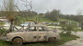 6.13 mi
+781 ft
-761 ft
3h 30
Moderate
Departure from Copponex (Haute-Savoie)
Walk starting from the Chosal farm, including the Land Art trail and its twenty or so installations in the heart of nature.
The Morennes trail in Dingy-en-Vuache
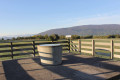 9.15 mi
+863 ft
-863 ft
5h 00
Moderate
Departure from Dingy-en-Vuache (Haute-Savoie)
Spanning four local authorities, this long circular walk allows you to explore the Pays du Vuache, a region rich in rural and natural heritage that remains well preserved.
After passing through the Bois du Mont (Chênex) and enjoying its cool shade, you’ll reach the Longues Reisses plateau, where the panoramic view stretches from the Haute-Chaîne du Jura to the Alps (orientation board). Continue your walk along the botanical trail and head towards the village of Epagny. Walk along the edge of the Vuache Massif at the end of the walk.
Motz, the sentinel of the Rhône
 4.63 mi
+1,496 ft
-1,486 ft
3h 25
Moderate
Departure from Savoie
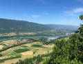
Route from the Motz leisure centre to the top of the village. Magnificent views over the Rhône from Seyssel to Chindrieux.
Château de Montrottier - Berges du Fier
1.77 mi
+210 ft
-223 ft
1h 00
Easy
Departure from Lovagny (Haute-Savoie)
Balade qui permet de découvrir le Château de Montrottier avec son architecture remarquable et son imposant donjon situé sur une colline puis les berges du Fier, de la « Pierre aux Fées » à une perte qui s'engouffre sous la roche sur quelques mètres.