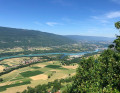
From Clermont to the Comte farm via the hills above Seyssel

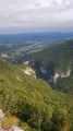
This walk takes you across the Clermont-Droisy plateau before joining the Way of St James via the heights of Seyssel overlooking the Rhône. The climb towards the Comte farm takes place through woodland.
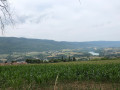
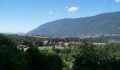
The view over the Albanais region may not be as picturesque as that on the Rhône side, but it does allow you to make out the many villages in the area.

Details

36826455
Creation:
Last update:
Last review:
  • Walking
    Activity: Walking
  • ↔
    Distance: 8.86 mi
  • ◔
    Average duration: 5h 35 
  • ▲
    Difficulty: Moderate

  • ⚐
    Back to start: Yes
  • ↗
    Ascent: + 1,755 ft
  • ↘
    Descent: - 1,759 ft

  • ▲
    Highest point: 3,051 ft
  • ▼
    Lowest point: 1,549 ft

Photos

Description of the walk

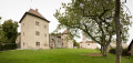
Park in the car park near Clermont Castle.

(S/E) Follow the sign for Droisy and turn right onto the Crêt de la Molière climb, which leads to the Chemin du Mont des Princes. Follow this path until you are directly beneath the power line.

(1) Keep to the right to follow the Chemin de la Verne. Turn right, pass the Barbouillon barn and continue across the plateau. A little further on, leave the Droisy country lane on your left and carry on straight ahead until you reach the junction with the Chemin des Contins.

(2) Carry on straight downhill towards Curty d’en haut. At Curty, the path joins the Chemin des Baules, which, after the water reservoir, links up with the Chemin de Saint-Jacques de Compostelle,GR®65. (Yellow shell on a blue background).

(3) Follow this path to the left along the tarmac road heading south as far as the hamlet of Chez Cudet.

(4) Turn right onto the forest track which, after crossing the D57 departmental road, leads to Romaz.

(5) Leave theGR®65, the Way of St James, and head up to the left, then follow the Chemin Rural du Chenal au Crêt, a stony track with a fairly steep gradient, until you reach a crossroads.

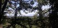
(6) Leave the stony track and take the path opposite, signposted ‘Ferme du Comte’. Pass the path signposted ‘Tour Romaine’ on your right. Climb steadily through a boxwood forest. A little further up, the boxwood gives way to pine and beech trees. You’ll reach a fork at the 864-metre mark.

(7) Do not take the path leading off to the right towards Chavanne, but follow the path to the left which climbs up to the Ferme du Comte at a Y-junction.

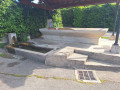
(8) Keep to the right to reach Chez Pantet, in front of the remains of the destroyed houses (see the link below). Continue along the path through the woodland to the car park on the Route des Esserts. Carry on straight ahead until you reach the junction with the Route de Droisy.

(9) Take the path opposite towards La Tuilière. Further on, cross the D57 carefully to return to the junction you passed on the way there.

(1) Turn right to reach the car park (S/E) via the reverse route of the outward journey: the Chemin du Mont des Princes, then the Montée du Crêt de la Molière.

Waypoints

  1. S/E : mi 0 - alt. 2,139 ft - Clermont Castle car park
  2. 1 : mi 0.54 - alt. 2,205 ft - Crossroads of the circular loop
  3. 2 : mi 1.53 - alt. 2,083 ft - Junction with the Chemin des Contins
  4. 3 : mi 2.28 - alt. 1,621 ft - Curty. Way of St James
  5. 4 : mi 2.73 - alt. 1,716 ft - Junction. The Way of St James towards Romaz
  6. 5 : mi 3.79 - alt. 1,581 ft - Junction. Climb towards Prairod
  7. 6 : mi 4.58 - alt. 2,126 ft - Crossroads. Path towards the Comte’s farm
  8. 7 : mi 5.17 - alt. 2,835 ft - Junction with the path to Chavanne
  9. 8 : mi 5.86 - alt. 3,051 ft - La Ferme du Comte. Fork in the path
  10. 9 : mi 7.51 - alt. 2,234 ft - Junction. Route de Droisy
  11. S/E : mi 8.86 - alt. 2,139 ft - Clermont Castle car park

Notes

After (6), the climb continues steadily through a boxwood forest infested with the box tree moth.
Don’t be surprised to see caterpillars suspended by a thread in the middle of the path.
These are the caterpillars of the box tree moth.

Worth a visit

As mentioned in (8), some explanations are provided on the website

Always be cautious and plan ahead when you're outdoors. Visorando and the author of this route cannot be held responsible for any accidents occurring on this route.

The GR® and PR® markings are the intellectual property of the Fédération Française de Randonnée Pédestre.

Reviews and comments

4.3 / 5
Based on 2 reviews

Reliability of the description
4.5 / 5
Ease of following the route
4 / 5
Route interest
4.5 / 5
User 27516266

Overall rating : 4.3 / 5

Date of your route : Sep 08, 2025
Reliability of the description : ★★★★★ Very good
Ease of following the route : ★★★★☆ Good
Route interest : ★★★★☆ Good
Very busy route : Yes

THE ITINERARY DESCRIPTION IS PERFECTLY INFORMATIVE. DO NOT CHANGE ANYTHING. BEST REGARDS.

Machine-translated

richardd
richardd

Overall rating : 4.3 / 5

Date of your route : Jun 19, 2024
Reliability of the description : ★★★★☆ Good
Ease of following the route : ★★★★☆ Good
Route interest : ★★★★★ Very good
Very busy route : Yes

A lovely walk with the vegetation’s stunning colours at this time of year, and some beautiful views.

Machine-translated

Other walks in the area

For more walks, use our search engine .

The GPS track and description are the property of this route's author. Please do not copy them without permission.