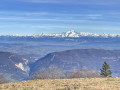
Motz, the sentinel of the Rhône

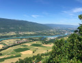
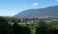
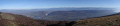
Route from the Motz leisure centre to the top of the village. Magnificent views over the Rhône from Seyssel to Chindrieux.

Details

24072474
Creation:
Last update:
Last review:
  • Walking
    Activity: Walking
  • ↔
    Distance: 4.63 mi
  • ◔
    Average duration: 3h 25 
  • ▲
    Difficulty: Moderate

  • ⚐
    Back to start: Yes
  • ↗
    Ascent: + 1,496 ft
  • ↘
    Descent: - 1,486 ft

  • ▲
    Highest point: 2,238 ft
  • ▼
    Lowest point: 833 ft

Photos

Description of the walk

Park after the Fier bridge at the Motz leisure centre near the treetop adventure course.

(S/E) From the leisure centre, cross the Route de Seyssel (D991) to take the tarmac track closed to traffic.

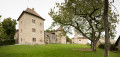
(1) Pass the entrance to Motz Castle on your left as you head towards the hamlet of Châteaufort.

(2) Turn left into Impasse des Banches and follow theGR®965as it climbs towards the village of Motz and leads to the church.

(3) Walk along the left-hand side of the church, then take the street on the right. Just before the last houses, take the path leading uphill to the left and follow theGR® to the Bossons junction. This section after the church is very steep.

(4) At Les Bossons, take the path on the left which climbs steadily and leads to a fork.

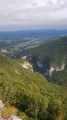
(5) Turn left onto the path leading to the viewpoint over the Rhône.

(6) Retrace your steps back to the junction.

(5) Take the path on the left again, which will lead you back to the village of Motz.

(7) Take the rather steep shortcut to reach Motz church.

(3) Follow theGR®965back along the same route you took on the way out to reach the hamlet of Châteaufort and the leisure centre (S/E).

Waypoints

  1. S/E : mi 0 - alt. 837 ft - Motz Leisure Centre - Fier (rivière)
  2. 1 : mi 0.25 - alt. 1,024 ft - Access to Motz Castle
  3. 2 : mi 0.46 - alt. 965 ft - Châteaufort
  4. 3 : mi 1.4 - alt. 1,424 ft - Motz. Church of the Assumption
  5. 4 : mi 1.72 - alt. 1,755 ft - Les Bossons
  6. 5 : mi 2.09 - alt. 2,192 ft - Junction. Return route to the headland
  7. 6 : mi 2.15 - alt. 2,156 ft - Viewpoint over the Rhône
  8. 7 : mi 2.6 - alt. 2,106 ft - Shortcut
  9. S/E : mi 4.63 - alt. 833 ft - Motz Leisure Centre - Rhône (River)

Notes

Before reaching the village of Motz, theGR® is in full sun in summer. The climb to Les Bossons is quite steep.

(3) Restaurant near the church in Motz.

Worth a visit

The leisure centre has a swimming area and a treetop adventure course featuring several zip lines running just above the water.

Always be cautious and plan ahead when you're outdoors. Visorando and the author of this route cannot be held responsible for any accidents occurring on this route.

The GR® and PR® markings are the intellectual property of the Fédération Française de Randonnée Pédestre.

Reviews and comments

4.8 / 5
Based on 2 reviews

Reliability of the description
4.5 / 5
Ease of following the route
5 / 5
Route interest
5 / 5
Dilou013
Dilou013

Overall rating : 4.7 / 5

Date of your route : Jul 30, 2024
Reliability of the description : ★★★★☆ Good
Ease of following the route : ★★★★★ Very good
Route interest : ★★★★★ Very good
Very busy route : No

Very nice outing. No major difficulties. And a beautiful viewpoint.
Good balance between road walking and undergrowth.

Machine-translated

Dilou013
Dilou013

Overall rating : 5 / 5

Date of your route : Aug 05, 2024
Reliability of the description : ★★★★★ Very good
Ease of following the route : ★★★★★ Very good
Route interest : ★★★★★ Very good
Very busy route : No

Family outing: don't be put off by a slightly steep start.

Machine-translated

Other walks in the area

For more walks, use our search engine .

The GPS track and description are the property of this route's author. Please do not copy them without permission.