Country:

 City:
City:


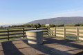
The starting point is Dingy-en-Vuache Town Hall, accessible by car (car park and welcome sign). To reach this car park from the departmental road, follow the sign for “Sentier du Vuache” (wooden arrow sign).
(S/E) From Dingy-en-Vuache town hall, head towards Les Longues Reisses (on the left when facing away from the town hall) and make your way to the few farms with a distinctly rural character at the top of the village. Take the path leading uphill at the end of the village. Note the cross at the crossroads. Worshippers regularly gather for pilgrimages around this religious symbol, which is ubiquitous in the Vuache region. Turn left at the three-way junction. Carry on until you reach the hamlet of Champs Fans. Continue straight ahead on the road (D7) until you reach a crossroads.
(1) Turn left towards Fontagny. Keep left at the next junction to reach a T-junction.
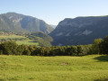
(2) Keep right, then, at the top of the hamlet of Les Plans, enjoy a lovely panoramic view of the Geneva plain, surrounded by the Salève and Jura mountain ranges. You’ll reach a crossroads in Champs Folliets.
(3) Take the track on the left, keep right at the Fork in the road, and head towards Jurens. As you pass, admire the magnificent open-air orchards planted with heritage varieties.
(4) When you reach the first houses in Jurens, turn right and head up to the water reservoir (picnic table). Then take the path on the left, which first runs along the edge of the woodland before entering the forest.
(5) After about 1.5 km through the woodland (Les Bois du Mont), turn right onto the wide track that climbs towards the plateau. At a place called Les Granges, turn right to reach Les Longues Reisses.
(6) Do feel free to take a short detour to the right to the water reservoir, where you’ll find a 360° orientation table (offering exceptional views). Continue on your way towards Dingy-en-Vuache via Murcier. At the fork in the road that appears immediately, turn left. Cross the plateau (botanical trail set within a hedge), then head back down towards Épagny.
(7) Cross the road (Route du Mont) twice before following it to the right. Cut across the next bend and carry on straight ahead to join the D34.
(8) Then follow the signposted route to the right along the road, then head down to the left into a hedge. After a right-hand bend, continue along a wide farm track (picnic table). The track leads to the hamlet of Murcier; keep going straight on at every junction.
(9) Cross through du Fornant.
(10) Turn left, join a road (D7) and follow it to the left to reach a crossroads in the village of Savigny.
(11) At the recently restored church, take the road up to the right (Route du Château), which leads to the old hamlet of Cortagy. As you pass, take a look at the remains of Savigny Castle, a massive square-shaped structure that resembles a fortified house.
On the slopes of Mount Vuache, you may spot two ‘balmes’ (caves) which, until the early 19th century, were home to brown bears. Savigny is, in fact, locally known as the ‘Land of Bears’. Continue to the third junction.
(12) Take the road on the right (Route de Cortagy) to pass through the village of the same name and its traditional farmhouses, then take the path on the right, running parallel to the road, which leads you to a place called La Maisonnette (picnic table).
(13) Then take the path on the right which winds its way through grazed meadows and farmland. At the road (Route d’Olliet), turn right and head towards the signpost for Champs Fans.
(1) Follow the route back in the opposite direction to reach Dingy-en-Vuache Town Hall (S/E).

 Local authority
 Very difficult
 Visorando Member
 Difficult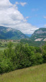
 Easy
Easy 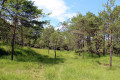
 Tourist office