Chilly circular loop via Curnillex

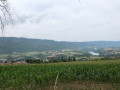
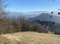
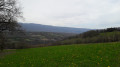
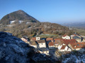
This pleasant circular walk starting from Chilly allows you to explore the surrounding countryside via Curnillex. The route mainly follows paths, with lovely stretches through the forest and peaceful natural surroundings. A varied walk, ideal for enjoying the tranquillity of the countryside and discovering the landscapes of this part of Haute-Savoie.

Details

n°111208553
Creation:
Last update:
Last review:
–
  • Walking
    Activity: Walking
  • ↔
    Distance: 3.84 mi
  • ◔
    Average duration: 2h 10 
  • ▲
    Difficulty: Easy

  • ⚐
    Back to start: Yes
  • ↗
    Ascent: + 482 ft
  • ↘
    Descent: - 479 ft

  • ▲
    Highest point: 2,073 ft
  • ▼
    Lowest point: 1,627 ft

Description of the walk

Park at the Salle des Fêtes car park in Chilly.

(S/E) Leave the car park by turning right, then turn left to follow Rue Haute. You’ll come to a junction.

(1) Take the wide path on the left and climb steadily through the woodland. You’ll reach the edge of the woods and come out onto Route du Stade.

(2) Head to the right towards the stadium.

(3) Just before you reach it, take the path on the left and continue for about 350 metres towards a wooded area. Ignore the dead-end path straight ahead and turn right. Cross the woods and reach a crossroads in open country.

(4) Turn left and carry on straight ahead until you reach a road at Curnillex.

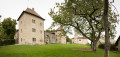
(5) Follow it to the left, negotiate the right-hand bend and then carry on straight ahead, passing a large building on your right.

(6) Leave the road by taking the path on the left.

(7) Turn left to follow the track which enters the woods and leads to the Mont buildings.

(8) Take the Route du Mont on the right at the hairpin bend and rejoin the Route du Stade.

(9) Continue to the right towards the village centre and head for the Salle des Fêtes car park (S/E).

Waypoints

  1. S/E : mi 0 - alt. 1,627 ft - Salle des Fêtes car park
  2. 1 : mi 0.26 - alt. 1,690 ft - Junction, turn left
  3. 2 : mi 0.82 - alt. 1,985 ft - Route du Stade
  4. 3 : mi 1.05 - alt. 2,018 ft - Path on the left
  5. 4 : mi 1.7 - alt. 2,054 ft - Crossroads
  6. 5 : mi 2.08 - alt. 1,775 ft - Curnillex
  7. 6 : mi 2.44 - alt. 1,719 ft - Path on the left
  8. 7 : mi 2.88 - alt. 1,749 ft - Turn left at the fork
  9. 8 : mi 3.32 - alt. 1,788 ft - Le Mont
  10. 9 : mi 3.67 - alt. 1,673 ft - Route du Stade
  11. S/E : mi 3.84 - alt. 1,627 ft - Salle des Fêtes car park

Notes

The elevation gain is around 180D+ and not 147D+

Other walks in the area

For more walks, use our search engine .

The GPS track and description are the property of this route's author. Please do not copy them without permission.