


Refine your search for walks in Blavet (fleuve)
Blavet (fleuve) walks


 Around the Abbey of Notre-Dame de Bon-Repos
 Visorando Member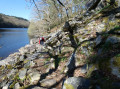
 6.92 mi
 +492 ft
 -469 ft
 3h 35
3h 35
 Moderate
 Departure from Saint-Gelven (Côtes-d'Armor)
Take a short loop around Bon Repos Abbey by following the towpath of the Nantes-Brest canal to the Bellevue lock. The hike continues on theGR®34trail, which runs along the shores of Lake Guerlédan before venturing into the countryside and returning to the abbey.
Around Hennebont and the towpath
 9.90 mi
+249 ft
-249 ft
4h 45
Moderate
Departure from Hennebont (Morbihan)
9.90 mi
+249 ft
-249 ft
4h 45
Moderate
Departure from Hennebont (Morbihan)
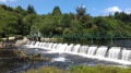
An easy loop starting from Hennebont. Pass through Saint-Antoine, Saint-Gilles, the Quelennec lock, and return to Hennebont via the towpath through Lochrist.
9/08/2023 Message from the moderator: following feedback, the hike has been modified at point 9 to avoid passing through private property.
Saint-Nicolas des Eaux circuit via Saint-Nicodème
 5.15 mi
+269 ft
-256 ft
2h 35
5.15 mi
+269 ft
-256 ft
2h 35
 Easy
Departure from Pluméliau (Morbihan)
Easy
Departure from Pluméliau (Morbihan)
The banks of the Blavet are rich in religious heritage.This circuit will take you to Saint-Nicolas des Eaux, its chapel and fountain, before continuing through the countryside to the imposing Saint-Nicodème Chapel and its four majestic fountains.Enjoy a peaceful return trip along the towpath.
Kerhervy boat cemetery circular
 8.27 mi
+318 ft
-318 ft
4h 05
Moderate
Departure from Lanester (Morbihan)
8.27 mi
+318 ft
-318 ft
4h 05
Moderate
Departure from Lanester (Morbihan)
This walk takes you along the Blavet estuary, between woodlands and salted meadows. Beautiful landscapes, fauna, flora, and a fascinating boat cemetery.
Goden Marsh and banks of the Blavet
 4.72 mi
+108 ft
-108 ft
2h 15
Easy
Departure from Lanester (Morbihan)
4.72 mi
+108 ft
-108 ft
2h 15
Easy
Departure from Lanester (Morbihan)
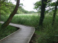
A peaceful walk on the outskirts of Lanester around the Marais de la Goden, whose banks have been developed so you can walk without getting your feet wet, then along the Ria du Ruisseau du Plessis.Pass by the little Chapel of Saint-Guénaël and its fountain, then the banks of the Blavet opposite Pen Mané Bay, where the two rivers of Lorient—the Blavet and the Scorff—meet.
Covered walkways of Liscuis and Daoulas Gorges
 3.81 mi
+472 ft
-492 ft
2h 10
Easy
Departure from Laniscat (Côtes-d'Armor)
3.81 mi
+472 ft
-492 ft
2h 10
Easy
Departure from Laniscat (Côtes-d'Armor)
A short circular walk to discover the covered alleys listed as Historic Monuments, then the Daoulas Gorges in a somewhat wild rocky environment. A complete change of scenery guaranteed. As a bonus, and for a short 1 km detour, I suggest you visit the ruins of Notre-Dame de Bon Repos Abbey.
Route des Forgerons in Inzinzac-Lochrist
 Local authority
 7.96 mi
+577 ft
-577 ft
4h 10
Moderate
Departure from Inzinzac-Lochrist (Morbihan)
7.96 mi
+577 ft
-577 ft
4h 10
Moderate
Departure from Inzinzac-Lochrist (Morbihan)
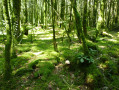
The blacksmiths' route will take you from the banks of the Blavet, which was canalised inthe 19th century, to the green hills of the Trémelin Forest. A walk in the heart of unspoilt nature, once exploited for the Kerglaw Forges, which produced iron to meet the needs of Breton canneries.
Blavet Meander Route
 3.20 mi
+210 ft
-210 ft
1h 40
Easy
Departure from Pluméliau (Morbihan)
3.20 mi
+210 ft
-210 ft
1h 40
Easy
Departure from Pluméliau (Morbihan)
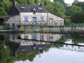
Route on the right bank of the Blavet to follow the meander formed by this river at Saint-Nicolas des Eaux.
Lake Guerlédan - Anse de Sordan - Bon Repos Abbey
 10.97 mi
+771 ft
-791 ft
5h 45
Moderate
Departure from Saint-Aignan (Morbihan) (Morbihan)
10.97 mi
+771 ft
-791 ft
5h 45
Moderate
Departure from Saint-Aignan (Morbihan) (Morbihan)
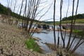
A lovely hike that allows you to discover the shores of Lake Guerlédan. Start at Anse de Sordan and walk back up to Bon Repos Abbey.
Tour of the Pen Mané marsh
1.92 mi
+10 ft
-13 ft
0h 55
Easy
Departure from Locmiquélic (Morbihan)
Short tour of the Pen Mané marsh, classified as a Special Protection Area (SPA) for birds. Bring binoculars to fully enjoy the 165 species of birds identified on the site, such as grey herons and white egrets. This short tour can easily be extended with detours and variations for those who want a longer walk.
Two-day tour of Lake Guerlédan
 22.13 mi
+1,581 ft
-1,604 ft
2 days
22.13 mi
+1,581 ft
-1,604 ft
2 days
 Difficult
Departure from Saint-Aignan (Morbihan) (Morbihan)
Difficult
Departure from Saint-Aignan (Morbihan) (Morbihan)
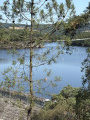
A superb hike, mostly through woodland, with magnificent views of the lake from the highest points. Some sections of the trail are quite steep – ideal for giving your thighs a good workout – but these are short stretches. Walking poles may be useful for those who find the going a bit tough. There are plenty of lodges and campsites available for an overnight stay. There are seven different starting points; check the lake’s website for details: http://www.lacdeguerledan.com/.The trail is very well signposted with ‘Sentier de Guerlédan’ signposts along the entire route and the red and white markings ofthe GR®® 341 andGR®® 37. A few paths branch off from the main trail to stay close to the lake or climb a little higher into the forest, but they always rejoin the main trail.Please note! The entire route around the lake is open from 1 March to 15 September. Outside this period, sections of the trail are closed for hunting.
Blavet towpath on the left bank
 8.63 mi
+23 ft
-23 ft
4h 00
Moderate
Departure from Pluméliau (Morbihan)
8.63 mi
+23 ft
-23 ft
4h 00
Moderate
Departure from Pluméliau (Morbihan)
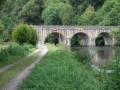
This easy route follows the meandering Blavet river along the towpath on the left bank.
Along the way, enjoy views of the Castennec escarpments, the Saint-Gildas chapel-hermitage on the other bank and three locks.
The Nantes–Brest Canal between the Guerlédan Dam and Saint-Aignan
 4.58 mi
+344 ft
-344 ft
2h 25
Easy
Departure from Mûr-de-Bretagne (Côtes-d'Armor)
4.58 mi
+344 ft
-344 ft
2h 25
Easy
Departure from Mûr-de-Bretagne (Côtes-d'Armor)
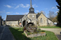
Between the Côtes-d'Armor and Morbihan. Following the Guerlédan trail, you climb up to overlook the dam built around 1930 to supply the region with electricity, then through heathland and woods, you descend to the Nantes–Brest Canal.
As you pass through the village of Saint-Aignan, you’ll come past an interesting little church and the electricity museum. Also worth seeing on the way out of the village is the small Saint-Aignan dam.
From Saint-Adrien to Sainte-Barbe in Quistinic
 9.03 mi
+751 ft
-725 ft
4h 50
Moderate
Departure from Quistinic (Morbihan)
9.03 mi
+751 ft
-725 ft
4h 50
Moderate
Departure from Quistinic (Morbihan)
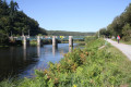
Starting from the Saint-Adrien bridge, set off to explore the eastern part of Quistinic. Head up to the heights of Lann Velin Avel, then return along the Blavet Valley. As you walk, enjoy the beauty of the lush green landscapes and the views over the river. As you wander along the paths, let yourself be surprised by the chapels, fountains, hamlets, bridges and locks… This route follows the eastern section of the Chapels Route.
Anse de Sordan - Le Mané
 10.69 mi
+883 ft
-889 ft
5h 40
Moderate
Departure from Saint-Aignan (Morbihan) (Morbihan)
10.69 mi
+883 ft
-889 ft
5h 40
Moderate
Departure from Saint-Aignan (Morbihan) (Morbihan)
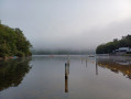
First section of the tour around Lake Guerlédan, Brittany’s largest lake. Departure from Anse de Sordan towards Le Mané, passing by the Guerlédan dam. This route follows the eastern shore of the lake.
The Hingair Route in Hennebont
 3.12 mi
+449 ft
-440 ft
1h 50
Moderate
Departure from Hennebont (Morbihan)
3.12 mi
+449 ft
-440 ft
1h 50
Moderate
Departure from Hennebont (Morbihan)
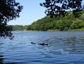
Starting from the banks of the Blavet in Saint-Caradec, walk beneath the canopy of the Bois du Hingair. Follow its wide paths and narrow forest trails, crossing the streams. Walk along the estuary and enjoy the magnificent views of the valley and the meandering river below.
The Talhouët Route in Hennebont
 4.87 mi
+236 ft
-233 ft
2h 25
Easy
Departure from Hennebont (Morbihan)
4.87 mi
+236 ft
-233 ft
2h 25
Easy
Departure from Hennebont (Morbihan)
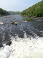
Walking the Talhouët route takes you through the heart of medieval alleyways and along the River Blavet, through woods and into Kerbihan Park, through the housing estates and into the heart of the town rebuilt after the war. These are all opportunities to discover the rich and turbulent history of Hennebont, a strategic location in the Blavet estuary.
Route des chapelles in Quistinic
 19.28 mi
+1,460 ft
-1,460 ft
10h 10
19.28 mi
+1,460 ft
-1,460 ft
10h 10
 Very difficult
Departure from Quistinic (Morbihan)
Very difficult
Departure from Quistinic (Morbihan)
Through sunken lanes and the bocage, set off to discover the history of Quistinic: its religious heritage, its villages, its bridges and its locks. Delving into the heart of the forests and moors, overlooking the Blavet Valley and following the streams, you will be enchanted by the beauty of the landscapes. A route to be enjoyed as a day trip, with a picnic.
Lake Guerlédan via the Guerlédan Dam and the Trou à Cochons
 Association / Club / Walk leader
 9.42 mi
+1,237 ft
-1,220 ft
5h 25
Moderate
Departure from Morbihan
9.42 mi
+1,237 ft
-1,220 ft
5h 25
Moderate
Departure from Morbihan
Hike on the south side of Lake Guerlédan, starting from the church of Saint-Aignan in the commune of the same name. A rather bucolic route dotted with a few farms. The route runs along the shores of the lake and through the forest surrounding it. The landscapes are therefore very varied. Numerous paths allow you to diversify the route.
From Saint-Rivalain station to Saint-Bathélemy and the Blavet towpath
 7.10 mi
+344 ft
-351 ft
3h 35
Moderate
Departure from Melrand (Morbihan)
7.10 mi
+344 ft
-351 ft
3h 35
Moderate
Departure from Melrand (Morbihan)
A straightforward route that weaves in and out of the narrow railway line, which is still used by a few goods trains carrying plant-based raw materials between Auray and Pontivy.
A leisurely return via the towpath.
Please note: the walk takes place in the commune of Saint-Barthélémy and not in Melrand, as indicated by the software.
Route from the Kerhervy ship graveyard to Lanester
 8.99 mi
+344 ft
-325 ft
4h 25
Moderate
Departure from Lanester (Morbihan)
8.99 mi
+344 ft
-325 ft
4h 25
Moderate
Departure from Lanester (Morbihan)
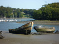
Explore the Blavet estuary, with its magnificent landscapes shaped by the sea. Discover the flora and fauna of the woodlands and salt meadows, as well as the historical heritage, including bridges, chapels and fountains… Lose yourself in reverie as you gaze upon the fascinating ship graveyard, with its old Groix tuna boats and their masts abandoned after 1945 in Kerhervy Cove.
Route from Poul Fetan to Quistinic
 8.28 mi
+732 ft
-712 ft
4h 25
Moderate
Departure from Quistinic (Morbihan)
8.28 mi
+732 ft
-712 ft
4h 25
Moderate
Departure from Quistinic (Morbihan)
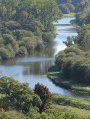
This route, winding through steep-sided valleys and passing through villages, will enchant you with the diversity of its landscapes. Stroll along extraordinary sunken paths shaded by centuries-old beech trees. From Poul Fetan to the Blavet, let the history of rural life—etched into the stone, houses, barns, wells, bread ovens and mills—unfold before you. On your return, in the warmer months, head to Poul Fetan and immerse yourself in village life as it was in 1850.
Circular route around the Étang de Kerné Uhel via the Chaos de Toul Goulic
10.21 mi
+302 ft
-292 ft
4h 55
Moderate
Departure from Lanrivain (Côtes-d'Armor)
A lovely circular route around the Étang de Kerné Uhel along the left bank of the Blavet, then along the river through the Chaos de Toul Goulic. The return route, following a pretty stream, will take you back to the hydroelectric dam, then along the right bank, round the Goz-ar Hand peninsula before reaching the bridge and the car park. You’ll also have the pleasure of spotting a wide variety of birds and many remarkable trees.
⚠️15/09/2026: Route modified between points 6 and 8.
Le Mané - Anse de Sordan
11.43 mi
+702 ft
-712 ft
5h 50
Moderate
Departure from Caurel (Côtes-d'Armor)
The second part of the tour of Lake Guerlédan, the most physically demanding, particularly at the start. Departure from Le Manet towards Anse de Sordan, passing by the former Abbey of Notre-Dame de Bon Repos. Return route via the western side of the lake.
Route de Castennec in Pluméliau-Bieuzy
 Tourist office7.33 mi
+761 ft
-735 ft
4h 00
Difficult
Departure from Pluméliau (Morbihan)
Tourist office7.33 mi
+761 ft
-735 ft
4h 00
Difficult
Departure from Pluméliau (Morbihan)
A cultural and nature trail where you can admire the Saint-Gildas Chapel, nestled beneath a rock formation, as well as the church and fountain at Bieuzy, both listed as Historic Monuments.
The Bay of Lorient on foot and by water bus
 9.69 mi
+30 ft
-30 ft
4h 30
Moderate
Departure from Lorient (Morbihan)
9.69 mi
+30 ft
-30 ft
4h 30
Moderate
Departure from Lorient (Morbihan)
This hike combines walking (12 km) and water bus crossings. Board the boat to Pen Mané and follow the coastal path to the ramparts of Port Louis. Board the boat again to reach Keroman and walk through the streets of Lorient to Quai des Indes.
Remember to check the water bus timetable in advance (see the link in the practical information section).
You will be hiking through natural and private sites. Stay on the marked paths and respect nature, facilities and cultivated land. For your comfort and safety, make sure you have the appropriate hiking equipment.
 From Hennebont to Pontivy via the towpath
36.87 mi
+233 ft
-85 ft
3 hrs
Moderate
Departure from Hennebont (Morbihan)
Or how to take a leisurely trip from Hennebont to Pontivy? There are a few sections with cars and lots of pedestrians at the start and finish, but otherwise it's just hikers and cyclists. It's a peaceful route for walking or cycling.The landscape changes as you follow the river, making this a peaceful walk, but it can be challenging: 60 km there (and possibly the same back).Here and there, you will find places to quench your thirst and eat, but make sure you take everything you need with you. Enjoy the peace and quiet and the countryside.
Guerlédan Lake and Dam
 3.17 mi
+433 ft
-420 ft
1h 50
Moderate
Departure from Mûr-de-Bretagne (Côtes-d'Armor)
3.17 mi
+433 ft
-420 ft
1h 50
Moderate
Departure from Mûr-de-Bretagne (Côtes-d'Armor)
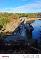
Starting from the Mileade centre, this hike will take you along Lake Guerlédan to the dam. On the way back, you can take a break at the leisure centre before crossing the Bois Cornec.
The Petit Rivalain route
2.56 mi
+115 ft
-115 ft
1h 15
Easy
Departure from Saint-Barthélemy (Morbihan) (Morbihan)
A pleasant little family route, ideal for a leisurely stroll. The route takes you through farmland, past a farm and a small hamlet, and, best of all, offers a lovely walk along the River Blavet. Things to see: a lock, a lock-keeper’s house and peaceful countryside. A route accessible from the stop on the tourist train, the Napoléon Express. Collect postcards along the way using the Bavar[t] app!
Route from Saint-Rivalain to Saint-Adrien
7.76 mi
+285 ft
-299 ft
3h 50
Moderate
Departure from Saint-Barthélemy (Morbihan) (Morbihan)
A walk that will take you through granite villages, sunken paths and mysterious fountains. You’ll follow largely the same route as the Circuit des Écureuils, passing by the Chapel of Saint-Adrien, the Guervaud Stream, the hamlet of Tréblavet and the Fountain of Saint-Fiacre, before returning to the starting point.
Rimaison route
12.83 mi
+1,063 ft
-1,060 ft
6h 50
Difficult
Departure from Bieuzy (Morbihan)
A cultural and nature trail where you can admire theSaint-GildasChapel, nestled beneath a rock formation, as well as the church and fountain at Bieuzy, both of which are listed as Historic Monuments.
The Méandre route in Saint-Nicolas-des-Eaux
 2.79 mi
+203 ft
-203 ft
1h 30
Easy
Departure from Pluméliau (Morbihan)
2.79 mi
+203 ft
-203 ft
1h 30
Easy
Departure from Pluméliau (Morbihan)
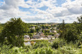
A signposted circular walk starting from the Promenade des Estivants in Saint-Nicolas-des-Eaux. Through woodland and along the banks of the Blavet, discover the cultural and natural heritage of the area around the Saint-Nicolas-des-Eaux meander, the Castennec hill and the Blavet.
Tour of Pontivy
 3.38 mi
+52 ft
-52 ft
1h 35
Easy
Departure from Pontivy (Morbihan)
3.38 mi
+52 ft
-52 ft
1h 35
Easy
Departure from Pontivy (Morbihan)
A walk to explore Pontivy. It takes in the archaeological site, the castle and the Clisson district, as well as the old town, not forgetting the Nantes–Brest Canal.
The V45 cycle route from Guidel to Riantec
52.97 mi
+249 ft
-213 ft
2 days
Difficult
Departure from Riantec (Morbihan)
The V45 cycle route between Guidel and Riantec.
Pass through the towns of Guidel, Ploemeur, Larmor, Lorient, Locmiquelic, Port-Louis and Riantec on a route marked with cycle route signs. Enjoy the coastal landscapes and town centres along the way.
Lorient - Languidic
21.41 mi
+256 ft
-233 ft
5 hrs
Moderate
Departure from Lorient (Morbihan)
From the Bay of Lorient to the Bay of Saint-Brieuc, Cycle Route 8 (188 km) crosses the Breton countryside on towpaths and peaceful little roads lined with water points.
The V8 first follows shared paths, passing through pretty residential neighbourhoods in the city, then through the countryside, before reaching the Blavet towpath, which meanders between the wooded hills of a green valley. Route 8 then continues along the quiet and winding Hilvern canal, which has been converted into a greenway, to join the Nantes-Brest stream at Allineuc.
Guidel - Riantec
27.31 mi
+144 ft
-98 ft
5 hrs
Difficult
Departure from Guidel (Morbihan)
Pass through the towns of Guidel, Ploemeur, Larmor, Lorient, Locmiquelic, Port-Louis and Riantec on a route marked with cycle route signs. Enjoy the coastal landscapes and town centres along the way.
Between harbour, land and marshland in Locmiquélic
8.79 mi
+135 ft
-135 ft
4h 10
Moderate
Departure from Locmiquélic (Morbihan)
Starting from the pier, you will cross the quiet streets of Locmiquélic to the Pointe du Bigot with its panoramic view of the Lorient harbour and the mudflats that are revealed at low tide. The rest of the route will take you to the old imperial road and the villages near the Blavet. You will finish this circular loop by walking through the Pen Mané marsh, a true haven of peace for wildlife.
Between harbour, land and marshland in Locmiquélic
 8.58 mi
+135 ft
-138 ft
4h 05
Moderate
Departure from Locmiquélic (Morbihan)
8.58 mi
+135 ft
-138 ft
4h 05
Moderate
Departure from Locmiquélic (Morbihan)
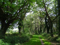
Starting from the pier, you will cross the quiet streets of Locmiquelic to the Pointe du Bigot with its panoramic view of the Lorient harbour and the mudflats that are revealed at low tide. The rest of the route will take you to the old imperial road and the villages near the Blavet. You will finish this circular loop by walking through the Pen Mané marsh, a true haven of peace for wildlife.
The estuaries from Lorient to Locmiquélic
 11.91 mi
+318 ft
-305 ft
5h 45
Difficult
Departure from Lorient (Morbihan)
11.91 mi
+318 ft
-305 ft
5h 45
Difficult
Departure from Lorient (Morbihan)
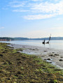
Discover the natural and built heritage of Lorient harbour along the GR®34. From the historic port of Lorient, you will walk along the Scorff before reaching the Blavet estuary, which offers beautiful views of the maritime landscape.
The walking loop ends at the Pen Mané pier in Locmiquélic. A water bus will take you back to your starting point in Lorient in 8 minutes. Remember to check the water bus timetable in advance.
You will be walking through natural and private sites. Stay on the marked paths and respect nature, facilities and cultivated land. For your comfort and safety, make sure you have the appropriate hiking equipment.