


Refine your search for walks in Beaumont-de-Pertuis
Beaumont-de-Pertuis walks


 Circular walk between Beaumont-de-Pertuis and La Bastide-des-Jourdans
 Visorando Member
 12.22 mi
 +1,273 ft
 -1,270 ft
 6h 45
6h 45
 Moderate
 Departure from Beaumont-de-Pertuis (Vaucluse)
A circular walk between Beaumont-de-Pertuis and La Bastide-des-Jourdans, winding through forests and vineyards. Make the most of it by visiting these two beautiful villages with their chapels, castle and fountains.
Circular route on the summit of Les Plaines in Mirabeau
 4.31 mi
+430 ft
-430 ft
2h 20
Moderate
Departure from Mirabeau (Vaucluse) (Vaucluse)
4.31 mi
+430 ft
-430 ft
2h 20
Moderate
Departure from Mirabeau (Vaucluse) (Vaucluse)
A lovely walk along a wide, pleasant track, with a climb offering unobstructed views of the plateau and a descent in the shade of the woods.
Around and on the Éburettes
 4.60 mi
+509 ft
-505 ft
2h 35
Moderate
Departure from Mirabeau (Vaucluse) (Vaucluse)
4.60 mi
+509 ft
-505 ft
2h 35
Moderate
Departure from Mirabeau (Vaucluse) (Vaucluse)
A short walk offering a variety of atmospheres, terrain and views.
Between Mirabeau and Beaumont-de-Pertuis
 7.99 mi
+1,276 ft
-1,276 ft
4h 45
Moderate
Departure from Mirabeau (Vaucluse) (Vaucluse)
7.99 mi
+1,276 ft
-1,276 ft
4h 45
Moderate
Departure from Mirabeau (Vaucluse) (Vaucluse)
From Mirabeau to Beaumont de Pertuis, between hills and descents, towards the Sainte Croix chapel and Notre Dame de Beauvoir.
The "tiny ochres" of Mirabeau
 3.45 mi
+495 ft
-492 ft
2h 00
3.45 mi
+495 ft
-492 ft
2h 00
 Easy
Departure from Mirabeau (Vaucluse) (Vaucluse)
Easy
Departure from Mirabeau (Vaucluse) (Vaucluse)
A walk in the hills and a scramble across a small area of orange sand.
From Mirabeau to the Mirabeau Bridge
 6.08 mi
+587 ft
-584 ft
3h 20
Easy
Departure from Mirabeau (Vaucluse) (Vaucluse)
6.08 mi
+587 ft
-584 ft
3h 20
Easy
Departure from Mirabeau (Vaucluse) (Vaucluse)
Family hike from the small Provençal village of Mirabeau to the pillars of the old suspension bridge over the Durance. Large car park at the entrance to the village.
The Mirabeau Botanical Trail
 3.74 mi
+531 ft
-558 ft
2h 10
Moderate
Departure from Mirabeau (Vaucluse) (Vaucluse)
3.74 mi
+531 ft
-558 ft
2h 10
Moderate
Departure from Mirabeau (Vaucluse) (Vaucluse)
This is a beautiful walk starting from the village where many scenes from the films Jean de Florette and Manon des Sources were shot. You can rediscover the plants of our hills by looking for the signs at the foot of the plants.
The path is poorly maintained, but the view of the Durance, the village and the Château de Mirabeau are well worth the walk.
The Saint-Sépulcre circular route starting from the Mirabeau Bridge
 6.96 mi
+1,270 ft
-1,273 ft
4h 20
6.96 mi
+1,270 ft
-1,273 ft
4h 20
 Difficult
Departure from Mirabeau (Vaucluse) (Vaucluse)
Difficult
Departure from Mirabeau (Vaucluse) (Vaucluse)
A circular route for mapping the terrain in a little-visited area.
Best done in the opposite direction.
Trou du Loup and Ravin de Bernadine, with return via La Bosse
 5.27 mi
+902 ft
-896 ft
3h 10
Easy
Departure from Corbières (Alpes-de-Haute-Provence)
5.27 mi
+902 ft
-896 ft
3h 10
Easy
Departure from Corbières (Alpes-de-Haute-Provence)
An easy loop starting from Corbières, with the Torrent de Corbières gorges and the Trou du Loup. The start of the walk offers a glimpse of the gorge on a gently ascending path, with very cool spots and a wide variety of flora. The Ravin de Bernadine has the same atmosphere but with a torrent that is often dry. The climb to La Bosse and the descent on the way back take you through scrubland typical of the Luberon. A pleasant way to discover the hills and scrubland of the Luberon.
Le Trou du Loup via the cairn
 8.25 mi
+650 ft
-640 ft
4h 20
Easy
Departure from Corbières (Alpes-de-Haute-Provence)
8.25 mi
+650 ft
-640 ft
4h 20
Easy
Departure from Corbières (Alpes-de-Haute-Provence)
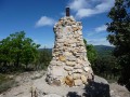
This is a pleasant hike with a visit to the Chapelle Saint Brice, another to the cairn built here for the 20th anniversary of the Sainte Tulle Hiking Club, and finally the Trou du Loup reservoir.
Vallée sous les Sarrasins and back via the Chapelle Saint-Brice
 2.51 mi
+492 ft
-489 ft
1h 35
Easy
Departure from Corbières (Alpes-de-Haute-Provence)
2.51 mi
+492 ft
-489 ft
1h 35
Easy
Departure from Corbières (Alpes-de-Haute-Provence)
An easy walk: after a short stroll through Corbières, we’ll follow the valley along the hillside, returning via the Saint-Brice Chapel.
A circular walk starting from the Mirabeau bridge
 12.59 mi
+1,437 ft
-1,437 ft
7h 00
Difficult
Departure from Jouques (Bouches-du-Rhône)
12.59 mi
+1,437 ft
-1,437 ft
7h 00
Difficult
Departure from Jouques (Bouches-du-Rhône)
This circular walk, starting from the Mirabeau Bridge, takes in:
- the Chapel of Sainte-Madeleine,
- the Chapel of the Heath and its statue of the Virgin Mary,
- Mirabeau with its fountain, church and castle,
- a path overlooking the village of Beaumont-en-Pertuis,
- the Chapel of Sainte-Croix and its viewpoints.
A circular walk between La Bastide-des-Jourdans and Vitrolles-en-Lubéron
 13.63 mi
+1,608 ft
-1,604 ft
7h 40
Difficult
Departure from La Bastide-des-Jourdans (Vaucluse)
13.63 mi
+1,608 ft
-1,604 ft
7h 40
Difficult
Departure from La Bastide-des-Jourdans (Vaucluse)
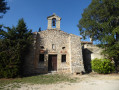
A circular walk starting from La Bastide-des-Jourdans towards Vitrolles-en-Lubéron, mostly through woodland. A stroll through the pretty village of Vitrolles-en-Lubéron and, on the way back, views of the surroundings of La Bastide-des-Jourdans.
Les small passes du Luberon Est
 11.14 mi
+1,772 ft
-1,781 ft
6h 40
Difficult
Departure from La Bastide-des-Jourdans (Vaucluse)
11.14 mi
+1,772 ft
-1,781 ft
6h 40
Difficult
Departure from La Bastide-des-Jourdans (Vaucluse)
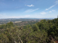
Hike in the eastern foothills of the Luberon between La Bastide-des-Jourdans and Vitrolles-en-Luberon.
Extended version of the small passes of Luberon East
 13.26 mi
+1,995 ft
-2,005 ft
7h 50
Difficult
Departure from La Bastide-des-Jourdans (Vaucluse)
13.26 mi
+1,995 ft
-2,005 ft
7h 50
Difficult
Departure from La Bastide-des-Jourdans (Vaucluse)
An easy circular walk in the eastern part of the Luberon between La Bastide des Jourdans and Vitrolles-en-Luberon, offering magnificent views over the Vaucluse hills and the Montagne de Lure. The vegetation is varied. The village of Vitrolles-en-Luberon is magnificent.
An extended version of a route published by pbrion (many thanks!) See § During the walk or nearby.
A circular walk around Saint-Paul-lès-Durance
 11.19 mi
+820 ft
-840 ft
5h 50
Difficult
Departure from Saint-Paul-lès-Durance (Bouches-du-Rhône)
11.19 mi
+820 ft
-840 ft
5h 50
Difficult
Departure from Saint-Paul-lès-Durance (Bouches-du-Rhône)
A circular walk starting from La Castellane, above Saint-Paul-lès-Durance.
Descent towards the village alongside the Abeou stream, passing the orientation table for views of the village and the Durance valley.
Climb up into the mountains along a track. On the plateau, walk through the vineyards and along a road lined with pruned trees, taking a detour to a memorial stone.
Descend along a path towards the Mirabeau Bridge.
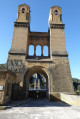
At the bridge, enjoy the view of the piers of the old bridge, the River Durance and the Sainte-Madeleine Chapel.
In the Pays d'Aigues: from Grambois to La Bastide-des-Jourdans
 9.34 mi
+1,358 ft
-1,365 ft
5h 30
Moderate
Departure from Grambois (Vaucluse)
9.34 mi
+1,358 ft
-1,365 ft
5h 30
Moderate
Departure from Grambois (Vaucluse)
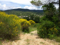
A walk through the Provençal countryside in the magnificent landscapes of the Luberon Regional Nature Park. This route, linking two typical villages in the Pays d'Aigues, follows unmarked paths, often through woodland and away from any traffic.
The landscapes are varied and reflect the richness of the flora and a past that can be glimpsed.
Please note: follow the directions carefully; using a GPS device can provide additional safety.
Circular route from Saint-Patrice Chapel, starting from Pierrevert
 3.80 mi
+217 ft
-213 ft
1h 55
Easy
Departure from Pierrevert (Alpes-de-Haute-Provence)
3.80 mi
+217 ft
-213 ft
1h 55
Easy
Departure from Pierrevert (Alpes-de-Haute-Provence)
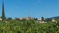
A pleasant and varied walk, often shaded, starting from Pierrevert.
The Vautubière mountain
 5.55 mi
+896 ft
-909 ft
3h 20
Easy
Departure from Jouques (Bouches-du-Rhône)
5.55 mi
+896 ft
-909 ft
3h 20
Easy
Departure from Jouques (Bouches-du-Rhône)
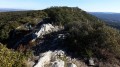
Despite a slight elevation gain, this is a scenic hike with 360° views of the Luberon and, behind, Mont Ventoux, the Lure mountain, the upper and lower Verdon, and the Dévoluy. On the other side, you can see Sainte-Victoire, Sainte-Baume, and Mont Olympe.
Circular around the Plateau de Bèdes via Jouques
 4.61 mi
+509 ft
-509 ft
2h 35
Moderate
Departure from Jouques (Bouches-du-Rhône)
4.61 mi
+509 ft
-509 ft
2h 35
Moderate
Departure from Jouques (Bouches-du-Rhône)
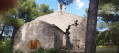
Circular starting from the hamlet of Bèdes, across the plateau, passing by Notre-Dame de Consolation. Beautiful panoramic views of the Durance, the Vautubière and the Peyrolles gravel pits.
No particular difficulty, between sandy (ochre) paths, tarmac and a few rocky passages.
From Montfuron to Villemus
 4.58 mi
+512 ft
-509 ft
2h 35
Easy
Departure from Montfuron (Alpes-de-Haute-Provence)
4.58 mi
+512 ft
-509 ft
2h 35
Easy
Departure from Montfuron (Alpes-de-Haute-Provence)
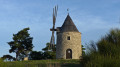
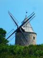
A walk between two small hilltop villages in the Luberon: Montfuron, with its castle and windmill, and Villemus, with its 12th-century chapel and paved slanting streets.
Montfuron to Villemus circular – long version
 7.38 mi
+968 ft
-971 ft
4h 15
Moderate
Departure from Montfuron (Alpes-de-Haute-Provence)
7.38 mi
+968 ft
-971 ft
4h 15
Moderate
Departure from Montfuron (Alpes-de-Haute-Provence)
Whilst Montfuron and Villemus are already featured on Visorando, here is a longer circular route that incorporates a different version of the signposted route as you leave Villemus, and a detour via the ruins of the old plaster mill.Don’t be surprised if you see a large dog wandering along the paths around Villemus. He’s peaceful and harmless. He’s (most likely) the one from Café Restaurant Les Tilleuls.
From Vitrolles to Céreste via Montjustin
 9.01 mi
+915 ft
-1,312 ft
4h 55
Moderate
Departure from Vitrolles-en-Lubéron (Vaucluse)
9.01 mi
+915 ft
-1,312 ft
4h 55
Moderate
Departure from Vitrolles-en-Lubéron (Vaucluse)
The third stage is the shortest of this route. After a very pleasant walk along a track at the foot of wooded hills, we take a narrow path that allows us to cross from the southern to the northern side of the massif. We then climb up to the pretty village of Montjustin, before descending via a ridge offering superb views.
From Vitrolles-en-Lubéron to Oppedette
 16.74 mi
+2,434 ft
-2,405 ft
9h 50
Difficult
Departure from Vitrolles-en-Lubéron (Vaucluse)
16.74 mi
+2,434 ft
-2,405 ft
9h 50
Difficult
Departure from Vitrolles-en-Lubéron (Vaucluse)
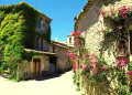
This fourth stage begins with a route halfway up the wooded slope of the Vallat de Pissaire before entering the Ravin du Gancet and then crossing the Aiguebelle valley to reach the hilltop village of Montjustin. The route follows the ridge of the hill separating this valley from that of the Encrême and descends to reach Céreste, situated at their confluence. It crosses the remarkable Pont de la Baou before revealing, nestled in the woods, the medieval Priory of Carluc. It climbs the side of the valley and swings over to that of the Grand Vallat, then ascends its sunny slope towards Sainte-Croix-à-Lauze, from where it reaches the top of the Cavalon valley before descending it to reach the village of Oppedette.
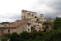
Discovering the heritage of La Bastide-des-Jourdans from Vitrolles
 9.98 mi
+1,332 ft
-1,342 ft
5h 45
Moderate
Departure from Vitrolles-en-Lubéron (Vaucluse)
9.98 mi
+1,332 ft
-1,342 ft
5h 45
Moderate
Departure from Vitrolles-en-Lubéron (Vaucluse)
A hike with two circular loops, combining pleasant forest trails with a stroll through the narrow streets of La Bastide-des-Jourdans to discover its rich heritage: ancient gate, fountain column, church, old castle, tower,...
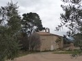
Toutes Aures circular loop
 3.73 mi
+400 ft
-400 ft
2h 05
Easy
Departure from Manosque (Alpes-de-Haute-Provence)
3.73 mi
+400 ft
-400 ft
2h 05
Easy
Departure from Manosque (Alpes-de-Haute-Provence)
This easy circular walk is used by hikers from Manosque after a rainy day to avoid the mud. The destination is the Chapelle Toutes Aures chapel, nestled in a field of olive trees.
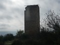
Mont d'Or
 3.67 mi
+620 ft
-607 ft
2h 15
Easy
Departure from Manosque (Alpes-de-Haute-Provence)
3.67 mi
+620 ft
-607 ft
2h 15
Easy
Departure from Manosque (Alpes-de-Haute-Provence)
The Tour du Mont d'Or is the remains of an ancient watchtower. It is located on a hill surrounded by olive groves and can be seen from far away when you arrive in Manosque.
The Balconies of Manosque: the Thomassine Water Trail
 5.90 mi
+938 ft
-909 ft
3h 30
Easy
Departure from Manosque (Alpes-de-Haute-Provence)
5.90 mi
+938 ft
-909 ft
3h 30
Easy
Departure from Manosque (Alpes-de-Haute-Provence)
"Les Balcons de Manosque" is the title of a series of walks organised by the Manosque Heritage Committee (CPM) that allow visitors to discover the town’s heritage “beyond the walls”.
This first route broadly follows the Thomassine watercourse, one of the springs that once supplied Manosque. The route includes the remains of an aqueduct, a sulphurous spring, a 15th-century bridge, animal footprints dating back 30 million years, an asphalt mine and a water mine.
From Aire des Mascas to Coteau de la Combe and back via Vallon des Roumis
6.86 mi
+1,302 ft
-1,312 ft
4h 15
Moderate
Departure from Vitrolles-en-Lubéron (Vaucluse)
A lovely hike along the Luberon ridges, often through woodland with views on both sides. Views of the Pre-Alps and the Vaucluse mountains during the first part and of the Aigues valley and the Durance valley and beyond, weather permitting. A few kilometres on the DFCI track overlooking the valleys, but the view is well worth it.
The first 1,000 metres of the Grand Lubéron on the eastern side
 7.17 mi
+1,417 ft
-1,421 ft
4h 30
Moderate
Departure from Céreste (Alpes-de-Haute-Provence)
7.17 mi
+1,417 ft
-1,421 ft
4h 30
Moderate
Departure from Céreste (Alpes-de-Haute-Provence)
The Luberon massif, whether the ‘small’ or ‘large’ Luberon, is mainly forested.It is only from an altitude of 1,000 metres that the forest gives way to open areas offering a 360° panoramic view of the entire region, provided you are on the ridge.Starting from the Col de l’Aire Deï Masco at 700 m, between Céreste-en-Lubéron and Vitrolles-en-Lubéron, the route heads westwards to tackle the first two peaks of the Grand Lubéron, both over 1,000 m in altitude. From there, the view is magnificent, both to the south and to the north.As an added bonus, there’s the signal at the summit of Mourre Nègre on the western side.Whilst the climb along the GR® on the way out may leave you feeling there’s no hope of ever making it, the reward is complete after just 4 km.On the return journey, the suggested route follows the track, which is easy, open and offers some lovely views to the south at the start of the descent.The fittest walkers will probably not hesitate to continue along the ridge to Mourre Nègre… but not on a scorching hot day!
More walks in Beaumont-de-Pertuis
Select a point of interest below: