A circular walk starting from the Mirabeau bridge

This circular walk, starting from the Mirabeau Bridge, takes in:
- the Chapel of Sainte-Madeleine,
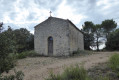
- the Chapel of the Heath and its statue of the Virgin Mary,
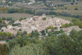
- Mirabeau with its fountain, church and castle,
- a path overlooking the village of Beaumont-en-Pertuis,
- the Chapel of Sainte-Croix and its viewpoints.

Details

1040749
Creation:
Last update:
Last review:
  • Walking
    Activity: Walking
  • ↔
    Distance: 12.59 mi
  • ◔
    Average duration: 7h 00 
  • ▲
    Difficulty: Difficult

  • ⚐
    Back to start: Yes
  • ↗
    Ascent: + 1,437 ft
  • ↘
    Descent: - 1,437 ft

  • ▲
    Highest point: 1,709 ft
  • ▼
    Lowest point: 755 ft
  • ⚐ Country: France
  • ⚐
    Area: Luberon
  • ⚐ City: Jouques (13490)
  • ⚑
    Start/End: N 43.689318° / E 5.668359°
  • ❏
    IGN map(s): Ref. 3243OT, 3244ET, 3342OT
  • Hour-by-hour weather

Photos

Description of the walk

Park on the D952 coming from Saint-Paul-lès-Durance, in the car park next to the pier of the old Mirabeau bridge.

(S/E) Cross the bridge over the Durance using the right-hand footpath, then walk alongside the road.
At the first car park, turn right to reach the Sainte-Madeleine Chapel. After your visit, return to the car park, cross the road and turn right. Caution: traffic.
Walk along the road, cross over the railway line to reach a small car park at the Baume signpost.

(1) Take the track on the left towards Mirabeau, follow the signposts and continue straight on. At the junction of two small roads, continue straight on, passing over a children’s playground.

(2) At the entrance to the village, take the first road on the right to reach the Chapelle de la Heath. After your visit, return to the junction, follow the signposts again to enter Mirabeau.
Turn right onto Rue de La Madeleine. At the entrance to the square with the fountain, turn left onto Rue de l’Église, walk past the church and continue along Rue des Aires. Walk past a wayside cross and turn onto Rue des Écoles. Join the D 973.

(3) Turn right onto the Route de Pertuis, then left, continuing along theGR®9. Walk past the Espinasses signpost and carry on along the D135 towards Beaumont-de-Pertuis. Walk past the entrance to the Domaine des Auquiers, then past milestone 18. You’ll reach a junction after the silo.

(4) Take the small road on the right, Chemin de l’Aube Loup, pass the end of the vineyard and carry on straight ahead. At the next junction, take the small road on the left. Pass a jar (surprising), then the Aube Loup buildings and carry on to the Les Pacharots signpost.

(5) Carry on, taking a few bends to the right and left, to reach the ‘l’Escarenne’ signpost with ease.

(6) Leave theGR®9here and turn right onto the uphill track, signposted in green, to reach the Chapel of Sainte-Croix.
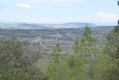
Visit the chapel and enjoy the various views over the two valleys.

(7) Take the path towards Les Campanettes. Pass the wayside cross and a reception centre, then continue along the path following the green and yellow markings. Join the D198.

(8) Turn right onto it, leaving the signposted route behind, and continue along this road. At the next bend, take the track on the left. At the corner of a detached house, walk past all the letterboxes and continue straight ahead along this track. At a Y-junction, turn right. Pass under a power line and, at the next Y-junction, turn right again and carry on straight ahead. Join the D42.

(9) Turn right. Head towards the Dorgons signpost, take the track on the right, then turn left to follow a grass track.
At the end of the grass track, turn left onto another track. Take the first track on the left at the entrance to the woods, then carry on straight ahead to reach the X-junction by the railway line.

(10) Turn onto the track on the right to go round the vineyards (the track straight ahead leads nowhere); the track turns into a narrow path. Join the D996 at the Grand Logis crossroads.

(11) Cross the road and turn right; then, at the junction of the two roads, continue towards the Pont de Mirabeau.
Take the second small road on the left, pass the old railway station and rejoin the D996 at the original junction. Caution: motor traffic.

(1) Follow the same route as on the way out to return to the starting car park (S/E).
Waypoints

  1. S/E : mi 0 - alt. 794 ft - A pier of the old Mirabeau bridge. Bridge over the - La Durance
  2. 1 : mi 0.49 - alt. 807 ft - Baume
  3. 2 : mi 1.64 - alt. 1,043 ft - Entrance to the village
  4. 3 : mi 2.48 - alt. 1,040 ft - the D973
  5. 4 : mi 3.91 - alt. 1,253 ft - Before a bend
  6. 5 : mi 4.95 - alt. 1,319 ft - Les Pacharots
  7. 6 : mi 7.08 - alt. 1,404 ft - At the top of the hill
  8. 7 : mi 7.67 - alt. 1,699 ft - Chapelle Sainte-Croix
  9. 8 : mi 7.98 - alt. 1,306 ft - The D 198
  10. 9 : mi 9.89 - alt. 856 ft - The D 42
  11. 10 : mi 11.01 - alt. 791 ft - Next to the railway line
  12. 11 : mi 11.59 - alt. 814 ft - The D 996
  13. S/E : mi 12.59 - alt. 791 ft - The Mirabeau bridge

Worth a visit

At the start, admire the two piers of the old Mirabeau bridge and the River Durance.
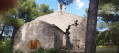
The Sainte-Madeleine Chapel; walk round it for a view of the Durance.
The Chapel of La Garrique.
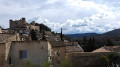
The village of Mirabeau with its fountain square, church and castle.
The vineyards around the Aube Loup.
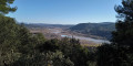
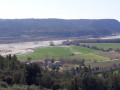
The Sainte-Croix Chapel and the views over the two valleys and the village of Beaumont-en-Pertuis.

Always be cautious and plan ahead when you're outdoors. Visorando and the author of this route cannot be held responsible for any accidents occurring on this route.

The GR® and PR® markings are the intellectual property of the Fédération Française de Randonnée Pédestre.

Reviews and comments

4.2 / 5
Based on 4 reviews

Reliability of the description
4 / 5
Ease of following the route
4.3 / 5
Route interest
4.3 / 5
Randonneur du dimanche

Overall rating : 4 / 5

Date of your route : Apr 20, 2024
Reliability of the description : ★★★★☆ Good
Ease of following the route : ★★★★☆ Good
Route interest : ★★★★☆ Good
Very busy route : No

A pleasant, easy walk.
The car park at the start is of no interest: situated near a main road and a busy junction, the crushed glass on the ground suggests that it’s not advisable to leave your car there. Furthermore, crossing the bridge on foot is of very limited interest.
I preferred to park and start the circular route at Mirabeau, which is safer and more pleasant.
The first 4 kilometres on tarmac made me doubt the appeal of this walk, but once past that point, the path became much more pleasant.

Machine-translated

Michelberbeche
Michelberbeche

Overall rating : 4 / 5

Date of your route : Dec 30, 2019
Reliability of the description : ★★★★☆ Good
Ease of following the route : ★★★★☆ Good
Route interest : ★★★★☆ Good

A very pleasant walk through countryside that’s full of colour at this time of year. Do take care on the short stretch of road you have to take along the route, but there’s no way round it. Tip: head down to the right of the chapel to get a closer look at the Durance. Best done from autumn through to April – watch out for the heat, in my opinion. A very pleasant walk that’s fairly easy to do. (Passes through villages, chapels, etc.)

Machine-translated

CLOLI84
CLOLI84

Overall rating : 4.7 / 5

Date of your route : Apr 15, 2019
Reliability of the description : ★★★★☆ Good
Ease of following the route : ★★★★★ Very good
Route interest : ★★★★★ Very good

HERE’S A LOVELY HIKE WITH SOME BEAUTIFUL VIEWS! IT’S LONG BUT WITHOUT ANY STEEP SLOPES. PLEASE NOTE: THE PATH TO TAKE AT POINT 8 ISN’T EASY TO FIND! IN SHORT, IT’S A ROUTE I’D RECOMMEND.

Machine-translated

Visorando55
Visorando55

Overall rating : 4 / 5

Date of your route : Nov 18, 2018
Reliability of the description : ★★★★☆ Good
Ease of following the route : ★★★★☆ Good
Route interest : ★★★★☆ Good

There was perhaps a bit too much walking along the road, but otherwise it was a lovely walk with a beautiful view of the Alps – already covered in snow at that time of year – before the descent.

Machine-translated

Other walks in the area

For more walks, use our search engine .

The GPS track and description are the property of this route's author. Please do not copy them without permission.