


Refine your search for walks in Balaguères
Balaguères walks


 The barns of Balagué
 Visorando Member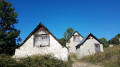
 4.12 mi
 +1,316 ft
 -1,316 ft
 3h 00
3h 00
 Moderate
 Departure from Balaguères (Ariège)
Sunshine, panoramic views of the Vallier massif and the Pyrenees, and barns are all on the agenda for this loop above the village of Balagué.
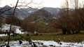
Circular route starting from Engomer
 3.12 mi
+1,325 ft
-1,316 ft
2h 35
Moderate
Departure from Engomer (Ariège)
3.12 mi
+1,325 ft
-1,316 ft
2h 35
Moderate
Departure from Engomer (Ariège)
A pleasant climb towards Compussan under the beech trees accompanies the summer pastures. It continues across high-altitude meadows and leads to the rocky massif of Cap de Broc with a beautiful view of the valley floor, returning via Alas and theGR®® which follows the Lez river a little higher up.
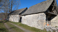
The Bourdaous trail from Cazavet
 Association / Club / Walk leader
 7.71 mi
+2,474 ft
-2,457 ft
5h 40
Moderate
Departure from Cazavet (Ariège)
7.71 mi
+2,474 ft
-2,457 ft
5h 40
Moderate
Departure from Cazavet (Ariège)
Discover the bourdaous, which are pastoral mountain hamlets, groups of barns and stables used in the past during the summer months. A bourdaou can also be an isolated barn with an adjoining hut, a very basic dwelling for shepherds. This route offers the chance to discover some of them, starting from Cazavet and climbing up to the Cours mountain pasture. The route passes by the summit of Roc de Maléchart, where a 360° view allows you to discover the Pyrenees mountain range.
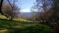
Montégut-en-Couserans - Tuc de Casterot and Char de Lique via the three passes
 4.13 mi
+1,060 ft
-1,063 ft
2h 50
Moderate
Departure from Montégut-en-Couserans (Ariège)
4.13 mi
+1,060 ft
-1,063 ft
2h 50
Moderate
Departure from Montégut-en-Couserans (Ariège)
An accessible and charming hike with varied terrain and landscapes and panoramic views of over 180°.
The Haut-Garonne foothills at Saleich
 8.55 mi
+2,047 ft
-2,028 ft
5h 45
Moderate
Departure from Saleich (Haute-Garonne)
8.55 mi
+2,047 ft
-2,028 ft
5h 45
Moderate
Departure from Saleich (Haute-Garonne)
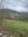
This is a lovely walk that will introduce you to the first foothills of the Haute-Garonne Piedmont between Saint-Gaudens and Saint-Girons. With a touch of the mountains about it, this walk will take you from the Valattes Chapel, perched on a grassy promontory, to the Saleich State Forest, passing by the mysterious Laspugue Cave and the lush green meadows of Artigues.
Circular Pré Carré and Artigues from Saleich
8.01 mi
+2,064 ft
-2,054 ft
5h 30
Moderate
Departure from Saleich (Haute-Garonne)
This hike takes place on good tracks and forest roads, through beautiful forests of beech, ash, chestnut, boxwood and other trees. The descent is mainly on less comfortable paths, which require a little more attention as they are less well-trodden. The yellow markings are good, but seem to have been scratched and partially erased between points (8) and (9). The route, which is mostly in the shade, can be done in any season. However, avoid periods of fog due to the reported problem of poor markings on part of the route.
Saleich loop via Urau and Castelbiague
 8.67 mi
+1,020 ft
-1,040 ft
4h 55
Moderate
Departure from Saleich (Haute-Garonne)
8.67 mi
+1,020 ft
-1,040 ft
4h 55
Moderate
Departure from Saleich (Haute-Garonne)
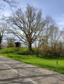
This easy hike is located on the border of Haute-Garonne and at the gateway to Ariège. You will walk along the foothills of the Pyrenees. Varied landscapes and architectural sites are waiting to be discovered on this interesting walk.
Pic de l'Arraing from Uchentein
 4.79 mi
+2,231 ft
-2,231 ft
4h 10
Moderate
Departure from Uchentein (Ariège)
4.79 mi
+2,231 ft
-2,231 ft
4h 10
Moderate
Departure from Uchentein (Ariège)
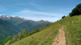
Summit with a superb view of the Couserans part of the Pyrenees mountain range.
Col de l'Arraing
 3.57 mi
+1,355 ft
-1,352 ft
2h 50
Moderate
Departure from Balacet (Ariège)
3.57 mi
+1,355 ft
-1,352 ft
2h 50
Moderate
Departure from Balacet (Ariège)
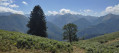
Splendid view of the Couserans peaks with a crossing of a summer pasture and the discovery of an old marble quarry.
Bethmale Pond from Ayet
 6.15 mi
+1,217 ft
-1,220 ft
3h 55
Moderate
Departure from Bethmale (Ariège)
6.15 mi
+1,217 ft
-1,220 ft
3h 55
Moderate
Departure from Bethmale (Ariège)
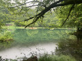
This guide has been created to reflect the new yellow signposting introduced in 2024.The route has been modified at the start and at point (7), and has been moved entirely to the left bank of the Balamet stream.
The Bethmale lake
 5.68 mi
+1,335 ft
-1,306 ft
3h 45
Moderate
Departure from Bethmale (Ariège)
5.68 mi
+1,335 ft
-1,306 ft
3h 45
Moderate
Departure from Bethmale (Ariège)
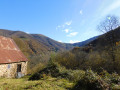
A pleasant forest walk accessible to all, leading you to the Étang de Bethmale, a must-see spot in the Couserans region of Ariège.(!) Possible problem with the trail disappearing at (5), see reviews, keep us informed.
The Rochers de Péne Blanque as seen from Baderque
5.36 mi
+1,348 ft
-1,322 ft
3h 40
Moderate
Departure from Herran (Haute-Garonne)
From the hamlet of Baderque, looking south-west, you’ll notice a white limestone outcrop – the destination of this short walk – which is accessible to all, except for the summit itself, where you’ll need to use your hands for both the ascent and descent (no equipment required), with a sheer drop of over 100 m on the western side. The first section follows a track suitable for vehicles, then a forest track and well-marked footpaths. The yellow markings are sometimes faint, as some of the markers on the outward journey have been scraped off, but the return journey is straightforward. A large part of the route passes through the Campas woods, where the abundance of moss makes you feel as though you’re in the Amazon. Return via the same route.
Pics of the Arraing and Serau in a circular loop from Balacet
7.36 mi
+3,087 ft
-3,074 ft
6h 05
 Difficult
Departure from Balacet (Ariège)
Difficult
Departure from Balacet (Ariège)
A beautiful ridge walk offering magnificent views of the Pyrenean mountains, including Mont Valier and the Piedmont. Moderately challenging, it is fairly easy to complete. It is possible to stay overnight at the Cabane de l'Arraing: maximum four to five places.
From the Bishops’ Palace to the Marsan Chapel in Saint-Lizier
 2.91 mi
+397 ft
-420 ft
1h 40
2.91 mi
+397 ft
-420 ft
1h 40
 Easy
Departure from Saint-Lizier (Ariège)
Easy
Departure from Saint-Lizier (Ariège)
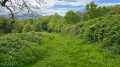
An easy walk, mostly in the shade. Mainly a dirt track, tarmac only in Saint-Lizier. You’ll enjoy superb views of the Pyrenees, the Bishops’ Palace and Saint-Lizier Cathedral.
Le belvédère du Couserans
 5.33 mi
+1,138 ft
-1,138 ft
3h 25
Moderate
Departure from Saint-Lizier (Ariège)
5.33 mi
+1,138 ft
-1,138 ft
3h 25
Moderate
Departure from Saint-Lizier (Ariège)
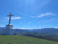
Winding through narrow streets and along footpaths, this route takes walkers from Saint-Lizier to Montcaliver, a viewpoint overlooking all the Couserans valleys and the splendid peaks dominated by the ‘Lord of the Couseran’: Mont Valier.⚠️ On 18 May 2026, a user reported:>Between the points (6) and (7), the route passes through private property.=> Route and description updated on 24 August 2026 by a moderator
Circular Mont Aragnoué from Castelbiague
 8.85 mi
+1,604 ft
-1,621 ft
5h 30
Moderate
Departure from Castelbiague (Haute-Garonne)
8.85 mi
+1,604 ft
-1,621 ft
5h 30
Moderate
Departure from Castelbiague (Haute-Garonne)
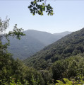
This long, fairly challenging circular route takes you up to Mont Aragnoué and its paragliding launch site via a well-shaded forest track, allowing for a relatively quick ascent, before a gentler descent via the Col d’Arbas and the western face of the Tucas, before returning to your starting point, the small village of Castelbiague.
Tour du Mail des Morères
 5.16 mi
+2,198 ft
-2,192 ft
4h 15
Moderate
Departure from Antras (Ariège)
5.16 mi
+2,198 ft
-2,192 ft
4h 15
Moderate
Departure from Antras (Ariège)
The route is mainly in the shade. Only the summit is in full sun from the village of Antras. The climb up the Col de Mourères is not difficult. A beautiful walk on the Balcon du Biros
Pic de l'Arraing route
 9.94 mi
+3,678 ft
-3,688 ft
7h 45
Difficult
Departure from Sentein (Ariège)
9.94 mi
+3,678 ft
-3,688 ft
7h 45
Difficult
Departure from Sentein (Ariège)
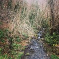
A circular loop to climb Pic de l'Arraing via Pic de Sérau, following the pretty ridges.
The Biros Valley – Circular Tour from Sentein to the Refuge d’Eylie
 19.08 mi
+6,572 ft
-6,549 ft
2 days
Difficult
Departure from Sentein (Ariège)
19.08 mi
+6,572 ft
-6,549 ft
2 days
Difficult
Departure from Sentein (Ariège)
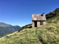
Two days, exploring both sides of the cool Biros Valley through which the River Lez flows, in a very mountainous setting.One night’s stay in the hamlet of Eylie d’en Haut. The mountain refuge and dining area are separate and welcoming.Both days are spent largely on marked trails, but these are challenging, sometimes steep and often very steep.- The first day is challenging, with 1,200 metres of ascent and 900 metres of descent. Do not underestimate it. The descent from the Col des Cos is not straightforward due to the patous and the path being difficult to follow, despite the markings, as well as the crossing of the Ruisseau du Haurendech (torrent). The views make you forget these difficulties.- The second day begins with a very steep climb (25 per cent gradient). Then, the beautiful balcony path requires great caution as it is not maintained and is very narrow. After the Col des Cassaings, conditions improve. The views make you forget these difficulties.
From Sentein to the Refuge d’Eylie via the Vallée de l’Isard and the Col des Cos
 8.68 mi
+3,747 ft
-2,864 ft
7h 15
Difficult
Departure from Sentein (Ariège)
8.68 mi
+3,747 ft
-2,864 ft
7h 15
Difficult
Departure from Sentein (Ariège)
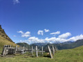
First day of this trip to the Refuge d’Eylie. A day not to be underestimated.Set off from Sentein along an old track, then take the small road up to Bencarrech, joining the GRP® Tour du Biros. The GRP® in the Isard Valley crosses to the other bank via the Illa Maria footbridge. It then passes the Passerelle du Pichès on the right and begins a steep climb. From there, a PR® trail leads to the Col des Cos (mountain hut, fountain). This is followed by a tricky descent due to fallen trees blocking the path (PR®). After at least 6 hours’ walking, including breaks, with 1,200 m of ascent and 900 m of descent, the Eylie restaurant and bar is a welcome sight.
A different perspective on Le Crabère
15.52 mi
+6,768 ft
-6,732 ft
13h 00
 Very difficult
Departure from Sentein (Ariège)
Very difficult
Departure from Sentein (Ariège)
The “standard route” up the Pic du Crabère passes via the Refuge d’Araing and the Col d’Auréan. As this route is very busy during the summer months, I’m suggesting an unusual and unspoilt route here, allowing you to reach the Crabère whilst avoiding the crowds, and without any difficulty. The return journey will follow the standard route, allowing you to complete a circular route around the Étang d’Araing. This 25 km route, with 2,000 m of elevation gain, requires good stamina, but can be completed in two days with an overnight stay at the Refuge de l’Étang d’Araing.The section from (7) to (13) is feasible provided there is no snow.
The Étang d'Araing Refuge as seen from the Anglade car park
 6.20 mi
+4,065 ft
-305 ft
6h 25
Difficult
Departure from Sentein (Ariège)
6.20 mi
+4,065 ft
-305 ft
6h 25
Difficult
Departure from Sentein (Ariège)
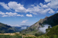
First stage of the Petit Tour du Biros.From the Anglade car park, a steady climb along theGRP®® Tour du Biros to the Passerelle des Pichès, then a detour via the Chapel and the Cabane Forestière de l'Isard.Then, after returning to theGRP®®, you arrive at the Cabane d'Illau.This is followed by a steep climb up to just below the Étang d’Araing dam and finally the arrival at the Refuge Jacques Husson de l’Étang d’Araing.This stage is only feasible when there is no snow, from late May until the huts close or the first snowfall begins.
The short Tour du Biros
 19.78 mi
+8,130 ft
-8,127 ft
3 days
Difficult
Departure from Sentein (Ariège)
19.78 mi
+8,130 ft
-8,127 ft
3 days
Difficult
Departure from Sentein (Ariège)
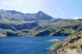
Suggestion for a shorter Tour du Biros with alternative routes.Start from the Anglade car park (Frechendech).A fairly challenging first stage with an alternative route via La Chapelle and the Maison Forestière de l'Isard.A second stage exploring an old lead and zinc mine, preceded by the ascent of the Pic de l’Har.A third, more leisurely stage, but over rough terrain, on a path damaged by fallen trees and the absence of a footbridge over a torrent.This route is only feasible when there is no snow, from late May until the mountain huts close or the first snowfall begins.
Pic de Crabère via the Étang d'Araing
15.99 mi
+6,365 ft
-6,378 ft
12h 55
Very difficult
Departure from Sentein (Ariège)
This large circular takes us through varied landscapes, discovering the riches of the Couserans. The Pic de Crabère is the remarkable highlight of this beautiful journey. From its height of 2,630 metres, you can see the high peaks of the Ariège and Luchonnais on either side, while to the south, the Aneto massif dominates the landscape. To fully enjoy this long hike, don't hesitate to stop for the night at the Étang d'Araing refuge. You'll have a front-row seat to watch the magical spectacle of the sunset over the Pic de Crabère.
Illau Cabin and Isard Chapel
 8.75 mi
+2,618 ft
-2,625 ft
6h 20
Moderate
Departure from Sentein (Ariège)
8.75 mi
+2,618 ft
-2,625 ft
6h 20
Moderate
Departure from Sentein (Ariège)
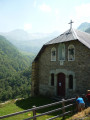
Torrential streams, forests, mountain pastures, panoramic views, huts and chapels await you on this hike at the bottom of the Biros valley.
Col de la Mothe from Montgaillard-de-Salies
5.51 mi
+443 ft
-436 ft
2h 55
Easy
Departure from Montgaillard-de-Salies (Haute-Garonne)
A pleasant walk on quiet roads, mainly on the heights, offering beautiful views of the Cornudère ridge and the Cagire, after passing through a beautiful forest. Then, the descent along the Arbas, to the sound of running water, should charm walkers. Please respect the gates.
Circular walk between Saint-Martin and Rouède
 3.94 mi
+279 ft
-308 ft
2h 05
Easy
Departure from Montastruc-de-Salies (Haute-Garonne)
3.94 mi
+279 ft
-308 ft
2h 05
Easy
Departure from Montastruc-de-Salies (Haute-Garonne)
This circular loop, which is mostly in open country, follows short stretches of road (departmental road) and tarmac paths, offering lovely panoramic views of the Pyrenean foothills and the summit of Cagire in particular. It passes through the hamlet of Lebrats in Saint-Martin and runs alongside Rouède before returning to the starting point via several small hamlets on the edge of the Bagiri Forest.