Circular walk between Saint-Martin and Rouède

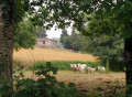
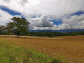
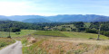
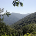
This circular loop, which is mostly in open country, follows short stretches of road (departmental road) and tarmac paths, offering lovely panoramic views of the Pyrenean foothills and the summit of Cagire in particular. It passes through the hamlet of Lebrats in Saint-Martin and runs alongside Rouède before returning to the starting point via several small hamlets on the edge of the Bagiri Forest.

Details

24155340
Creation:
Last update:
Last review:
  • Walking
    Activity: Walking
  • ↔
    Distance: 3.94 mi
  • ◔
    Average duration: 2h 05 
  • ▲
    Difficulty: Easy

  • ⚐
    Back to start: Yes
  • ↗
    Ascent: + 279 ft
  • ↘
    Descent: - 308 ft

  • ▲
    Highest point: 1,434 ft
  • ▼
    Lowest point: 1,201 ft

Photos

Description of the walk

From Mane, follow the D83 towards Rouède and head to the Chapelle Saint-Martin via the Chemin de La Carrère. You can park easily near the chapel.

(S/E) Head down the Chemin des Lebrats and you’ll very quickly reach the four-way junction at Lebrats

(1) Turn left onto the Chemin des Sources, then turn right at the next junction onto the Chemin de Lios. Pass under some large walnut trees, then go up and down through the fields before coming out onto the D83, the Route de la Justale.

(2) Turn right onto this road, cross a bridge and, at the junction, turn right to reach the village of Rouède.

(3) Cross the D83f and carry on towards the village centre, then turn right twice towards Montespan via the Chemin Prat Bediaou and Léoudary, before the bakery.
Then leave Rouède via the Route de Larouquet, which climbs gently to the hamlet of Galin.

(4) Leave the main road and turn right onto the Route des Gax – more of a track – then turn left a few hundred metres further on. Pass through several hamlets and go past a water tower before joining the Route Sainte-Colombe.

(5) Turn left onto this road to reach the Y-junction with the Chemin de Lebrats.

(6) Turn right onto this track and then return to the original junction you passed on the way out.

(1) Follow the route you took on the way there in the opposite direction to return to the car park at the Chapelle Saint-Martin (S/E)

Waypoints

  1. S/E : mi 0 - alt. 1,325 ft - Car park at the Chapel of Saint-Martin
  2. 1 : mi 0.13 - alt. 1,293 ft - Chemin des Sources
  3. 2 : mi 1.05 - alt. 1,227 ft - Route de Justale
  4. 3 : mi 1.42 - alt. 1,250 ft - First Carrefour in Rouède
  5. 4 : mi 2.25 - alt. 1,414 ft - Route des Gax
  6. 5 : mi 3.22 - alt. 1,394 ft - Route Sainte-Colombe
  7. 6 : mi 3.56 - alt. 1,348 ft - Chemin des Lebrats
  8. S/E : mi 3.93 - alt. 1,325 ft - Car park at the Chapel of Saint-Martin

Notes

No water sources and the walk is mostly in open country (little shade).
Bakery and patisserie in Rouède, open Tuesday to Sunday from 7.00 am to 12.30 pm. Croustades, brioches, sourdough breads + a handy little grocery shop.

Worth a visit

Views of the Pyrenean foothills, the Cornudère ridge, the Thouas woods and the summit of Cagire.

Reviews and comments

4.1 / 5
Based on 3 reviews

Reliability of the description
4 / 5
Ease of following the route
4.3 / 5
Route interest
4 / 5
lecervin
lecervin

Overall rating : 4 / 5

Date of your route : Jan 30, 2024
Reliability of the description : ★★★★☆ Good
Ease of following the route : ★★★★☆ Good
Route interest : ★★★★☆ Good
Very busy route : No

A pleasant walk with lovely views of the surrounding hills, following small roads and a short stretch along a forest track. However, the path marked out for the descent through the woods to reach the Garonne was impassable.
This walk is best avoided in summer as the paths are unshaded and tarmacked.

Machine-translated

Algerard1
Algerard1

Overall rating : 4.7 / 5

Date of your route : Sep 15, 2022
Reliability of the description : ★★★★★ Very good
Ease of following the route : ★★★★★ Very good
Route interest : ★★★★☆ Good
Very busy route : No

Walk on 15 September 2022
A lovely little countryside route. Lovely weather. Just three cars around midday – that’s all.

Thanks to the poster.

Machine-translated

grandin
grandin ★

legna

Thanks, it’s been corrected

Machine-translated

legna
legna

Overall rating : 3.7 / 5

Date of your route : Aug 12, 2022
Reliability of the description : ★★★☆☆ Average
Ease of following the route : ★★★★☆ Good
Route interest : ★★★★☆ Good
Very busy route : No

A morning walk, to avoid the heatwave forecast for the day. A short, pleasant stroll along paths and tarmac roads with very little traffic; the route takes you through gently rolling countryside, offering a lovely mix of meadows grazed by cows and calves and fields of maize (looking rather stricken) or wheat yet to be harvested. The route description is well done, but there’s a significant error on the map: point 4 has been moved to point 5, and this shift has consequently caused point 7 to disappear. This needs to be corrected as soon as possible.

Machine-translated

Other walks in the area

For more walks, use our search engine .

The GPS track and description are the property of this route's author. Please do not copy them without permission.