Country:

 City:
City:


Park at the Langlade car park, 400 m below Fréchendech.
(S/E) Follow the yellow/red markings for the Tour du Biros heading west (follow the markings as far as the Étang d’Araing). The path follows the ‘normal route’ up the Crabère.
(1) At Fréchendech (820 m), continue along the path on the left bank of the Izard. Further on, pass the Playras turn-off on your right.
(2) Cross the footbridge (920 m). The path then climbs initially north-eastwards before turning right to follow the hillside overlooking the right bank of the Isard.
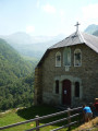
(3) Pass the Passerelle des Pichès footbridge (1105 m) on your right, which leads to the Chapelle de l’Isard, and continue along the path. You’ll come to a metal gate; make sure to close it properly and continue along the path, which remains clearly marked.
(4) Emerge from the forest at 1,385 m.
(5) Pass the Cabane d’Ilhau (1,490 m) on your right and continue along the path through rhododendrons and junipers. At 1,640 m, the path crosses a stream and begins the final series of hairpin bends towards the Étang d’Araing.
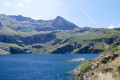
(6) Once you reach the foot of the dam (1,911 m), continue left onto the GR®10. Pass the Étang d’Araing shepherds’ hut on your left and follow the path to the Serre d’Araing.
(7) At the Serre d’Araing, leave the GR®10 and continue to the right along the cross-border path taken for the Pass Aran circular route. The path is almost flat at the start, then climbs a grassy spur.
(8) Top of the grassy spur (2,325 m). Continue along the path as it descends.
(9) At the bottom, leave the cross-border path leading to the Portillon d’Albe, and head up the grassy valley due west. There is no marked path, but progress is easy through the grass. Aim for a pass between the Mail des Luzes and the Pic de Canejean.
(10) The pass is marked by a large cairn. The Pic de Crabère comes into view and seems inaccessible. This is just an illusion! Descend with a degree of caution down a grassy couloir heading north-east for about twenty metres. As soon as possible, turn left into a rocky area that presents no difficulty or danger. Make your way onto the upper terraces of the Cirque de l’Étang d’Araing.
(11) You then simply continue along this almost level terrace (2,450 m), still off the beaten track, but the route is obvious. Do not lose altitude. The route overlooks the lake from a great height.
(12) The slope becomes steeper, still easy but steep through the grass. You need to reach the border ridge about a hundred metres to the left of the Crabère.
(13) Pass and border ridge (2,611 m). A track on the Spanish side leads to the Crabère without difficulty in 10 minutes. Stay focused, however, as the Spanish slope is very steep. It is also possible to reach the summit by staying on the ridge and using your hands for support. Where this becomes difficult, join the track on the Spanish side a few metres below.
(14) Pic de Crabère (2,630 m). Head north for a bird’s-eye view of the Étang d’Araing. For the return journey, simply follow the standard route down from the Crabère.
(15) Reach the Col d’Auréan and return to the GR®10, following it eastwards.
(16) Reach the Étang d’Araing refuge, then continue the descent to the Araing Dam, where you’ll rejoin the route you took on the way up.
(6) Follow the outward route in the opposite direction to return to the Langlade car park (S/E).
 Visorando Member
 Difficult
 Moderate
  Association / Club / Walk leader