Date of your route : Jun 03, 2025
Reliability of the description : ★★★★★ Very good
Ease of following the route : ★★★★★ Very good
Route interest : ★★★★★ Very good
Very busy route : Yes
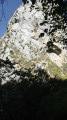
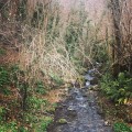
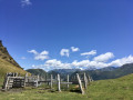
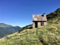
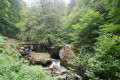
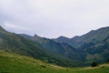
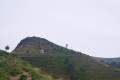
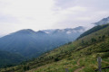
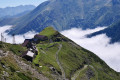
A lovely little trek that the two of us did as a self-guided hike during the last week of May. The weather was poor on the first day, so we decided to reverse the route: a very good choice, as we arrived at the Araing pond at the end of the second day in glorious weather. We chose this trek because my partner is new to hiking, so we wanted something fairly gentle in terms of both distance and elevation gain. Day 1: The route from the Anglade car park to the Eylie lodge is lovely, very shaded and follows a multitude of streams, the last of which, near the lodge, we had to cross by taking off our shoes as there was quite a lot of water following recent rain. Note that it is normally equipped with a footbridge during the tourist season. The elevation gain is very reasonable and fairly gradual, with no difficulties. The lodge warden was really lovely and helped us out with some bread and cheese, and we even got to enjoy a local beer. We slept at the campsite located below the lodge, following the GR10. There wasn’t much space (3–4 tents max) but we were on our own. Close to the river, so very damp. Drinking water available at the Eylie lodge. Day 2: From the Eylie lodge to the Araing pond, the path climbs quite steeply at first then more gradually, quickly rising above the tree line to reach a former mining site that’s well worth a visit. The total elevation gain for the day exceeds 1,500m. Many springs gush forth or run through the mining installations, so we didn’t dare draw water from them. We found more ‘natural’ springs in the final third of the route. The ascent of the Pic de l’Har is quick and the view is magnificent. Nothing technical. The arrival at the Étang d’Araing refuge comes after a somewhat long descent at the end of the day, though it’s fairly gentle. The refuge itself is very modern and functional, with a water point and toilets (even outside the tourist season). The Étang d’Araing is rather uninteresting, to be honest, particularly because of the EDF dam which detracts from its charm. The view of the peaks behind the lake remains magnificent. We slept in a tent and the temperature dropped to around 5°C. It’s windy but nothing to worry about. Be careful with the rather rough vegetation when pitching your tent; some spots are covered in fairly soft grass, but others are carpeted with very prickly grass that can pierce the groundsheets and air mattresses. Absolutely magnificent sunrise. Day 3: The descent from the Araing pond to the Anglade car park, passing by a small chapel-refuge. Quite peaceful and truly magnificent. A slightly steep section at the start where you re-enter the forest, and the rest of the descent is gentle. A notable passage through an absolutely idyllic bog (but avoid trampling on it), then past the chapel, which was unfortunately closed. Lots of streams, including another one we had to cross without our shoes on, but it was a delight. Up to that point we’d literally not come across a soul, but we started seeing quite a few people that day—a good dozen hikers heading the other way on the half-day walk. We reached the car park after just 4 hours’ walking, so in this direction the section is very short. All in all, a great, relatively easy route and perfect for an introduction to backpacking. There’s water absolutely everywhere, and in these temperatures (5–20°C) we didn’t drink more than 1.5 litres before being able to refill our supplies (bearing in mind that we always use a filter). The trails and viewpoints are magnificent. I highly recommend it at the very end of May (just before the refuges reopen) if the weather permits. Ticks: we picked up a few ticks over the course of the trip despite taking plenty of precautions (long trousers and long sleeves), so be on your guard. Ticks in the Pyrenees are major carriers of Borrelia, so don’t ignore a bite that shows abnormal and spreading redness. Make sure you have a tick remover and do a quick check at the end of the day to remove any potential new bites.
Machine-translated



 Country:

 City:
City:





 Visorando Member
 Very difficult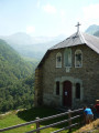
 Moderate
  Association / Club / Walk leader