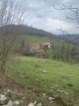
Circular Mont Aragnoué from Castelbiague

This long, fairly challenging circular route takes you up to Mont Aragnoué and its paragliding launch site via a well-shaded forest track, allowing for a relatively quick ascent, before a gentler descent via the Col d’Arbas and the western face of the Tucas, before returning to your starting point, the small village of Castelbiague.

Details

38826024
Creation:
Last update:
Last review:
  • Walking
    Activity: Walking
  • ↔
    Distance: 8.85 mi
  • ◔
    Average duration: 5h 30 
  • ▲
    Difficulty: Moderate

  • ⚐
    Back to start: Yes
  • ↗
    Ascent: + 1,604 ft
  • ↘
    Descent: - 1,621 ft

  • ▲
    Highest point: 2,651 ft
  • ▼
    Lowest point: 1,135 ft

Photos

Description of the walk

From the A64 motorway, take exit 20 (Saint-Girons) and head towards Castelbiague via Salies-du-Salat/Mane, then follow the D13 to Castelbiague.
Park at the entrance to the village, near Castelbiague church.

(S/E) Head to the village centre, then continue along the D13 towards La Ribereuille/Arbas. At the hamlet of Pau, turn left to quickly reach the junction with the Chemin du Moulin.

(1) Turn left onto this track, cross the River Arbas, then go round a hairpin bend. After the hamlet of Fesons, you’ll come to a Y-junction.

(2) Turn right onto the Chemin des Petits Bérets, marked with yellow signposts. Carry on, then rejoin the Ruisseau de l’Arbas and follow it to reach La Ribereuille.

(3) Turn left onto the Chemin du Chanchou, which very quickly becomes a forest track. Climb steadily through a dense forest. When the slope levels out, look out for the ruins of a small stone house.

(4). Leave these on your left to join a clear, stony track leading up to the Col de Noustens.

(5) Turn right and follow this easy path, which leads to a fork in a vast, rocky clearing.

(6) Take the path on the right which follows the contour line. Leave the woodland temporarily before returning to it at some old charcoal kilns. Follow the path as it re-enters the woodland and joins the Route d’Heregade.

(7) Follow the sign for ‘Mont Aragnoué – mountain bike route’ to the right to reach the summit.

(8) Return to the previous junction.

(7) Turn right onto the Route d’Heregade until you reach a junction of paths and tracks at the Col d’Arbas.

(9) Turn left onto a small path marked in yellow which winds through pastures. At the fork, continue left and you’ll reach a junction with a drinking trough on the left.

(10) Turn left onto the ascending path marked in yellow. You will soon reach the wide stony path and the rocky clearing you passed on the way out.

(6) Head down this forest track to the right to return to the Col de Noustens crossroads.

(5) Keep to the right on the track suitable for vehicles; after a long circular right-hand bend, you’ll reach a crossroads. Head far to the right for 150 m.

(11) Continue to the right, still on the track, then, after a hairpin bend to the left, you’ll reach a junction at a place called Les Gaouats, with its fountain.

(12) Carry on straight ahead, then turn right onto Chemin du Moulin. Follow the Rieuouaris on your right until you finally reach the Arbas and the Castelbiague cemetery at a T-junction.

(13) Turn left and carefully follow the departmental road to reach the centre of the village of Castelbiague, the church and the car park (S/E).

Waypoints

  1. S/E : mi 0 - alt. 1,207 ft - Castelbiague Church car park
  2. 1 : mi 0.41 - alt. 1,155 ft - Chemin du Moulin. Confluence of the Arbas and - Rucan (rivière) - Affluent de l'Arbas
  3. 2 : mi 0.83 - alt. 1,211 ft - Chemin des Petits-Bérets
  4. 3 : mi 2.04 - alt. 1,253 ft - Chemin du Chanchou
  5. 4 : mi 2.62 - alt. 1,785 ft - Ruins (old stone house)
  6. 5 : mi 3.17 - alt. 2,201 ft - Junction: 1st circular loop - Col de Noustens (658m)
  7. 6 : mi 3.36 - alt. 2,201 ft - Laugères. Junction for the 2nd circular loop
  8. 7 : mi 3.87 - alt. 2,513 ft - Heregade Route
  9. 8 : mi 4.1 - alt. 2,651 ft - Mont Aragnoué (811m)
  10. 9 : mi 4.8 - alt. 2,280 ft - Col d'Arbas (691m)
  11. 10 : mi 5.37 - alt. 2,100 ft - Near Artigues
  12. 11 : mi 6.69 - alt. 1,857 ft - Woodland junction
  13. 12 : mi 7.88 - alt. 1,276 ft - Les Gaouats
  14. 13 : mi 8.47 - alt. 1,138 ft - Castelbiague Cemetery - Arbas (rivière) - Affluent du Salat
  15. S/E : mi 8.85 - alt. 1,207 ft - Castelbiague Church car park

Notes

(12) Fontaine aux Gaouats.
A walking stick may come in handy to help you get over tree trunks that may block the forest track in the first section (the climb through the forest).
Trousers are recommended, or do remember to bring tick tweezers, as you will sometimes have to walk along poorly maintained paths where the grass is tall.
It also offers two shorter alternatives:
- between (2) and (13),
- between (5) and (12).

Worth a visit

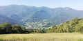
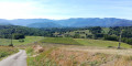
(8) View from Mont Aragnoué towards the Crète de Cornudère and the village of Arbas below.
You may come across mountain bikers (particularly on the way back) and a few paragliders at the summit.
Accommodation available at La Demeure de Zoé
Organic spirulina production

Reviews and comments

3.9 / 5
Based on 5 reviews

Reliability of the description
4 / 5
Ease of following the route
3.8 / 5
Route interest
4 / 5
User 29849096
• Edited:

Overall rating : 4.3 / 5

Date of your route : Jul 06, 2026
Reliability of the description : ★★★★★ Very good
Ease of following the route : ★★★★★ Very good
Route interest : ★★★☆☆ Average
Very busy route : No

The paths and signposting aren’t maintained properly. Fortunately, Visorando was a great help. Thank you

Machine-translated

User 8925286

Overall rating : 5 / 5

Date of your route : Jun 15, 2026
Reliability of the description : ★★★★★ Very good
Ease of following the route : ★★★★★ Very good
Route interest : ★★★★★ Very good
Very busy route : No

Despite the heat, this walk, with its many shaded areas, is also ideal for summer.
The slopes are a bit steep at the start.
We set off, not from the church but from the path to the mill, to avoid the heat in the open parts of the village. So we took the 12-2 route back as the descent is long along the forest track paved with large stones.
Avoid wearing shorts as there are plenty of brambles at this time of year
We didn’t see a soul (on a 5-hour hike, mind you). And no mountain bikes on the upper section of the route.
A lovely hike

Machine-translated

Piot39
Piot39
• Edited:

Overall rating : 4.3 / 5

Date of your route : Oct 13, 2025
Reliability of the description : ★★★★★ Very good
Ease of following the route : ★★★★☆ Good
Route interest : ★★★★☆ Good
Very busy route : No

A beautiful hike mainly through the forest. Starting from the village on the main road, which isn't great... but it doesn't last too long. You then turn onto a quieter stretch of road and a pleasant path along the river.
From 3 to 5, it climbs steeply through the forest! It's very quiet. Arriving at Mont Aragnoué at midday, we had a picnic with a beautiful view of the valley, the village and the mountains opposite (unfortunately, there were no tables). This is one of the few views on the route (there's another on the way back). Good shoes are essential, as there is mud, loose earth and stones.
Lots of chestnuts at this time of year. The descent from 11 to 12 is quite long on a forest path. I wanted to cut across an old GR trail on the map, but it wasn't maintained. From time to time, the GPS doesn't follow the route exactly, but there is only one possible path. Even if there are no markings, it's fairly easy to find your way. We end up on the road, fortunately without too much traffic.

Machine-translated

Kriss1951
Kriss1951

Overall rating : 1.7 / 5

Date of your route : Sep 19, 2024
Reliability of the description : ★☆☆☆☆ Very disappointing
Ease of following the route : ★☆☆☆☆ Very disappointing
Route interest : ★★★☆☆ Average
Very busy route : No

The markings have been completely worn away and are therefore illegible. Good luck.

Machine-translated

lecervin
lecervin

Overall rating : 4.3 / 5

Date of your route : Apr 11, 2024
Reliability of the description : ★★★★☆ Good
Ease of following the route : ★★★★☆ Good
Route interest : ★★★★★ Very good
Very busy route : No

A lovely walk – the climb from the Chemin de Chanchou is long, steady and consistent.
This walk isn’t signposted at all (no markings), but the directions in the guidebook are reliable and ensure you won’t go astray.
However, you’ll need to drive a bit to and from the start and finish.
I thought I’d find a pass (Col de Noustens), but it’s actually a junction of forest tracks at 658m.

Machine-translated

Other walks in the area

For more walks, use our search engine .

The GPS track and description are the property of this route's author. Please do not copy them without permission.