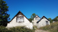
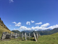
The barns at Junqualas

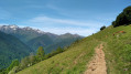
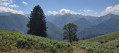
A short walk along the hillside with views of the Vallier range and a chance to explore the old barns of Junqualas.

Details

n°69747851
Creation:
Last update:
Last review:
  • Walking
    Activity: Walking
  • ↔
    Distance: 2.64 mi
  • ◔
    Average duration: 1h 45 
  • ▲
    Difficulty: Easy

  • ⚐
    Back to start: Yes
  • ↗
    Ascent: + 643 ft
  • ↘
    Descent: - 623 ft

  • ▲
    Highest point: 2,356 ft
  • ▼
    Lowest point: 1,749 ft

Photos

Description of the walk

The route starts from the small car park by the church.

(S/E) Walk down the street with your back to the church and turn left to reach the wash house.

(1) Carry on straight ahead, then turn left almost immediately onto a small road (Rue Tire du Juncalas). At the junction, carry on straight along the path until you reach a small road near the D618.

(2) Take this road to the left, which goes uphill and then turns into a track.

(3) Ignore a path on the left that leads back down towards the village; then, in the middle of the mountain pasture, take the path that climbs to the left and follow it for about a hundred metres. Then turn right at a 90° angle onto the footpath that leads to the first barns at Junqualas.

(4) Turn right, then quickly take the path on the left. Shortly after a small renovated barn, take the path on the right which descends into the woods and joins the GR®°°®°°78.

(5) Follow it to the right and you’ll come to a fork you passed on the way out.

(2) Follow the outbound route in the opposite direction to return to the wash house and then to the church car park (S/E).

Waypoints

  1. S/E : mi 0 - alt. 1,778 ft - Church car park
  2. 1 : mi 0.08 - alt. 1,749 ft - Washhouse
  3. 2 : mi 0.28 - alt. 1,759 ft - Crossroads marking the end of the circular route. Near the - Bouigane (rivière) - Affluent du Lez
  4. 3 : mi 1.04 - alt. 2,277 ft - Crossroads
  5. 4 : mi 1.27 - alt. 2,349 ft - Junqualas barns
  6. 5 : mi 2.01 - alt. 1,804 ft - GR°°®°° junction, bench
  7. S/E : mi 2.64 - alt. 1,798 ft - Church car park

Notes

PR® yellow signposting, route 6: please note that the arrows sometimes point in the opposite direction.

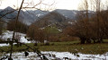
The route can be walked in either direction; the descent through the chestnut woods after the barns is a bit steep.

Picnic table near the church; drinking fountain on the street before the wash house.

Best viewpoints: towards the (1) or by heading slightly uphill through the mountain pasture towards the end of the barns.

Worth a visit

La Core cheese dairy.

Always be cautious and plan ahead when you're outdoors. Visorando and the author of this route cannot be held responsible for any accidents occurring on this route.

The GR® and PR® markings are the intellectual property of the Fédération Française de Randonnée Pédestre.

Reviews and comments

5 / 5
Based on 1 review

Reliability of the description
5 / 5
Ease of following the route
5 / 5
Route interest
5 / 5
MaryS
MaryS

Overall rating : 5 / 5

Date of your route : Apr 14, 2025
Reliability of the description : ★★★★★ Very good
Ease of following the route : ★★★★★ Very good
Route interest : ★★★★★ Very good
Very busy route : No

For such a short walk, it’s truly brimming with beauty and charm!

Machine-translated

Other walks in the area

For more walks, use our search engine .

The GPS track and description are the property of this route's author. Please do not copy them without permission.