Country:

 City:
City:


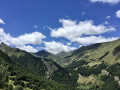
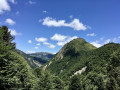
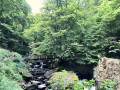
From Saint-Girons, head towards Castillon-en-Conserans via the D618 then the D4. Continue along the D4. Pass through Les Bordes-sur-Lez (follow the river). Cross the Pont de Bordes, pass through Bonac and arrive at Sentein. Park in the centre of the village in the large car park on the left.
(S) With your back to the hut that serves as a library, head towards the beautiful fountain and continue straight ahead along Rue du Commerce for 60 metres until you reach a junction with the Church of Notre-Dame opposite
(1) Turn left onto Boulevard du Barry, curving to the right for 60 metres to go round the church. Although it may seem odd, turn left towards a house (small square), then turn 90° to the right onto a small, ascending lane. You’ll reach Rue Carraou de l’Escalo; follow it to the left for 20 metres.
(2) Head up to the right onto a wide grassy path which very quickly becomes a stony sunken track as it veers to the left. Further up, you’ll join Route de Playras.
(3) Follow it uphill to the right and, after 1.5 km, look out for a signpost and yellow markings on the left.
Yellow PR® markings. Aourisis Circular Loop
(4) Continue along the Route de Playras, which now follows the PR® route. You’ll reach a sharp right-hand bend on this road.
(5) Please note: leave the road at this bend and take the path opposite which climbs into the forest. Pass behind a barn on your left and reach the hamlet of Bencarreh at the end of the road leading to it.
(6) Walk through the hamlet and head uphill opposite along a well-maintained track through the hamlet. Continue along a balcony-style path before rejoining a wider track.
Yellow and red markings for the GRP® Tour du Biros.
(7) Carry on straight ahead along the GRP®.
(8) Continue straight on along the GRP® on the left bank of the Isard and arrive at the Illa Maria footbridge.
(9) Cross the footbridge and head steeply uphill to the left, following the GRP® along the right bank.
(10) Pass the Fontaine de l’Escudié on your left. Further on, you’ll reach the wooden footbridge at Les Pichès.
(11) Leave this behind and continue climbing along the GRP® on the right bank of the Isard. Pass by springs, a valley floor and wetlands.
(12) Turn left and climb steeply via numerous hairpin bends until you reach a fork at elevation 1399. Recent signposts (observed in early July 2026).
Yellow markings are very sparse
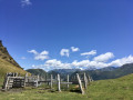
(13) Turn left towards the Col des Cos and begin a long, beautiful climb to reach it at an altitude of around 1,500 m. A vast area still used for grazing. A little further on, there is a freely accessible hut next to the one reserved for the shepherd. A spring flowing abundantly (observed in early July 2026).
It is advisable to stay off the marked trail when flocks of sheep are present, due to the three Patou dogs.
(14) Observed in early July 2026. Caution: flocks of sheep present, protected by three patous.
- Advice: leave the yellow markings to stay on a level path initially, then head for the edge of the forest further on to the right. Follow it along the fence. When you reach the edge of the ridge and the forest, head down to the left to rejoin the marked path at an altitude of 1,260 m.
- Alternatively, descend steeply along the yellow-marked path which starts between the huts and the fountain/watering hole.
Yellow markings are clearly visible. Do not take the path marked by a Yellow Cross (wrong direction). Look for the next set of yellow markings.
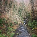
(15) Turn right onto the signposted path. Caution: from this point onwards, the rest of the signposted path is badly damaged due to fallen trees. Follow the clearly visible yellow markings carefully, ignoring the numerous Yellow Crosses indicating the wrong direction. Further down, you will reach the wide Ruisseau du Haurendech, which is particularly difficult to cross.
(16) After crossing this stream (torrent) as best you can, continue along the rest of the signposted path. You will reach a crossroads. There are signposts here.
(17) Take care. Head down to the left onto the track and follow it to the right. There is a spring and a drinking trough here. You’ll reach a fork in the path.There’s a signpost.
(18) Follow the sign for Eylie straight ahead. You’ll reach an open area. To the left, the path to and from the menhir was clear. Observed in early July 2026.
(19) Continue to the right until you reach a bend in the road. Directional posts.
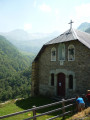
(20) Head up to the right towards the Refuge d’Eylie. At the end of the road, the refuge’s restaurant is situated higher up on the right. Check in with the warden to find out which bed to take at the stopover lodge. A bar, refreshments and food are available here.
(21) Head down to the left, following the signs, and after crossing the Ruisseau de Rouze, you’ll reach the Refuge d’Eylie (E).
 Visorando Member
 Association / Club / Walk leader
 Moderate
  Very difficult