Country:

 City:
City:


Park in the car park in front of the Saleich community hall, on Rue de Lestelas.
(S/E) Leave the car park; facing the village hall, turn right (east) onto Rue de Lestelas (D60H), then turn right onto Rue de Bourries for about 150 metres.
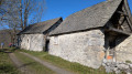
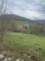
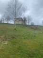
(1) At the crossroads, turn right onto Chemin de Vallates. Continue straight on along this small road until you reach the approach to Vallates Chapel.
(2) At the fork in the road, head up the small road furthest to the left. Walk past the Vallates Chapel on your right until, as you approach a low wall, you reach a path leading into the woods.
Yellow markings ( sometimes labelled ‘Pré carré’ on signs)
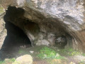
(3) Take the path on your left (the one on the right will be the return route), which heads through the undergrowth towards the south and then south-east. You’ll reach the Grotte de Laspugue, marked by a wooden sign nailed to a tree.
Follow a small path up to your right, which takes you to the foot of the cave, which opens into two chambers of differing sizes.
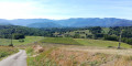
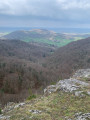
(4) Continue along the path to cross the Betmale Stream at a sharp left-hand bend. Take care when crossing this stream, as it is often flowing. You’ll begin a wide circular loop that heads northwards towards the Picon , offering beautiful views of the valley at times. The path turns south-east to join a wide track suitable for vehicles.
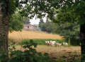
(5) Follow this track to the right. It opens out onto mountain pastures surrounded by pretty low stone walls. You’ll reach the hamlet of Artigues. At the crossroads leading to the hamlet, carry on straight ahead towards the south for about 200 metres.
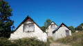
(6)Turn right onto a stony track signposted ‘Pré carré’. Climbsteeply towards some ruined barns. Pass between these barns and continue along a dirt track heading west. Further up, this track winds in a few circular loops. Stop to admire the stunning view to the north over the valley.
(7) Carry on southwards towards a meadow.
(8) When you reach the edge of this meadow (known as Pré carré), turn right towards a refuge (in a very dilapidated state). As you approach the hut, turn left onto a wide path climbing through the undergrowth. Continue due south towards Hourcatets, a large sloping meadow. Approach it from the right to find a grassy path that climbs diagonally, making the climb easier.
At the top of this meadow, turn right towards the south-west and re-enter the forest. At the next junction, turn left onto a forest track (yellow sign indicating: ‘Return to Saleich in 1h30’).
(9) Turn right onto this forest track, which heads west before beginning a series of wide, circular bends that descend gently through the woods to a junction where the track meets a path.
(10) As you approach the 793-metre mark, leave the main track and head straight ahead, north-north-east, along a grassy path signposted with a yellow sign: ‘Saleich in 1h15’. Continue along this track, which descends more steeply, passes an old pidgeon hunting hut and heads north towards Cap de Courech.
(11) At Cap de Courech, ignore the left-hand bend and turn right onto a small grassy track marked by a short wooden post painted yellow. Walk a few dozen metres before reaching the junction you passed on the way out, near the chapel.
(3) Follow the same route back as on the way there to return to the car park (S/E).

 Association / Club / Walk leader

 Visorando Member
 Easy
Easy