


Refine your search for walks in Abizanda
Abizanda walks


 The Entremon Gorges and the Mediano Dam
 Visorando Member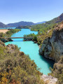
 4.20 mi
 +2,136 ft
 -2,142 ft
 3h 45
3h 45
 Moderate
 Departure from Abizanda (Huesca)
This spectacular hike through the Entremon Gorges leads to the Mediano dam, from where, depending on the season and water level, you’ll see a bell tower rising from the middle of the lake of the same name. This is the former village of Mediano, which was submerged during the construction of the dam.
Barfaluy
 Association / Club / Walk leader
 4.35 mi
+974 ft
-994 ft
2h 50
Moderate
Departure from Bárcabo (Huesca)
4.35 mi
+974 ft
-994 ft
2h 50
Moderate
Departure from Bárcabo (Huesca)
A loop passing through Lecina and its thousand-year-old oak tree, Abrigos de Barfaluy with its rock paintings and ancient beehives, Ermita de San Martín de Lecina.Enjoy a dip in the Rio Vero.
 Circular route starting from Santa Maria de Buil
 12.81 mi
+1,893 ft
-1,867 ft
3 hrs
12.81 mi
+1,893 ft
-1,867 ft
3 hrs
 Difficult
Departure from Aínsa-Sobrarbe/L´Aínsa-Sobrarbe (Huesca)
Difficult
Departure from Aínsa-Sobrarbe/L´Aínsa-Sobrarbe (Huesca)
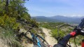
This route, starting from Santa Maria de Buil, will take you through forests, traditional villages, streams and steep terraces with breathtaking views of the mountains.
Sierra de Guara - From Alquezar to Asque
 5.88 mi
+1,201 ft
-1,217 ft
3h 45
Moderate
Departure from Alquézar (Huesca)
5.88 mi
+1,201 ft
-1,217 ft
3h 45
Moderate
Departure from Alquézar (Huesca)
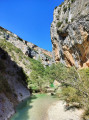
Magical panoramas of rocky massifs, the clear, refreshing waters of the Rio del Vero and olive tree-lined paths to the picturesque villages of Alquézar and Asque. The perfect change of scenery!
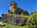
Bagüeste, the abandoned village
 5.28 mi
+866 ft
-856 ft
3h 10
5.28 mi
+866 ft
-856 ft
3h 10
 Easy
Departure from Aínsa-Sobrarbe/L´Aínsa-Sobrarbe (Huesca)
Easy
Departure from Aínsa-Sobrarbe/L´Aínsa-Sobrarbe (Huesca)
In the heart of the Sierra de Guara, this walk partly follows the historic Huesca trail. Along the way, you’ll discover the abandoned village of Bagüeste, with a church whose ruins are well worth seeing.
Barrancos de San Martin
3.39 mi
+1,427 ft
-1,407 ft
2h 50
Moderate
Departure from Boltaña (Huesca)
A walk that will allow you to discover a canyon featuring magnificent pools with a final surprise: the Confesionnario waterfall, also known as Conoelmundo. This can be done by walking up the canyon (wear shoes that can get wet) or by taking the path that runs along the top of the canyon. The best time to visit is May–June. From the car park, it’s a 10-minute walk and, after crossing the river, you reach the first pool. After 150 m along the path from the first pool, you reach the river again. You’ll come across two signposts about 20 m apart, which will guide you to the waterfall via the canyon or the path. You can complete a circular walk as shown on the .gpx file
Hermitage of the Virgin of the Castle and the Mascun Springs
4.01 mi
+1,014 ft
-1,020 ft
2h 45
Moderate
Departure from Bierge (Huesca)
From Rodellar, the proposed hike takes you up to the Ermita de la Virgen del Castillo via the hamlet of Cheto. The return journey takes a detour to las Fuentes del Mascun, following the Mascun river.
On arrival, you can take a tour of the village of Rodellar.
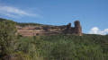
La Pena Falconera by Tamara Fountain
 7.67 mi
+1,325 ft
-1,329 ft
4h 40
Moderate
Departure from Bierge (Huesca)
7.67 mi
+1,325 ft
-1,329 ft
4h 40
Moderate
Departure from Bierge (Huesca)
A hike along the Rió Alcanedre before passing through the Fuente de Tamara, a true paradise of emerald waters, and finally arriving at the Pena Falconera (or Huevo de Morrano) with its astonishing shapes.
Please note that part of the walk is also wheelchair accessible (see description).
Walk around the Tozal de Pozos
8.81 mi
+2,562 ft
-2,572 ft
6h 15
Moderate
Departure from Laspuña (Huesca)
This walk starting from Laspuña takes you right up to the foot of the Peña Monatñesa and offers some views of the Cinca Valley, the Pyrenean peaks to the north-west and, of course, the Peña itself. Most of the route is in the welcome shade of the umbrella pines, with the notable exception of the end of the descent, which can be gruelling in full sun. In fine weather, make sure you carry enough water for the end of the walk. In wet weather, the descent is undoubtedly dangerous, as it is very slippery. Much of the route is marked with yellow and white signs.
Starting from the Laspuña car park, walk round the school and the adjoining field, then take the path that climbs up to the left. The path follows the valley floor as it ascends.
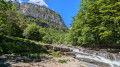
Anisclo Canyon
 8.94 mi
+3,596 ft
-3,615 ft
7h 15
Moderate
Departure from Fanlo (Huesca)
8.94 mi
+3,596 ft
-3,615 ft
7h 15
Moderate
Departure from Fanlo (Huesca)
In the Ordesa y Monte Perdido National Park, walk through the famous Anisclo Canyon, created by the Rio Bellos.
The altitude difference shown is an overestimate - it's only 500m.
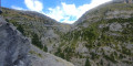
Anisclo Canyon circular loop via Col Arenas
 13.31 mi
+5,295 ft
-5,312 ft
8 hrs
13.31 mi
+5,295 ft
-5,312 ft
8 hrs
 Very difficult
Departure from Fanlo (Huesca)
Very difficult
Departure from Fanlo (Huesca)
Hike through the Anisclo Canyon, ascending via the Faja de la Pardina and Col Arenas.
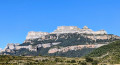
Añisclo Canyon: San Urbez to San Urbez via Sestrales and Fuenblanca
 18.89 mi
+8,058 ft
-7,940 ft
2 days
Difficult
Departure from Fanlo (Huesca)
18.89 mi
+8,058 ft
-7,940 ft
2 days
Difficult
Departure from Fanlo (Huesca)
A superb hike done over two days with a bivouac at the Refugio de San Vicenda. It is possible to go as far as Fuenblanca for the bivouac. In the Añisclo Canyon, bivouacking is permitted from 1,650 metres.
If you plan to sleep in your van the night before the hike, it is best to park 5-8 km before the canyon car park. The road to the car park is one-way, and crossing the canyon during the day must be magnificent.
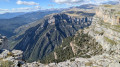
San Urbez - Sestrales - Refugio San Vicenda
 9.04 mi
+5,043 ft
-2,608 ft
8h 35
Difficult
Departure from Fanlo (Huesca)
9.04 mi
+5,043 ft
-2,608 ft
8h 35
Difficult
Departure from Fanlo (Huesca)
A superb two-day hike with a bivouac at the Refugio de San Vicenda. It is possible to go as far as Fuenblanca for the bivouac. In the Añisclo Canyon, bivouacking is permitted from 1,650 m.
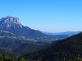
The watchtowers of Revilla
 2.64 mi
+1,339 ft
-1,362 ft
2h 25
Easy
Departure from Tella-Sin (Huesca)
2.64 mi
+1,339 ft
-1,362 ft
2h 25
Easy
Departure from Tella-Sin (Huesca)
This hike, accessible to all, takes you to various viewpoints offering breathtaking views of the Escuain Gorge and Rio Yaga. Stop to see the Ermita de San Lorenzo, a rock covered with mysterious symbols and inscriptions. If you're lucky, you'll be able to spot the mythical bearded vulture and, more easily, vultures.
From Calvera (Casa Puixico) to the Obarra Viewpoint
 Tourism professional
 2.47 mi
+748 ft
-735 ft
1h 45
Moderate
Departure from Beranuy (Huesca)
2.47 mi
+748 ft
-735 ft
1h 45
Moderate
Departure from Beranuy (Huesca)
Starting from the peaceful mountain village of Calvera, this round-trip hike leads to the Mirador de Obarra, which overlooks the magnificent Isábena Valley, in one of the least-visited areas of the Aragonese Pyrenees.
Guests staying at Casa Puixico can set off on foot straight away, without needing to use their car. The route passes through unspoilt mountain countryside and leads to a superb viewpoint offering panoramic views of Obarra Monastery, the Isábena Valley and the surrounding peaks.
The tranquillity is one of the great attractions of this walk. Calvera lies at the end of a small mountain road and, outside the mushroom-picking season, it is rare to come across other walkers there. Bearded vultures are frequently seen gliding above the cliffs.
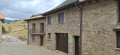
The abandoned village of Castrocit as seen from Calvera
 3.15 mi
+443 ft
-476 ft
1h 50
Easy
Departure from Beranuy (Huesca)
3.15 mi
+443 ft
-476 ft
1h 50
Easy
Departure from Beranuy (Huesca)
An easy walk of less than 6 km there and back from the Casa Puixico lodge in Calvera. An ideal walk to discover the abandoned village of Castrocit and its church in a wild and peaceful landscape.
From Calvera (Casa Puixico) to Obarra Monastery
 2.67 mi
+810 ft
-794 ft
1h 55
Moderate
Departure from Beranuy (Huesca)
2.67 mi
+810 ft
-794 ft
1h 55
Moderate
Departure from Beranuy (Huesca)
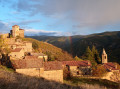
An ideal option for visiting the impressive 11th-century Obarra Monastery, accessible directly on foot from Calvera, without the need for a car. A magnificent route starting from the Casa Puixico lodge.
Tour of Tozal d'Escoubillons
6.72 mi
+1,624 ft
-1,594 ft
4h 30
Moderate
Departure from Tella-Sin (Huesca)
Hike in the heart of the pastures of the Sierra de los Fubillons (Aragon), with splendid views of the meadows and peaks of Aragon and the border.
The Ordesa Viewpoints
 11.35 mi
+3,619 ft
-3,606 ft
8h 20
Moderate
Departure from Fanlo (Huesca)
11.35 mi
+3,619 ft
-3,606 ft
8h 20
Moderate
Departure from Fanlo (Huesca)
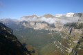
A magnificent hike along the edge of the Ordesa Canyon: extraordinary views of the canyon.
Refugio San Vicenda - San Urbez
9.79 mi
+2,799 ft
-5,331 ft
6h 55
Difficult
Departure from Puértolas (Huesca)
Second day of this superb two-day trip with a bivouac at the Refugio de San Vicenda. It is possible to go as far as Fuenblanca for the bivouac. In the Añisclo Canyon, bivouacking is permitted from 1,650 metres.
If you plan to sleep in your van the night before the hike, it is best to park 5-8 km before the canyon car park. The road to the car park is one-way, and crossing the canyon during the day must be magnificent (night crossing for the hike).
Muralla de Finestres
8.90 mi
+1,867 ft
-1,870 ft
5h 45
Difficult
Departure from Viacamp y Litera/Viacamp i Lliterà (Huesca)
The path climbs gradually through the arid landscape typical of the Sierra del Montsec. The ascent is steady but steep, with little shade, until you reach the ridges.
You then reach the Pic del Creu, a summit offering an impressive panoramic view of Lake Canelles and the surrounding hills. The ridge walk can be narrow in places, with a rather pronounced sense of exposure.
The descent then heads towards the Murallas de Finestras. You gradually approach these long rocky walls, whose silhouette becomes increasingly spectacular as you lose altitude. The path winds its way through scree and limestone areas, sometimes barely marked.
Once at the foot of the walls, the route heads southwards along the ridge, often on easier terrain but still isolated. This section offers a different perspective of the cliffs and the reservoir.
Finestras
8.98 mi
+1,841 ft
-1,841 ft
5h 45
Moderate
Departure from Viacamp y Litera/Viacamp i Lliterà (Huesca)
You will need to take an unpaved road to reach the starting point. Once you reach the starting point, you will begin your descent to the village of Finestras. From there, you will have a panoramic view of the Finestras wall. You will then descend to a small water source, which is beautiful and perfect for cooling off in summer. The return journey follows the same route as the outward journey.
Congost de Mont-Rebei and Montfalco Footbridges
 9.80 mi
+5,427 ft
-5,417 ft
9h 15
Difficult
Departure from Viacamp y Litera/Viacamp i Lliterà (Huesca)
9.80 mi
+5,427 ft
-5,417 ft
9h 15
Difficult
Departure from Viacamp y Litera/Viacamp i Lliterà (Huesca)
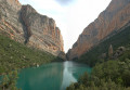
An unforgettable hike in the heart of an impressive gorge carved out by the Noguera Ribagoranza. Dizzying footbridges and breathtaking views await you.
Broto - Yosa - Tozal del Pueyo
 7.61 mi
+2,349 ft
-2,346 ft
5h 35
Moderate
Departure from Broto (Huesca)
7.61 mi
+2,349 ft
-2,346 ft
5h 35
Moderate
Departure from Broto (Huesca)
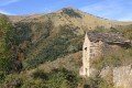
Superb loop to the abandoned village of Yosa, along the GR®-15. The return via the ridge offers sumptuous views of the surrounding area, particularly the Pyrenean peaks of Monte Perdido and its sisters.
The three waterfalls towards Cerier
4.21 mi
+1,106 ft
-1,099 ft
2h 55
Easy
Departure from Benasque/Benás (Huesca)
A very beautiful hike.
There is a tricky 10-metre section at the waterfall, but there is a safety line to help you.
The outward journey is a little more difficult than the return journey, but it's worth it. And it's good to do it in this direction.
The return route crosses fields.
La Faja Racon
 4.83 mi
+3,875 ft
-3,852 ft
5h 35
Difficult
Departure from Torla-Ordesa (Huesca)
4.83 mi
+3,875 ft
-3,852 ft
5h 35
Difficult
Departure from Torla-Ordesa (Huesca)
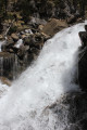
On the right bank of the Rio Arazas, the Faja Racon trail is very similar to that on the left bank, the Faja de Pelay.
The Soaso Waterfalls
11.17 mi
+6,562 ft
-6,686 ft
10h 50
Moderate
Departure from Torla-Ordesa (Huesca)
Round trip to the Soaso waterfalls. A lovely walk following the trail to the Soaso waterfalls. This is the Faja de Pelay walk, but it doesn’t go via the top as that section is quite dangerous. There are four waterfalls, as well as a shelter in the middle of the plain. For children, it’s possible to walk as far as the waterfalls and stop there before turning back. This can be brilliant for little ones who already enjoy walking. Please stay on the paths and respect the mountain.
La Faja de Pelay
 10.90 mi
+5,745 ft
-5,748 ft
10h 00
Difficult
Departure from Torla-Ordesa (Huesca)
10.90 mi
+5,745 ft
-5,748 ft
10h 00
Difficult
Departure from Torla-Ordesa (Huesca)
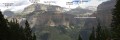
An exceptional hike in the Ordesa Mont Perdu Natural Park. You must take the shuttle bus from Torla at the large car park at the entrance to the village.Please note: the elevation gain for this hike is incorrect. It should be 750m of elevation gain and loss, not 1758m as stated in the paragraph below.
Estos Valley with the Batisielles and Escarpinosa mountain lakes
9.99 mi
+3,497 ft
-3,530 ft
7h 40
Difficult
Departure from Benasque/Benás (Huesca)
Park at the free car park in Estos. Follow the GR® as it climbs gradually, passing close to the Embiase and then the Ana hut. Then turn left towards the Batisielles ibonet. We choose to continue towards the upper lakes: a steep and demanding climb to the Gran de Batisielles ibon, followed by a gentler slope to the Aigüeta ibon. Lunch break by the lake after a short scrambling section. Return via the Ibon d’Escarpinosa: a more technical route with numerous scree slopes, where you must follow the cairns closely and remain vigilant, even in the forest. Once in Escarpinosa, we take a circular route to explore the two ibons, where a few locals are swimming in August. The descent alternates between steep slopes and more gentle trails before rejoining the GR®, the perfect way to round off this beautiful, long day.
Ibón de Batisielles
9.67 mi
+3,494 ft
-3,461 ft
7h 30
Difficult
Departure from Benasque/Benás (Huesca)
A very pleasant walk that goes as far as the Batisielles tarns and takes in a section of the path to the Estos mountain hut. The walk passes a small hut – the Santa Ana hut – which is very charming. You can make an initial stop at the Batisielles tarn, where you can take the path leading directly to the pass between the two tarns to avoid the following sections. You can also head to the second ibon, the Aigulla de Batisielles, but this adds an extra 100 metres of elevation gain. You can turn back and take a path to avoid the avalanche couloirs. There is also a very difficult and very long section through the middle of the avalanche couloirs and over rocky ground. The rest of the route through the avalanche couloirs continues to feature dangerous sections. To see the paths more clearly, switch the map to OSM Rando. Please stay on the paths and respect the mountain environment.
Estos car park – Estos mountain hut
 5.17 mi
+2,011 ft
-115 ft
4h 10
Moderate
Departure from Benasque/Benás (Huesca)
5.17 mi
+2,011 ft
-115 ft
4h 10
Moderate
Departure from Benasque/Benás (Huesca)
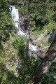
The first day of the Tour des Posets, which offers a gentle start with a steady climb to the Estos Mountain Hut. Initially through woodland, partly alongside the Rio Estos, the path follows the GR®11 route and takes you close to the Gorgues Galantes (waterfalls) before reaching thefirst mountain hut on this tour.
Tour of Aneto
24.52 mi
+9,741 ft
-9,744 ft
4 days
Difficult
Departure from Benasque/Benás (Huesca)
The walk starts from Fuente de la Pubiya, which is easily accessible by car and has a car park nearby. This walk allows you to reach your first peak at over 3,000 metres whilst enjoying magnificent high-mountain scenery, including glacial lakes, ridges and panoramic views of the Maladeta massif. However, the route remains challenging due to its length and elevation gain: it is advisable to be reasonably fit and to have experience of mountain walking before attempting it.
Fuente de la Pubiya – Prados de Llosás
5.63 mi
+3,074 ft
-476 ft
5h 15
Difficult
Departure from Benasque/Benás (Huesca)
Starting from Fuente de la Pubiya and ending at Prados de Llosás. The first day covers around 10 km with a climb of nearly 1,000 m. A lovely, gradual climb through the heart of the valley, with superb scenery and a finish in a magnificent setting.
Prados de Llosás – Cap de Llauset mountain hut
3.65 mi
+3,156 ft
-2,257 ft
4h 25
Difficult
Departure from Benasque/Benás (Huesca)
The route runs from Prados de Llosás to the Cap de Llauset mountain hut. This is a day during which you’ll have the chance to climb a peak over 3,000 metres high, the Tuca de Culebres. From there, you’ll be able to enjoy a magnificent view of the Aneto. You’ll then continue on a gentle descent to the mountain hut.