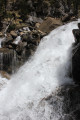
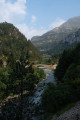
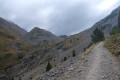
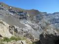
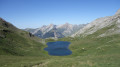
Round trip to the Soaso waterfalls. A lovely walk following the trail to the Soaso waterfalls. This is the Faja de Pelay walk, but it doesn’t go via the top as that section is quite dangerous. There are four waterfalls, as well as a shelter in the middle of the plain. For children, it’s possible to walk as far as the waterfalls and stop there before turning back. This can be brilliant for little ones who already enjoy walking. Please stay on the paths and respect the mountain.
Details
–
-
Activity: Walking -
Distance: 11.17 mi
-
Average duration: 10h 50
-
Difficulty: Moderate
-
-
Back to start: Yes
-
Ascent: + 6,562 ft
-
Descent: - 6,686 ft
-
-
Highest point: 6,184 ft
-
Lowest point: 4,505 ft
-
Country: Spain
-
Area: Pyrenees
-
City: Torla-Ordesa
-
Start/End: N 42.649829° / W 0.059875°
Waypoints
- S/E : mi 0 - alt. 4,629 ft - La Pradera de Ordesa
- 1 : mi 0.12 - alt. 5,079 ft - Fork in the road
- 2 : mi 2.03 - alt. 5,866 ft - La Cueva Waterfall
- 3 : mi 2.12 - alt. 4,977 ft - Cascade del Estrecho
- 4 : mi 2.32 - alt. 6,122 ft - Small waterfall
- 5 : mi 4.85 - alt. 5,712 ft - Shelters in the middle of the plain
- 6 : mi 5.54 - alt. 5,768 ft - Waterfall
- S/E : mi 11.17 - alt. 4,505 ft - La Pradera de Ordesa
Other walks in the area
La Faja Racon
La Faja de Pelay
The Spanish ledges
The Taillon circuit via the Brèche de Roland and the Escuzana ledge
Pic entre les Ports via Lac des Espécières.
The Brèche de Roland
Le Casque du Marboré via the normal route
For more walks, use our search engine .
The GPS track and description are the property of this route's author. Please do not copy them without permission.