


 Country:

 City:
City:


Starting from the Laspuña car park, walk round the school and the adjacent field, then follow the path that climbs to the left. The path follows the valley.
Walk around the Tozal de Pozos


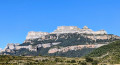
This walk starting from Laspuña takes you right up to the foot of the Peña Monatñesa and offers some views of the Cinca Valley, the Pyrenean peaks to the north-west and, of course, the Peña itself. Most of the route is in the welcome shade of the umbrella pines, with the notable exception of the end of the descent, which can be gruelling in full sun. In fine weather, make sure you carry enough water for the end of the walk. In wet weather, the descent is undoubtedly dangerous, as it is very slippery. Much of the route is marked with yellow and white signs.
Starting from the Laspuña car park, walk round the school and the adjoining field, then take the path that climbs up to the left. The path follows the valley floor as it ascends.
Details
Creation:
Last update:
Last review:
–
–
-
 Activity: Walking
 -
 Distance: 8.81 mi
 -
 Average duration: 6h 15
 -
 Difficulty: Moderate
 -
-
 Back to start: Yes
 -
 Ascent: + 2,562 ft
 -
 Descent: - 2,572 ft
 -
-
 Highest point: 4,843 ft
 -
 Lowest point: 2,323 ft
Description of the walk
Waypoints
- S/E : mi 0 - alt. 2,362 ft - Laspuna
- 1 : mi 0.6 - alt. 2,549 ft - Junction
- 2 : mi 0.67 - alt. 2,582 ft - Fork
- 3 : mi 0.86 - alt. 2,700 ft - Junction
- 4 : mi 0.92 - alt. 2,740 ft - Turn
- 5 : mi 1.05 - alt. 2,838 ft - Tarmac road
- 6 : mi 1.19 - alt. 2,841 ft - El Casal
- 7 : mi 1.43 - alt. 2,907 ft - Stony path before Ceresa
- 8 : mi 1.5 - alt. 2,953 ft - Junction
- 9 : mi 1.84 - alt. 3,133 ft - A narrow path leading uphill
- 10 : mi 2.15 - alt. 3,481 ft - Junction
- 11 : mi 3.05 - alt. 4,012 ft - Junction
- 12 : mi 4.48 - alt. 4,836 ft - Junction
- 13 : mi 5.67 - alt. 4,396 ft - Crossroads
- 14 : mi 5.96 - alt. 4,196 ft - Junction
- 15 : mi 6.04 - alt. 4,203 ft - Junction: return route possible via Los Pozos
- 16 : mi 6.12 - alt. 4,213 ft - Antenna
- 17 : mi 6.41 - alt. 4,167 ft - Junction
- 18 : mi 6.65 - alt. 3,842 ft - Junction
- 19 : mi 7.51 - alt. 2,946 ft - Route
- 20 : mi 7.59 - alt. 2,913 ft - Junction
- S/E : mi 8.81 - alt. 2,362 ft - Laspuna
Notes
Please note: at (8), you must turn right, not left!
Other walks in the area
Anisclo Canyon
 Visorando Member
 8.94 mi
+3,596 ft
-3,615 ft
7h 15
Moderate
8.94 mi
+3,596 ft
-3,615 ft
7h 15
Moderate
 Departure from Fanlo (Huesca)
In the Ordesa y Monte Perdido National Park, walk through the famous Anisclo Canyon, created by the Rio Bellos.
The altitude difference shown is an overestimate - it's only 500m.
The watchtowers of Revilla
 2.64 mi
+1,339 ft
-1,362 ft
2h 25
2.64 mi
+1,339 ft
-1,362 ft
2h 25
 Easy
Departure from Tella-Sin (Huesca)
Easy
Departure from Tella-Sin (Huesca)
This hike, accessible to all, takes you to various viewpoints offering breathtaking views of the Escuain Gorge and Rio Yaga. Stop to see the Ermita de San Lorenzo, a rock covered with mysterious symbols and inscriptions. If you're lucky, you'll be able to spot the mythical bearded vulture and, more easily, vultures.
Anisclo Canyon circular loop via Col Arenas
 13.31 mi
+5,295 ft
-5,312 ft
8 hrs
13.31 mi
+5,295 ft
-5,312 ft
8 hrs
 Very difficult
Departure from Fanlo (Huesca)
Very difficult
Departure from Fanlo (Huesca)
Hike through the Anisclo Canyon, ascending via the Faja de la Pardina and Col Arenas.
San Urbez - Sestrales - Refugio San Vicenda
 9.04 mi
+5,043 ft
-2,608 ft
8h 35
9.04 mi
+5,043 ft
-2,608 ft
8h 35
 Difficult
Departure from Fanlo (Huesca)
Difficult
Departure from Fanlo (Huesca)
A superb two-day hike with a bivouac at the Refugio de San Vicenda. It is possible to go as far as Fuenblanca for the bivouac. In the Añisclo Canyon, bivouacking is permitted from 1,650 m.
Añisclo Canyon: San Urbez to San Urbez via Sestrales and Fuenblanca
 18.89 mi
+8,058 ft
-7,940 ft
2 days
Difficult
Departure from Fanlo (Huesca)
18.89 mi
+8,058 ft
-7,940 ft
2 days
Difficult
Departure from Fanlo (Huesca)
A superb hike done over two days with a bivouac at the Refugio de San Vicenda. It is possible to go as far as Fuenblanca for the bivouac. In the Añisclo Canyon, bivouacking is permitted from 1,650 metres.
If you plan to sleep in your van the night before the hike, it is best to park 5-8 km before the canyon car park. The road to the car park is one-way, and crossing the canyon during the day must be magnificent.
Barrancos de San Martin
3.39 mi
+1,427 ft
-1,407 ft
2h 50
Moderate
Departure from Boltaña (Huesca)
A walk that will allow you to discover a canyon featuring magnificent pools with a final surprise: the Confesionnario waterfall, also known as Conoelmundo. This can be done by walking up the canyon (wear shoes that can get wet) or by taking the path that runs along the top of the canyon. The best time to visit is May–June. From the car park, it’s a 10-minute walk and, after crossing the river, you reach the first pool. After 150 m along the path from the first pool, you reach the river again. You’ll come across two signposts about 20 m apart, which will guide you to the waterfall via the canyon or the path. You can complete a circular walk as shown on the .gpx file
Refugio San Vicenda - San Urbez
9.79 mi
+2,799 ft
-5,331 ft
6h 55
Difficult
Departure from Puértolas (Huesca)
Second day of this superb two-day trip with a bivouac at the Refugio de San Vicenda. It is possible to go as far as Fuenblanca for the bivouac. In the Añisclo Canyon, bivouacking is permitted from 1,650 metres.
If you plan to sleep in your van the night before the hike, it is best to park 5-8 km before the canyon car park. The road to the car park is one-way, and crossing the canyon during the day must be magnificent (night crossing for the hike).
For more walks, use our search engine .
The GPS track and description are the property of this route's author. Please do not copy them without permission.

