


 Descend via a chimney equipped with chains and cables.


 Country:

 City:


Car park at Nerín.
(S/E) Take the track heading north and you’ll reach a fork after a hairpin bend to the left.
(1) Head up the path on the right-hand side until you reach another fork in the tracks.
(2) Turn left towards the north-west and rejoin the track. (Do not take the path on the right which leads to Mondoto).
(3) Continue to the right along the track for about 100 metres until you reach a junction with a path.
(4) There are two options at this junction with the path on the left:
- continue along the track to point 7, as it is easier to follow than the path that crosses it.
- take the footpath on your left and join another track (marked). Halfway along, a magnificent fountain provides a chance to top up your water supplies.
(5) Follow the path on the right that climbs up from Buissan. Further on, rejoin the track and follow it straight ahead. Pass the Barranco de Calderuela.
(6) Follow the track due north. After skirting as closely as possible along the Barranco de Calderuela, look out for a path on the right.
(7) Follow this path to the right, crossing the Barranco. You’ll reach a junction where four paths meet.
(8) Carry on straight ahead towards the Refugio De Cuello Arenas (private property; during the grazing season, there may be a herd of cattle nearby).
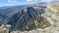
(9) Follow the path on the left which heads north and runs along the top of the cliff (do not take the path which descends to the Anisclo Canyon via the Barranco de la Pardina to La Ripareta). Spectacular view of the Pardina Canyon and the narrow path leading down to La Ripareta. This path provides an alternative route back down. It is a little steep in places but pleasant.
(10) Turn right and head down the ledge (signposted). A protective fence for livestock to the right of the descent prevents cows from straying. The path is overgrown with tall grass but remains easy to follow. There is a water source towards the end of the ledge: Salto de Agua de Ballisaco.
(11) Head due north, climbing back up onto the plateau via a rock ledge equipped with a chain, followed by cables and metal steps. Join a path.
(12) The path climbs up onto the plateau heading due north. At the fork, carry on straight ahead due north.
(13) You’ll reach a small, open hut, which is half-buried and covered by a beautiful slate roof. A little further on, the Refugio de Cuello Arenas is surrounded, in season, by a lovely herd of cows. Continue due north, descending 25 metres to a magnificent stone bridge spanning the Barranco de Caprariza.
(14) After crossing the bridge, climb a few steps and take the correct path to the right. Leave this path when it climbs up onto the plateau to the left and continue along the grassy ledge, which has no marked track or signposts. You’ll be overlooking the left bank of the small canyon carved out by the stream (Barranco de Caprariza). Walk along the base of a small cliff, about ten metres high, on your left and descend into the meadow that follows on your right. You’ll come to a wire fence preventing the cows from continuing their descent towards the Anisclo Canyon. Go round the fence on one side, then look out for the first cairns in the grassy area that follows. These cairns lead to the descending path visible through a gap in the vegetation. Two signposts indicate the direction of La Ripareta (turn right at the first signpost).
(15) The path winds through the boxwood. It has recently been cleared (2022) and numerous cairns make it easy to follow. A few rocky sections require you to use your hands for support. Upon reaching the Río Bellós, large boulders block the path. Here, there are two options:
- If the water flow allows, squeeze through between the water and the rock.
- Otherwise, two cables attached to the rock allow you to cross safely.
Look out for the carnivorous plants Pinguicula longifolia.
(16) At the bridge over the Barranco Caprariza, continue along the path without any major difficulty. Climb up through the forest and then descend along the stream to the La Ripareta junction.
(17) Continue the descent along the Río Bellós (ignore the path on the right which leads back up to the Refugio de Cuello Arenas).
(18) Head uphill, then continue along the Río Bellós. Further on, at Cumaz, a sign points to adrinking water sourcenot to be missed! As well as the many refreshing water pools. Further on, you’ll reach a fork in the path.
(19) Head uphill to the right along theGR®15, Camino de la Montana de Sensa, towards Nerín (ignore the path that continues along the Río Bellós). You’ll reach Sercué: a village with residents and a Romanesque church worth visiting.
(20) Continue along theGR® and head for the car park in Nerín (S/E).

 Visorando Member
 Difficult

 Moderate
 Easy

