


 Country:

 City:
City:


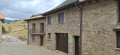
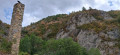
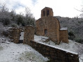
The walk starts directly from the Casa Puixico lodge. The route begins by crossing the village of Calvera, heading down the tarmac road to reach the start of the dirt track. You then simply follow this track, which is suitable for vehicles (but closed to unauthorised vehicles), as it descends gently through the countryside towards the valley. The path is clear and impossible to miss. As you approach your destination, the track continues to descend gently towards the barranc (gorge) of Castrocit, where you can explore the remains and ruins of the abandoned village. To round off the visit, a short track climbs slightly up the hill to reach the Church of Sant Cristòfol. The return journey then follows the same route, entirely uphill, back to the lodge in Calvera.
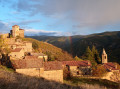
The abandoned village of Castrocit as seen from Calvera


An easy walk of less than 6 km there and back from the Casa Puixico lodge in Calvera. An ideal walk to discover the abandoned village of Castrocit and its church in a wild and peaceful landscape.
Details
Creation:
Last update:
Last review:
–
–
-
 Activity: Walking
 -
 Distance: 3.15 mi
 -
 Average duration: 1h 50
 -
 Difficulty: Easy
 -
-
 Back to start: Yes
 -
 Ascent: + 443 ft
 -
 Descent: - 476 ft
 -
-
 Highest point: 4,052 ft
 -
 Lowest point: 3,720 ft
Photos
Description of the walk
Waypoints
- S/E : mi 0 - alt. 4,052 ft - Casa Puixico
- 1 : mi 0.01 - alt. 4,039 ft - Photo
- 2 : mi 0.32 - alt. 3,862 ft - Information point
- 3 : mi 1.26 - alt. 3,750 ft - Calvaire
- 4 : mi 1.48 - alt. 3,763 ft - Photo
- 5 : mi 1.54 - alt. 3,766 ft - Castrocit
- 6 : mi 1.6 - alt. 3,819 ft - Iglesia de San Cristóbal
- S/E : mi 3.15 - alt. 4,042 ft - Casa Puixico
Notes
- Terrain: The route follows a dirt track suitable for vehicles throughout.
- Route profile: The route is mainly downhill on the way to the village and the Castrocit ravine. Please note that there is a short climb to reach the Church of Sant Cristòfol.
- Effort on the return journey: The return journey to Calvera is entirely uphill.
- Exposure: The track is completely exposed to the sun, with no shade. The climb back up to Calvera can be gruelling, particularly at midday during the summer. Remember to take water and a hat.
- Safety: If you decide to leave the track to explore the ruins of the abandoned village, please be careful. The site is overgrown with stinging nettles. It is advisable to wear long trousers.
Worth a visit
- The abandoned village of Castrocit: A hamlet steeped in history that was deserted in the second half of the 20th century. Its stone ruins offer a striking glimpse into the rural life of the Ribagorza region in days gone by.
- The Church of Sant Cristòfol: Perched on the hill overlooking the village, this 12th-century Romanesque church has a single nave and offers a magnificent view of the surrounding valley.
- The Barranc de Castrocit: The wild ravine stretching out at the foot of the village, carved out by the waters and typical of the rugged terrain of the Aragonese Pyrenees.
- Of note along the way (Sierra de Sis massif): Well before reaching Castrocit, the main track comes to a junction leading towards the peaks. This is where experienced hikers turn off to follow the famous Sierra de Sis route or the historic Las Tozas trail, without needing to descend all the way to the abandoned village.
Other walks in the area
From Calvera (Casa Puixico) to Obarra Monastery
 Tourism professional
 2.67 mi
+810 ft
-794 ft
1h 55
2.67 mi
+810 ft
-794 ft
1h 55
 Moderate
 Departure from Beranuy (Huesca)
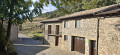
An ideal option for visiting the impressive 11th-century Obarra Monastery, accessible directly on foot from Calvera, without the need for a car. A magnificent route starting from the Casa Puixico lodge.
From Calvera (Casa Puixico) to the Obarra Viewpoint
 2.47 mi
+748 ft
-735 ft
1h 45
Moderate
Departure from Beranuy (Huesca)
2.47 mi
+748 ft
-735 ft
1h 45
Moderate
Departure from Beranuy (Huesca)
Starting from the peaceful mountain village of Calvera, this round-trip hike leads to the Mirador de Obarra, which overlooks the magnificent Isábena Valley, in one of the least-visited areas of the Aragonese Pyrenees.
Guests staying at Casa Puixico can set off on foot straight away, without needing to use their car. The route passes through unspoilt mountain countryside and leads to a superb viewpoint offering panoramic views of Obarra Monastery, the Isábena Valley and the surrounding peaks.
The tranquillity is one of the great attractions of this walk. Calvera lies at the end of a small mountain road and, outside the mushroom-picking season, it is rare to come across other walkers there. Bearded vultures are frequently seen gliding above the cliffs.
Circular route around the lakes and mountain huts starting from the Embalse de Llauset
 Visorando Member6.34 mi
+2,500 ft
-2,500 ft
5h 05
Visorando Member6.34 mi
+2,500 ft
-2,500 ft
5h 05
 Difficult
Departure from Montanuy / Montanui (Huesca)
Difficult
Departure from Montanuy / Montanui (Huesca)
One of the most beautiful hikes in the area, featuring a lovely, technical circular route that can be challenging at times due to steep gradients. It’s best to follow the suggested route. There are numerous mountain lakes to explore, magnificent landscapes offering varied views of the surrounding mountain ranges, and a brand-new mountain refuge (where you can enjoy a meal or stop for a picnic).
The three waterfalls towards Cerier
4.21 mi
+1,106 ft
-1,099 ft
2h 55
Easy
Departure from Benasque/Benás (Huesca)
A very beautiful hike.
There is a tricky 10-metre section at the waterfall, but there is a safety line to help you.
The outward journey is a little more difficult than the return journey, but it's worth it. And it's good to do it in this direction.
The return route crosses fields.
Cap de Llauset mountain refuge – Plan d’Abaixo
9.05 mi
+2,920 ft
-4,767 ft
6h 40
Difficult
Departure from Montanuy / Montanui (Huesca)
The route starts at the Cap de Llauset mountain hut and ends at Plan d’Abaixo. This stage takes you over the Col d’Ixalenques, which rises to an altitude of 2,812 metres. You’ll enjoy magnificent panoramic views of the surrounding peaks before beginning a long descent to Plan d’Abaixò, in the heart of a wild and unspoilt landscape.
Prados de Llosás – Cap de Llauset mountain hut
3.65 mi
+3,156 ft
-2,257 ft
4h 25
Difficult
Departure from Benasque/Benás (Huesca)
The route runs from Prados de Llosás to the Cap de Llauset mountain hut. This is a day during which you’ll have the chance to climb a peak over 3,000 metres high, the Tuca de Culebres. From there, you’ll be able to enjoy a magnificent view of the Aneto. You’ll then continue on a gentle descent to the mountain hut.
Val de Boí: Estanys de Llebreta and Llong
 13.16 mi
+2,247 ft
-2,218 ft
8h 00
Difficult
Departure from la Vall de Boí (Lleida)
13.16 mi
+2,247 ft
-2,218 ft
8h 00
Difficult
Departure from la Vall de Boí (Lleida)
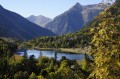
The Val de Boí is particularly well known for its many Romanesque churches, whose original frescoes are preserved at the National Art Museum of Catalonia (MNAC) in Barcelona. This valley is listed as a UNESCO World Heritage Site. But it is also the gateway to the Aigüestortes National Park. The suggested route is a discovery walk, a return trip that can therefore be adapted to suit. The scenery is breathtaking.
Estanys de Anglios
 6.72 mi
+2,789 ft
-2,756 ft
5h 35
Difficult
Departure from Montanuy / Montanui (Huesca)
6.72 mi
+2,789 ft
-2,756 ft
5h 35
Difficult
Departure from Montanuy / Montanui (Huesca)
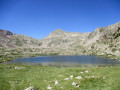
This challenging hike, situated in the Posets-Maladeta Natural Park, takes you to discover the Estanys de Anglios, a magnificent series of high-altitude lakes located off the beaten track of the Aigüestortes National Park’s main routes. The first section, mostly through woodland, follows the GR® 11 and leads to the Estany Gran, an ideal spot for a picnic break. The rest of the route requires a good sense of direction and experience of navigating difficult terrain with few landmarks. Nevertheless, the various lakes you’ll encounter and the beauty of the scenery will easily make you forget these challenges: torrents of all sizes, lakes with crystal-clear waters, enchanting woodland and an exceptional natural cirque.
For more walks, use our search engine .
The GPS track and description are the property of this route's author. Please do not copy them without permission.

