Angel Orus Mountain Hut – Estos car park

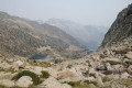
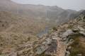
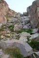
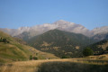
The final stage of the Tour du Posets starts from the Angel Orus refuge and leads to the car park in the Estos Valley. The first part of the day takes place over very stony terrain before moving into a more wooded area for the second half of the descent. The route offers further stunning views of the eastern slope of the Posets and of several lakes dotted along the way.

Details

107704433
Creation:
Last update:
Last review:
  • Walking
    Activity: Walking
  • ↔
    Distance: 8.41 mi
  • ◔
    Average duration: 5h 45 
  • ▲
    Difficulty: Difficult

  • ⚐
    Back to start: No
  • ↗
    Ascent: + 2,159 ft
  • ↘
    Descent: - 4,738 ft

  • ▲
    Highest point: 8,891 ft
  • ▼
    Lowest point: 4,318 ft

Photos

Description of the walk

Start from the Angel Orus refuge.

(S) Follow the previous day’s route in the opposite direction towards the GR®11.2 and the Collado de la Plana (still following the “Ruta de los 3 Refugios” signposting)

(1) At the junction, follow the path leading straight ahead towards Collado de la Plana

(2) Join the GR®11.2, which you follow to the right as it climbs up the mountainside.

(3) As you pass a group of small lakes, cross the stream flowing from them and begin the final ascent of the route.

(4) On reaching Collado de la Plana (2,700 m), the route continues with an initial descent over scree down to the Batisielles Lakes.

(5) At the junction, take the path branching off to the right towards the Santa Ana Hut and the Estos car park

(6) Here, you rejoin the track taken on the ascent to the Estos Hut on the first day of the tour. Follow it to the right as far as the car park (E).

Waypoints

  1. S : mi 0 - alt. 6,906 ft - Angel Orus mountain hut
  2. 1 : mi 0.64 - alt. 7,720 ft - Junction
  3. 2 : mi 0.85 - alt. 7,713 ft - GR11.2
  4. 3 : mi 1.88 - alt. 7,900 ft - Lake, junction
  5. 4 : mi 2.85 - alt. 8,845 ft - Pass
  6. 5 : mi 5.29 - alt. 6,224 ft - Junction
  7. 6 : mi 6.39 - alt. 5,180 ft - Track
  8. E : mi 8.41 - alt. 4,318 ft - Estos – Benasque car park

Notes

There are no water points on the route before reaching the Estos Valley track.

There are plenty of stones on the first part of the route (up to the Batisielles Lakes); the rest of the descent is much smoother and faster.

The “Ruta de los 3 refugios” route is clearly signposted throughout.

Worth a visit

The lakes dotted along the route provide lovely opportunities to take a break and recharge your batteries.

Lovely views and stunning panoramas of the peaks, particularly at the Collado de la Plana

Always be cautious and plan ahead when you're outdoors. Visorando and the author of this route cannot be held responsible for any accidents occurring on this route.

The GR® and PR® markings are the intellectual property of the Fédération Française de Randonnée Pédestre.

Other walks in the area

For more walks, use our search engine .

The GPS track and description are the property of this route's author. Please do not copy them without permission.