


Refine your search for walks in Val-de-Marne
Val-de-Marne walks


 Marne loop from Saint-Maur to Joinville
 Visorando Member
 8.41 mi
 +72 ft
 -26 ft
 3h 55
3h 55
 Moderate
 Departure from Saint-Maur-des-Fossés (Val-de-Marne)
The commune of Saint-Maur-des-Fossés lies entirely within a bend in the Marne. This walk, from station to station, follows almost the entire length of this bend. It can be enjoyed in all seasons and showcases the river and its islands, the residential neighbourhoods along its banks and Charles Trénet, who lived here for part of his life.
Loops of the Marne from Joinville-le-Pont to Neuilly-Plaisance
 5.45 mi
+16 ft
-62 ft
2h 30
5.45 mi
+16 ft
-62 ft
2h 30
 Easy
Departure from Joinville-le-Pont (Val-de-Marne)
Easy
Departure from Joinville-le-Pont (Val-de-Marne)
A short hike in an urban setting, from station to station, along the Marne and on one of its islands. A walk punctuated by bridges and the many rowing clubs located on the banks.
Servon ponds circular
 4.16 mi
+115 ft
-112 ft
2h 00
Easy
Departure from Santeny (Val-de-Marne)
4.16 mi
+115 ft
-112 ft
2h 00
Easy
Departure from Santeny (Val-de-Marne)
The circular route passes through two Briard villages and American-style residences before reaching the Servon ponds, a great place for a picnic.
The landscape is very varied, with woods, fields, an equestrian centre and a river punctuating the route.
Bois Notre Dame at the start of Santeny
7.78 mi
+121 ft
-121 ft
3h 40
Moderate
Departure from Santeny (Val-de-Marne)
A short hike in the Notre Dame woods.
Please note that theGR® is a little muddy when it rains.
The villas along the banks of the Yerres
6.28 mi
+180 ft
-180 ft
3h 05
Easy
Departure from Mandres-les-Roses (Val-de-Marne)
A varied walk from market gardeners to early 20th-century holiday homes.
From Boissy to Brunoy via the Grange forest and the banks of the Yerres
 8.10 mi
+243 ft
-249 ft
3h 55
Moderate
Departure from Boissy-Saint-Léger (Val-de-Marne)
8.10 mi
+243 ft
-249 ft
3h 55
Moderate
Departure from Boissy-Saint-Léger (Val-de-Marne)
The first part of this hike from station to station is mainly through forest, with a mix of wide paths and winding trails. Then you follow the course of the Yerres, playing leapfrog with the river, its branches and tributaries.
The former quarries of Fontenay-sous-Bois
 3.21 mi
+151 ft
-144 ft
1h 35
Easy
Departure from Fontenay-sous-Bois (Val-de-Marne)
3.21 mi
+151 ft
-144 ft
1h 35
Easy
Departure from Fontenay-sous-Bois (Val-de-Marne)
A short walk through the streets, alleys and paths of Fontenay-sous-Bois. Located on the site of former gypsum quarries, the Ecoparc offers a calm and exotic atmosphere as well as a beautiful panorama. The Parc de l'Hôtel de Ville, with its water features and a few paths lined with beautiful pavilions, completes the picture.
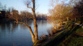
Old Saint-Maur and the banks of the Marne
 4.62 mi
+66 ft
-102 ft
2h 10
Easy
Departure from Saint-Maur-des-Fossés (Val-de-Marne)
4.62 mi
+66 ft
-102 ft
2h 10
Easy
Departure from Saint-Maur-des-Fossés (Val-de-Marne)
After walking along the Marne from Champigny station, we stroll through Old Saint-Maur and visit the remains of the former abbey that gave the town its name. The walk ends at the water's edge, along the Saint-Maur Canal and then, once again, the Marne.
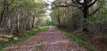
Between Boissy-Saint-Léger and Marolles-en-Brie via Grosbois and La Végétale
 9.87 mi
+295 ft
-279 ft
4h 50
Moderate
Departure from Boissy-Saint-Léger (Val-de-Marne)
9.87 mi
+295 ft
-279 ft
4h 50
Moderate
Departure from Boissy-Saint-Léger (Val-de-Marne)
A hike that is mostly in the forest and partly in urban areas. You will take well-maintained forest paths, a green corridor and the "Végétale" path built above a TGV tunnel.
From Saint-Maur to Suçy-en-Brie via the Marne and Morbras Park
 5.75 mi
+236 ft
-236 ft
2h 50
Easy
Departure from Saint-Maur-des-Fossés (Val-de-Marne)
5.75 mi
+236 ft
-236 ft
2h 50
Easy
Departure from Saint-Maur-des-Fossés (Val-de-Marne)
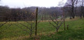
This is mainly an urban route that starts on the banks of the Marne. It then climbs up to take paths between gardens and enjoy extensive views of the eastern suburbs of Paris. After the Church of Saint-Pierre and the Château d'Ormesson, it crosses the green Morbras Park.
The painted walls of Vitry-sur-Seine
 5.12 mi
+36 ft
-39 ft
2h 25
Easy
Departure from Vitry-sur-Seine (Val-de-Marne)
5.12 mi
+36 ft
-39 ft
2h 25
Easy
Departure from Vitry-sur-Seine (Val-de-Marne)
Sometimes described as the French capital of street art, Vitry-sur-Seine boasts an impressive density and diversity of street art! This urban route from station to station allows you to discover a good number of these works, though it makes no claim to be exhaustive. A walk to be undertaken with your eyes wide open and your head turning in all directions!
From Saint-Maur to Créteil via a branch of the Marne and the tip of the lake
 5.16 mi
+92 ft
-102 ft
2h 25
Easy
Departure from Saint-Maur-des-Fossés (Val-de-Marne)
5.16 mi
+92 ft
-102 ft
2h 25
Easy
Departure from Saint-Maur-des-Fossés (Val-de-Marne)
After a few passages and alleys in Saint-Maur, the lock and the Créteil bridge, you walk along a small branch of the Marne and stroll through the residential Ile Brise Pain. After crossing the Mont-Mesly district of Créteil, with its large, airy housing estates, you arrive at the tip of the lake, which is decorated with several water jets.
A river, an aqueduct and a few parks between Arcueil and Fontenay
 3.59 mi
+226 ft
-174 ft
1h 50
Easy
Departure from Cachan (Val-de-Marne)
3.59 mi
+226 ft
-174 ft
1h 50
Easy
Departure from Cachan (Val-de-Marne)
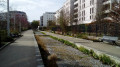
Starting from Arcueil-Cachan station, you cross two parks and a bamboo grove, and walk along the Bièvre river and then the Loing and Lunain aqueduct. The route then crosses Bagneux and Parc François Mitterrand to return to Fontenay-aux-Roses station, the start and end of this long circular route through the inner suburbs of Paris.
From Sucy-en-Brie to Boissy through the forests of Notre-Dame and Grosbois
 8.09 mi
+266 ft
-184 ft
3h 55
Moderate
Departure from Sucy-en-Brie (Val-de-Marne)
8.09 mi
+266 ft
-184 ft
3h 55
Moderate
Departure from Sucy-en-Brie (Val-de-Marne)
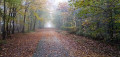
A hike from station to station, half urban, notably through the paths and alleys of Sucy-en-Brie, and half forest.
The painted walls of Ivry and the Rive Gauche neighbourhood of the 13th arrondissement
 4.98 mi
+92 ft
-85 ft
2h 20
Easy
Departure from Ivry-sur-Seine (Val-de-Marne)
4.98 mi
+92 ft
-85 ft
2h 20
Easy
Departure from Ivry-sur-Seine (Val-de-Marne)
Discovering street art on both sides of the Boulevard Périphérique! First, you’ll pass through Ivry-sur-Seine, where painted or graffitied walls alternate with much older heritage. Next, you’ll meander through the Rive Gauche neighbourhood of Paris’s 13th arrondissement, which is currently undergoing extensive renovation, and where murals and modern architecture sit alongside an interesting industrial heritage.
From Bry-sur-Marne to Lagny-sur-Marne
 Association / Club / Walk leader
 12.42 mi
+46 ft
-13 ft
5h 45
12.42 mi
+46 ft
-13 ft
5h 45
 Difficult
Departure from Bry-sur-Marne (Val-de-Marne)
Difficult
Departure from Bry-sur-Marne (Val-de-Marne)
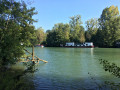
The spread of Columbanian rule led to the establishment of more than forty monasteries in Western Europe. Queen Bathilde founded one of the most important women's abbeys in France in Chelles.
This second journey, or path of exile, was travelled by Columbanus and his compatriots between 610 and 613, from Paris to Rebais. It marked the beginning of a new journey eastwards to Bregenz on Lake Constance and then Bobbio.
The René Dumont Tropical Agronomy Garden
 4.46 mi
+36 ft
-36 ft
2h 05
Easy
Departure from Nogent-sur-Marne (Val-de-Marne)
4.46 mi
+36 ft
-36 ft
2h 05
Easy
Departure from Nogent-sur-Marne (Val-de-Marne)
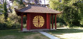
Discover a green oasis on the edge of Paris's 12th arrondissement and evidence of the French colonial vision that prevailed at the beginning of the 20th century, which we now view very differently. After visiting the garden, the hike offers a circular route in the Bois de Vincennes, around Lac des Minimes.
From Villejuif to Pont Neuf
 6.32 mi
+69 ft
-338 ft
3h 00
Moderate
Departure from Villejuif (Val-de-Marne)
6.32 mi
+69 ft
-338 ft
3h 00
Moderate
Departure from Villejuif (Val-de-Marne)
This urban route will allow you to discover a small corner of the suburbs, cross the Bicêtre Hospital and end up at the Seine after passing through Parc Montsouris and the Jardin du Luxembourg, then a few old districts of Paris.
Arc Boisé in eastern Paris
 15.21 mi
+161 ft
-220 ft
7h 10
Difficult
Departure from Boissy-Saint-Léger (Val-de-Marne)
15.21 mi
+161 ft
-220 ft
7h 10
Difficult
Departure from Boissy-Saint-Léger (Val-de-Marne)
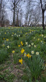
This long hike goes from one RER A station to another. It begins with a climb in Boissy Saint-Léger but the rest is flat. We start with a circular walk through the Gros-Bois Forest, then the main part of the walk takes us through the Notre-Dame Forest. We alternate between wide avenues and footpaths, with a wide variety of trees. The walk ends with a long, gently sloping green corridor and a walk through Morbras Park. Several alternative routes allow you to shorten the route.
Montjean Park and the nurseries of the city of Paris from Fresnes
 3.45 mi
+56 ft
-56 ft
1h 40
Easy
Departure from Fresnes (Val-de-Marne) (Val-de-Marne)
3.45 mi
+56 ft
-56 ft
1h 40
Easy
Departure from Fresnes (Val-de-Marne) (Val-de-Marne)
This route allows you to discover the very peaceful Parc de Montjean from Fresnes. After a complete tour of the park, the return journey is along the nurseries of the City of Paris, partially marked by a small footpath along the Voie des Laitières.
At the confluence of the Seine and the Marne
 3.88 mi
+20 ft
-52 ft
1h 50
Easy
Departure from Maisons-Alfort (Val-de-Marne)
3.88 mi
+20 ft
-52 ft
1h 50
Easy
Departure from Maisons-Alfort (Val-de-Marne)
A short walk that takes us to the point where the two main rivers of the Île-de-France region meet, two kilometres east of Paris. Numerous bridges, a dam and a lock on the Marne, a towpath and industrial heritage form the backdrop to this urban route.
The Parc départemental du Plateau and the banks of the Marne
 3.74 mi
+108 ft
-217 ft
1h 50
Easy
Departure from Villiers-sur-Marne (Val-de-Marne)
3.74 mi
+108 ft
-217 ft
1h 50
Easy
Departure from Villiers-sur-Marne (Val-de-Marne)
An urban route that first passes through a residential area and then runs alongside a commercial area. Crossing the Parc du Plateau, in several sections, allows you to enjoy some greenery and provides an opportunity to visit a few memorial sites. The walk ends with a pleasant stroll along the Marne and its islands.
Places of interest in the Bois de Vincennes
6.82 mi
+56 ft
-56 ft
3h 10
Easy
Departure from Vincennes (Val-de-Marne)
An 11 km walk with a shaded route, some unusual discoveries in the Bois de Vincennes and facilities dedicated to culture and sport. At the end of the walk, you can enjoy a drink at the UCPA equestrian centre.
From Créteil to Maisons-Alfort via the lake and the Juliottes neighbourhood
 4.56 mi
+46 ft
-16 ft
2h 10
Easy
Departure from Créteil (Val-de-Marne)
4.56 mi
+46 ft
-16 ft
2h 10
Easy
Departure from Créteil (Val-de-Marne)
An urban route starting along Lake Créteil from its southern tip to its northern tip, set amongst lawns and reed beds. You then cross, via footpaths, the ‘Du Chou et des Épis’ neighbourhood, with its cylindrical tower blocks featuring original designs, and the University district. The end of the route takes you to Maisons-Alfort via the Juliottes neighbourhood.
From Nogent-sur-Marne to Noisy-le-Grand
 6.75 mi
+197 ft
-89 ft
3h 15
Moderate
Departure from Nogent-sur-Marne (Val-de-Marne)
6.75 mi
+197 ft
-89 ft
3h 15
Moderate
Departure from Nogent-sur-Marne (Val-de-Marne)
From Nogent-sur-Marne RER station to Noisy-le-Grand Mont-d’Est station (Line A), passing along the banks of the Marne and its bridges. You can reach the start or finish points by taking Bus 120, which runs between the two stations (allow around 45 minutes). You can also break off your route towards Neuilly-Plaisance by heading to the RER station located very close to the route.
The green spaces of Sucy-en-Brie from Boissy-St-Léger station
 11.50 mi
+463 ft
-463 ft
5h 40
Moderate
Departure from Boissy-Saint-Léger (Val-de-Marne)
11.50 mi
+463 ft
-463 ft
5h 40
Moderate
Departure from Boissy-Saint-Léger (Val-de-Marne)
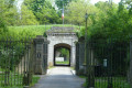
A surprisingly green walk, mostly passing through a succession of forests, numerous parks and other green corridors. It also takes you through the history of the centuries preceding our own, thanks to the architectural legacy they left behind, some of whose monuments have fortunately been well preserved, such as the Château de Sucy or the Château de Haute Maison, whilst others reveal only their outbuildings, such as the Château du Piple, or have left nothing but ruins, such as the Château du Grand Val.
From Alfort to the Pont d’Austerlitz via Lac de Daumesnil
 4.53 mi
+62 ft
-66 ft
2h 10
Easy
Departure from Maisons-Alfort (Val-de-Marne)
4.53 mi
+62 ft
-66 ft
2h 10
Easy
Departure from Maisons-Alfort (Val-de-Marne)
Starting from the Marne just before it joins the Seine, the route takes you through Charenton-le-Pont. The large park around Lac de Daumesnil offers a bucolic transition before entering Paris. After strolling through Parc de Bercy, you cross the Seine via a footbridge before reaching Austerlitz station near the bridge of the same name.
Along the Seine from Choisy-le-Roi to Alfort
 4.68 mi
+23 ft
-20 ft
2h 10
Easy
Departure from Choisy-le-Roi (Val-de-Marne)
4.68 mi
+23 ft
-20 ft
2h 10
Easy
Departure from Choisy-le-Roi (Val-de-Marne)
An urban walk that starts on the elevated quays and continues along the towpath, right by the river. After the confluence, the walk ends by following the Marne upstream for the final kilometre.
Adjust your route according to flood levels on the Seine or the Marne: see the practical information section.
 Notre-Dame Forest and the Réveillon Valley, starting from Boissy-Saint-Léger
18.65 mi
+387 ft
-364 ft
4 hrs
Moderate
Departure from Boissy-Saint-Léger (Val-de-Marne)
A relatively long but technically straightforward walk in a peri-urban area, taking you through the Gros Bois and Notre-Dame forests, then down the Réveillon Valley, before returning via the Camaldules and Grange forests.
Paths and routes between Villejuif and Vitry
 3.10 mi
+154 ft
-164 ft
1h 35
Easy
Departure from Villejuif (Val-de-Marne)
3.10 mi
+154 ft
-164 ft
1h 35
Easy
Departure from Villejuif (Val-de-Marne)
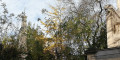
This urban walk will allow you to discover some of the footpaths and pedestrian routes that wind through these two neighbouring districts of Vitry-sur-Seine and Villejuif.
From Ivry to Arcueil via Fort de Bicêtre
 5.05 mi
+367 ft
-259 ft
2h 40
Easy
Departure from Ivry-sur-Seine (Val-de-Marne)
5.05 mi
+367 ft
-259 ft
2h 40
Easy
Departure from Ivry-sur-Seine (Val-de-Marne)
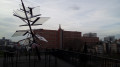
A route through a highly urbanised area that is still evolving, where old workshops, residential estates and post-war buildings stand alongside more recent architecture. The route is punctuated by a few spacious parks, a fort from the old walls of Paris, and the superimposed aqueducts of Arcueil and Cachan.
Circular between Marolles-en-Brie and Servon
7.67 mi
+194 ft
-177 ft
3h 40
Moderate
Departure from Marolles-en-Brie (Val-de-Marne) (Val-de-Marne)
Hike from Marolles-en-Brie, taking the old Chemin des Roses (former railway line to Paris Bastille, which carried passengers and roses to Les Halles). Discover Servon, its church and its château (Anne Boleyn is said to have lived here with her aunt in the 16th century).
Parks and Gardens of Fontenay-sous-Bois, Nogent-sur-Marne and Vincennes
7.67 mi
+249 ft
-266 ft
3h 45
Easy
Departure from Fontenay-sous-Bois (Val-de-Marne)
A lovely little walk taking in three towns, passing through parks and gardens, then along footpaths and narrow streets. The route takes you past the Fort of Nogent-sur-Marne, then through the marina. Discover the Viaduct and Yvette Horner’s ‘Île de Beauté’. And finish with the Tropical Agronomy Garden and Lac des Minimes.
Circular route via the Forêt de la Grange, the Réveillon and Yerres valleys
13.00 mi
+479 ft
-456 ft
6h 25
Difficult
Departure from Limeil-Brévannes (Val-de-Marne)
This walk starts at the “La Végétale” station on Cable Car 1, crosses the Forêt de la Grange via the Château du Maréchal de Saxe and the Étoile de Bellevue, then follows the Végétale to Villecresnes, before following the courses of the Réveillon and the Yerres to reach Caillebotte Park, where the painter lived. The walk continues with the ascent of Mont-Griffon, the highest point in the area, before returning.
The sprawling plain: from Le Plessis-Trévise to Chennevières-sur-Marne
 Local authority
 6.20 mi
+20 ft
-236 ft
2h 50
Easy
Departure from Le Plessis-Trévise (Val-de-Marne)
6.20 mi
+20 ft
-236 ft
2h 50
Easy
Departure from Le Plessis-Trévise (Val-de-Marne)
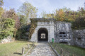
Discover or rediscover the Grand Paris Sud-Est Avenir area by exploring its various walking routes, which showcase the main points of interest and the often-overlooked treasures of our 16 municipalities, each with their own unique and distinctive histories.
The bucolic circular loop: from Périgny-sur-Yerres to Mandres-les-Roses
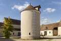 5.10 mi
+161 ft
-154 ft
2h 30
Easy
Departure from Périgny (Val-de-Marne) (Val-de-Marne)
5.10 mi
+161 ft
-154 ft
2h 30
Easy
Departure from Périgny (Val-de-Marne) (Val-de-Marne)
Discover or rediscover the Grand Paris Sud Est Avenir region by exploring its various walking routes, which showcase the main points of interest and the sometimes little-known treasures of our 16 municipalities, each with their own unique and distinctive histories.
Natural and historical sites between Boissy-Saint-Léger and Sucy-en-Brie
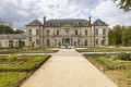 7.43 mi
+157 ft
-167 ft
3h 35
Moderate
Departure from Boissy-Saint-Léger (Val-de-Marne)
7.43 mi
+157 ft
-167 ft
3h 35
Moderate
Departure from Boissy-Saint-Léger (Val-de-Marne)
Discover or rediscover the Grand Paris Sud Est Avenir region by exploring its various walking routes, which showcase the main points of interest and the sometimes little-known treasures of our 16 municipalities, each with their own unique and distinctive histories.
The walk through the three villages: Villecresnes, Marolles-en-Brie, Santeny
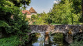 7.42 mi
+180 ft
-180 ft
3h 35
Moderate
Departure from Villecresnes (Val-de-Marne)
7.42 mi
+180 ft
-180 ft
3h 35
Moderate
Departure from Villecresnes (Val-de-Marne)
Discover or rediscover the Grand Paris Sud Est Avenir area by exploring its various walking routes, which showcase the main points of interest and the sometimes little-known treasures of our 16 municipalities, each with their own unique and distinctive histories.
A thousand and one activities by the water: from Créteil to Alfortville
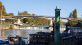 9.30 mi
+20 ft
-23 ft
4h 20
Moderate
Departure from Créteil (Val-de-Marne)
9.30 mi
+20 ft
-23 ft
4h 20
Moderate
Departure from Créteil (Val-de-Marne)
Discover or rediscover the Grand Paris Sud-Est Avenir area by exploring its various walking routes, which showcase the main points of interest and the sometimes little-known treasures of our 16 municipalities, each with their own unique and distinctive histories.
Adventures big and small: Chennevières-sur-Marne and Ormesson-sur-Marne
 8.66 mi
+266 ft
-276 ft
4h 15
Moderate
Departure from Saint-Maur-des-Fossés (Val-de-Marne)
8.66 mi
+266 ft
-276 ft
4h 15
Moderate
Departure from Saint-Maur-des-Fossés (Val-de-Marne)
Discover or rediscover the Grand Paris Sud-Est Avenir area by exploring its various walking routes, which showcase the main points of interest and the sometimes little-known treasures of our 16 municipalities, each with their own unique and distinctive histories.
Vincennes Woods and the banks of the Marne
9.05 mi
+89 ft
-92 ft
4h 15
Moderate
Departure from Fontenay-sous-Bois (Val-de-Marne)
A circular route starting from the RER station at Fontenay-sous-Bois.
The route passes through the Bois de Vincennes, then the Pavillon Baltard, the Yvette Horner promenade, the Bry-sur-Marne bridge, and returns along the opposite bank to the Joinville bridge. Return via the Bois de Vincennes, and the circular route ends by passing the Confiserie du Lac.
Agricultural nature trail in Périgny-sur-Yerres and Mandres-les-Roses
 5.52 mi
+23 ft
-23 ft
2h 35
Easy
Departure from Périgny (Val-de-Marne) (Val-de-Marne)
5.52 mi
+23 ft
-23 ft
2h 35
Easy
Departure from Périgny (Val-de-Marne) (Val-de-Marne)
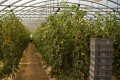
Discover or rediscover the Grand Paris Sud Est Avenir area by exploring its various walking routes, which showcase the main points of interest and the sometimes little-known treasures of our 16 municipalities, each with their own unique and distinctive histories.Marked by 17 information panels, the Agricultural Interpretation Trail allows you to discover local produce, identify crops and gain a better understanding of production techniques.Enjoy the landscapes shaped by farming, spot its traces in the local architecture, and understand how agriculture still contributes to the identity of this region today. Oscar the fox will accompany you throughout this trail!Find your way using the “Grande Boucle” signposts, located at the main junctions, and use the map to help you follow the route.
Street Art Trail in Alfortville
 5.46 mi
+10 ft
-13 ft
2h 30
Easy
Departure from Maisons-Alfort (Val-de-Marne)
5.46 mi
+10 ft
-13 ft
2h 30
Easy
Departure from Maisons-Alfort (Val-de-Marne)
Discover or rediscover the Grand Paris Sud Est Avenir area by exploring its various walking routes, which showcase the main points of interest and the sometimes little-known treasures of our 16 municipalities, each with their own unique and distinctive histories.
La Queue-en-Brie, Noiseau and Chennevières from Ormesson
 8.75 mi
+167 ft
-144 ft
4h 10
Moderate
Departure from Ormesson-sur-Marne (Val-de-Marne)
8.75 mi
+167 ft
-144 ft
4h 10
Moderate
Departure from Ormesson-sur-Marne (Val-de-Marne)
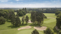
The official title of the walk is: “Head in the clouds, feet on the green: Ormesson, LQB, Noiseau and Chennevières”.Discover or rediscover the Grand Paris Sud Est Avenir area by exploring its various walking routes, which showcase the main points of interest and the sometimes little-known treasures of our 16 municipalities, each with their own unique and distinctive histories.
A flower-filled and chocolate-themed stroll: from Boissy-Saint-Léger to Limeil-Brévannes
 5.75 mi
+203 ft
-217 ft
2h 50
Easy
Departure from Boissy-Saint-Léger (Val-de-Marne)
5.75 mi
+203 ft
-217 ft
2h 50
Easy
Departure from Boissy-Saint-Léger (Val-de-Marne)
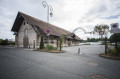
Discover, or rediscover, the Grand Paris Sud Est Avenir area by exploring its various walking routes, which showcase the main points of interest and the treasures—sometimes little-known—of our 16 municipalities, each with their own unique and distinctive histories.
A nature walk through the ‘island towns’: from Créteil to Bonneuil-sur-Marne
 5.53 mi
+131 ft
-115 ft
2h 40
Easy
Departure from Créteil (Val-de-Marne)
5.53 mi
+131 ft
-115 ft
2h 40
Easy
Departure from Créteil (Val-de-Marne)
Discover or rediscover the Grand Paris Sud-Est Avenir area by exploring its various walking routes, which showcase the main points of interest and the sometimes little-known treasures of our 16 municipalities, each with their own unique and distinctive histories.
Bonneuil-sur-Marne through the eyes of graffiti artists
 1.51 mi
+33 ft
-7 ft
0h 45
Easy
Departure from Bonneuil-sur-Marne (Val-de-Marne)
1.51 mi
+33 ft
-7 ft
0h 45
Easy
Departure from Bonneuil-sur-Marne (Val-de-Marne)
Discover or rediscover the Grand Paris Sud-Est Avenir area by exploring its various walking routes, which showcase the main points of interest and the sometimes little-known treasures of our 16 municipalities, each with their own unique and distinctive histories.
A green and flower-filled walk between Villecresnes and Mandres-les-Roses
 5.64 mi
+141 ft
-148 ft
2h 45
Easy
Departure from Villecresnes (Val-de-Marne)
5.64 mi
+141 ft
-148 ft
2h 45
Easy
Departure from Villecresnes (Val-de-Marne)
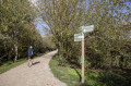
Discover or rediscover the Grand Paris Sud Est Avenir area by exploring its various walking routes, which showcase the main points of interest and the sometimes little-known treasures of our 16 municipalities, each with their own unique and distinctive histories.
More walks in Val-de-Marne
Select an area below: