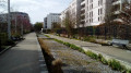
Paths and routes between Villejuif and Vitry

This urban walk will allow you to discover some of the footpaths and pedestrian routes that wind through these two neighbouring districts of Vitry-sur-Seine and Villejuif.

Details

4331767
Creation:
Last update:
Last review:
  • Walking
    Activity: Walking
  • ↔
    Distance: 3.10 mi
  • ◔
    Average duration: 1h 35 
  • ▲
    Difficulty: Easy

  • ⚐
    Back to start: Yes
  • ↗
    Ascent: + 154 ft
  • ↘
    Descent: - 164 ft

  • ▲
    Highest point: 371 ft
  • ▼
    Lowest point: 259 ft
  • ⚐ Country: France
  • ⚐ City: Villejuif (94800)
  • ⚑
    Start/End: N 48.796072° / E 2.368505°
  • ❏
    IGN map(s): Ref. 2314OT
  • Hour-by-hour weather

Photos

Description of the walk

Start on Boulevard Maxime Gorki, on the odd-numbered side, at the exit of the Villejuif–Paul Vaillant-Couturier metro station (line 7). Access is also possible by bus (lines 162 and 185).

(S/E) Turn onto Rue Jean-Baptiste Clément, which runs perpendicular to the avenue. Atthe first junction, turn left then right onto Sentier Paul Lafargue. At the end, turn right then left to follow Rue des Malassis.

Take thesecond right onto Rue André Messager. At the end, first turn left then right and follow Voie Victor Masse. At the end, turn right onto Rue Pergolèse.
Cross Rue Offenbach and, at the next junction, turn right onto Voie Charcot. At the end, turn left onto Rue Verdi. At the end, turn left. At the T-junction, turn right (Impasse des Sablons).
At the end, turn left onto Rue du Génie. Pass Rue Pergolèse on your left and continue to the next junction.

(1) Then turn right onto Rue Mozart, which is more of a ‘path’. Cross Rue du Lion d’Or and continue along Rue Rosa Luxembourg. At the next junction, turn right onto Sentier Courbet. At the end, turn left onto Rue Karl Liebknecht. Cross Boulevard Maxime Gorki and continue straight ahead onto Sentier Karl Liebknecht. Cross Rue Saint-Roch. You’ll come to Rue Jean Jaurès; follow it to the right.

(2) At the junction, turn left onto Avenue Paul Vaillant-Couturier. Take thefirst right onto Rue Gustave Flaubert. Then take thesecond right onto Rue Alfred de Musset. At the end, turn right onto Rue Jean-Jacques Rousseau (contrary to the map, this is not yet the Sentier du Moulin). Go round a small square and walk alongside the George Sand school complex, following the Sentier du Moulin. At the end, turn left onto the Sentier Rabelais. At the end, turn left onto Rue Jean-Jaurès, preferably on the right-hand pavement. Continue along Avenue de Paris.

(3) Between numbers 155 and 153, turn right into the Passage de la Pyramide. Cross Boulevard Maxime Gorki and continue straight ahead through the passage. After a right-left turn, you’ll come out onto Rue Condorcet; follow it to the left. At the end, turn left into Rue Bizet (not Rue Émile Zola as shown on the map). Atthe first junction, turn right onto the street leading to the entrance of a residential car park. Continue for about fifty metres.

(4) Turn right up the steps onto the Sentier Émile Zola in the municipality of Villejuif. Continue along the Sentier Émile Zola in the municipality of Vitry-sur-Seine. Carry on straight ahead, continuing along the steeply sloping Rue Bellevue. At the end, turn left into Rue Donizetti. Take thefirst right, the Voie Francis Poulenc, which winds its way past the foot of blocks of flats and turns into a footpath.

(5) Turn right onto thefirst road you come to: this is Voie Gluck; follow it to the end and turn right onto Rue Bizet. Carry on straight ahead and take thefirstleft, Rue Beaumarchais. At the end, continue via a pedestrian crossing. Join Rue Condorcet and follow it to the left. You’ll come out onto Boulevard Maxime Gorki; follow it to the left until you reach the Villejuif Paul Vaillant-Couturier metro station (A/D).

Waypoints

  1. S/E : mi 0 - alt. 358 ft - Villejuif Paul Vaillant-Couturier metro station
  2. 1 : mi 0.83 - alt. 331 ft - Rue Mozart
  3. 2 : mi 1.27 - alt. 351 ft - Rue Jean Jaurès x Avenue Paul Vaillant-Couturier
  4. 3 : mi 1.97 - alt. 328 ft - Passage de la Pyramide
  5. 4 : mi 2.28 - alt. 259 ft - Émile Zola Trail
  6. 5 : mi 2.63 - alt. 289 ft - Voie Francis Poulenc x Voie Gluck
  7. S/E : mi 3.1 - alt. 358 ft - Villejuif Paul Vaillant-Couturier metro station

Notes

Shops along this route, near the metro, on Rue Jean Jaurès, and on Avenue and Boulevard Paul Vaillant-Couturier.
Any errors noted in the description relate to the “OpenStreetMap (World)” map.

Worth a visit

Reviews and comments

3.9 / 5
Based on 4 reviews

Reliability of the description
4 / 5
Ease of following the route
4.3 / 5
Route interest
3.5 / 5
xoff50
xoff50

I think you’ve discovered it at just the right time...

Machine-translated

Lanouille333160
Lanouille333160
• Edited:

Overall rating : 4.7 / 5

Date of your route : Jun 14, 2026
Reliability of the description : ★★★★★ Very good
Ease of following the route : ★★★★★ Very good
Route interest : ★★★★☆ Good
Very busy route : No

An easy and pleasant walk this Sunday morning. It was sunny, the gardens were in bloom and the route was quiet (few pedestrians and little traffic) – a lovely discovery of this neighbourhood, which I didn’t know even though I’m from round here x)

Machine-translated

GwennBen
GwennBen

Overall rating : 4 / 5

Date of your route : May 31, 2024
Reliability of the description : ★★★★☆ Good
Ease of following the route : ★★★★☆ Good
Route interest : ★★★★☆ Good
Very busy route : No

A lovely, leisurely stroll at the end of a spring day. We enjoyed exploring the footpaths, the pretty flower-filled gardens, the rose bushes and the houses dating from the 1950s to the 1970s. A village-like, vintage atmosphere in the heart of the city and just a stone’s throw from Paris, with gentle slopes.

Machine-translated

xoff50
xoff50

This route is a way of exploring little-known paths in certain towns, particularly in the Paris suburbs.
The last time I went that way, on a lovely, sunny Sunday in early spring, it was also a great opportunity to meet people tending to their gardens.

Machine-translated

Kyla
Kyla

Overall rating : 3.7 / 5

Date of your route : Mar 21, 2022
Reliability of the description : ★★★★☆ Good
Ease of following the route : ★★★★★ Very good
Route interest : ★★☆☆☆ Disappointing
Very busy route : No

The description is fairly clear on the whole, and the route is impeccably marked, but the walk itself is disappointing.
You walk along charmless paths, lined with run-of-the-mill houses, preceded by poorly maintained or derelict front gardens (with a few rare exceptions of gardens over-decorated with an abundance of flowers, fake animals and garden gnomes).
You walk past numerous noisy, smelly and dusty building sites, the surroundings of which are littered with rubbish.
A very sad picture of the town of Villejuif.

Machine-translated

xoff50
xoff50

And if there are still any issues, please do let me know;
I’ve made a slight change to the description after the Émile (not Èmile!) Zola Trail
(which is currently bordered on the right by a large plot of land that will soon be replaced by a whole housing estate)
Kind regards
Christophe Givord

Machine-translated

garré
garré

Thank you for your reply. So I shouldn’t have gone into the residential complex. I’ll do the walk in the opposite direction, starting from Rue Condorcet.

Kind regards
Anne Marie Garré

Machine-translated

xoff50
xoff50
• Edited:

Hello, and thank you for your comment
As shown on the map and in the description, Rue Bellevue is a direct extension of the Sentier Émile Zola
and perhaps its name isn’t shown: I’ll check before confirming this.
I should perhaps also point out that the turn-off onto the Sentier Émile Zola is the first turn on the right along the street towards the residential car park, and that it is located before the entrance to that car park.
Kind regards
NB: the end of your message is cut off

Machine-translated

garré
garré

Overall rating : 3.3 / 5

Date of your route : Apr 27, 2021
Reliability of the description : ★★★☆☆ Average
Ease of following the route : ★★★☆☆ Average
Route interest : ★★★★☆ Good
Very busy route : No

I got lost near the car park at the Résidence. I managed to find the Emile Zola footpath but couldn’t find Rue Bellevue or the route leading on to Rue Bizet. I had to take a long detour to get back onto Rue Bizet just before the end of the walk. The walk description had warned me that the route on the map was incorrect, but…

Machine-translated

Other walks in the area

For more walks, use our search engine .

The GPS track and description are the property of this route's author. Please do not copy them without permission.