Vincennes Woods and the banks of the Marne

A circular route starting from the RER station at Fontenay-sous-Bois.

The route passes through the Bois de Vincennes, then the Pavillon Baltard, the Yvette Horner promenade, the Bry-sur-Marne bridge, and returns along the opposite bank to the Joinville bridge. Return via the Bois de Vincennes, and the circular route ends by passing the Confiserie du Lac.

Details

103874075
Creation:
Last update:
Last review:
  • Walking
    Activity: Walking
  • ↔
    Distance: 9.05 mi
  • ◔
    Average duration: 4h 15 
  • ▲
    Difficulty: Moderate

  • ⚐
    Back to start: Yes
  • ↗
    Ascent: + 89 ft
  • ↘
    Descent: - 92 ft

  • ▲
    Highest point: 207 ft
  • ▼
    Lowest point: 108 ft

Description of the walk

Head to the Fontenay-sous-Bois station on the RER A line and take the Moreau David exit.

(S/E) Head towards the Bois de Vincennes via Avenue du Président Roosevelt.

(1) When you reach the crossroads, head for the fountain and take the path on the left.

(2) Cross Avenue de Nogent and take the path on the left (avoid the one running alongside the road).

(3) Continue straight on and cross the stream. Leave the woods and follow Avenue des Châtaigners (Nogent-sur-Marne).

(4) Cross Rue de Joinville. Turn left until you reach a footpath on the right (Victor Baltard).

(5) Turn right towards the Pavillon Baltard, taking this footpath.

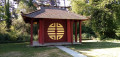
(6) In front of the Pavillon Baltard, you can read about its history on a sign. Walk down Rue Victor Bach.

(7) Take the Promenade Yvette Horner on the left (marked by a large metal gate). Follow the banks of the Marne.

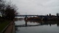
(8) Continue along the banks of the Marne until you reach the Bry-sur-Marne Bridge.

(9) At the bridge, take the steps to cross to the right.

(10) Go down the stairs from the bridge to continue walking on the other bank of the Marne. You can see sculptures in the water on the banks of the islands opposite (a panther, a dinosaur). Pass under the A4 motorway.

(11) Continue along the banks of the Marne.

(12) When you reach the Pont de Joinville, cross it (to the right) and carry on straight ahead. Walk up the hill. Pass under the Joinville-le-Pont RER A line.

(13) Turn right onto the Route de la Pyramide. Go over the A4 motorway, then past the Arboretum and the École d’Horticulture du Breuil (free entry and open to the public).

(14) At the roundabout, cross the farm track on the right, then take the path alongside the rugby pitches to the watercourse currently under construction (as of August 2026).

(15) At the fountain, cross over and stay on the path on the left-hand side of the stream.

(16) Continue on the left-hand side of the stream.

(17) Turn right onto Route Circulaire / Ronde des Minimes, then immediately left to rejoin a path. This time, follow the path on the right-hand side of the stream.

(18) Once you reach Lac des Minimes, you can take a break at Rosa Bonheur or the lakeside sweet shop before heading back up to the starting point.

(19) Cross Avenue de Nogent carefully at the pedestrian crossing – be particularly vigilant as not all cars stop – and continue along the path opposite until you reach the junction of Avenue du Président Roosevelt and Avenue de la Dame Blanche. Return to the RER A station at Fontenay-sous-Bois (S/E).

Waypoints

  1. S/E : mi 0 - alt. 200 ft - Fontenay-sous-Bois station - Gare de Fontenay-sous-Bois
  2. 1 : mi 0.12 - alt. 194 ft - Fountain on Avenue de la Dame Blanche
  3. 2 : mi 0.44 - alt. 190 ft - Crossing Avenue de Nogent
  4. 3 : mi 0.63 - alt. 194 ft - Crossing the Route de la Ménagerie - Jardin d’agronomie tropicale René-Dumont
  5. 4 : mi 0.85 - alt. 197 ft - Crossing Avenue de Joinville - Gare de Nogent-sur-Marne
  6. 5 : mi 0.93 - alt. 203 ft - Allée Victor Baltard
  7. 6 : mi 1.05 - alt. 180 ft - Pavillon Baltard
  8. 7 : mi 1.25 - alt. 118 ft - Yvette Horner Walk - Marne (la)
  9. 8 : mi 2.78 - alt. 121 ft - Bank of the Marne - Marne (la)
  10. 9 : mi 3.28 - alt. 118 ft - Crossing the Bry Bridge - Pont de Bry
  11. 10 : mi 3.37 - alt. 131 ft - Bry Bridge - Pont de Bry-sur-Marne
  12. 11 : mi 6.05 - alt. 112 ft - Bank of the Marne
  13. 12 : mi 6.39 - alt. 135 ft - Pont de Joinville - Pont de Joinville
  14. 13 : mi 6.77 - alt. 177 ft - Route de la Pyramide - Gare de Joinville-le-Pont
  15. 14 : mi 7.18 - alt. 174 ft - Arboretum–École du Breuil, towards the rugby pitches
  16. 15 : mi 7.57 - alt. 194 ft - Crossing Avenue du Tramblay
  17. 16 : mi 7.92 - alt. 190 ft - Waterfall Route
  18. 17 : mi 8.19 - alt. 180 ft - Circular road, then path to the left
  19. 18 : mi 8.57 - alt. 177 ft - Confiserie du Lac - Lac des Minimes
  20. 19 : mi 8.64 - alt. 180 ft - Avenue de Nogent - Lac des Minimes
  21. S/E : mi 9.05 - alt. 197 ft - Fonctenay-sous-Bois station - Gare de Fontenay-sous-Bois

Notes

The sections through the woods at the start and end of the route are shaded. The sections along the banks of the Marne are less shaded, but there are large benches in the shade where you can have a picnic between points (10) and (11).
The numerous drinking fountains along the route are open from spring to autumn. There are no toilets along the route.
Don’t count on stopping for a bite to eat at Gégène’s along the route; it has been closed since December 2024 (the owner has retired).
Do take the time to read the many historical information boards along the route.
There are some interesting graffiti tags under the bridges.
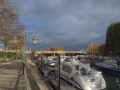
You can use the water buses for free with a Navigo pass.
You cannot reach the islands on foot, apart from Île Fanac after the point (12) at the end by the Pont de Joinville. The stretch between the points (12) and (13) is in the city centre, uphill and in full sun in the afternoon. I haven’t found a pleasant alternative.
Between waypoints (14) and (15), stay firmly on the path; do not try to take any shortcuts, as you’ll come across a huge, particularly revolting open-air toilet.

Worth a visit

Pavillon Baltard.
Beautiful houses along the Yvette Horner promenade.
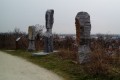
Sculptures on the banks of Île Amour after the Pont de Bry.
If you have the stamina, you can visit the René-Dumont Tropical Agronomy Garden free of charge before point (4) on the edge of the woods to your right, as well as the Arboretum and the École du Breuil between points (13) and (14), particularly in spring. Île Fanac is a pleasant, shaded spot after point (12).

Other walks in the area

For more walks, use our search engine .

The GPS track and description are the property of this route's author. Please do not copy them without permission.