Country:
 City:
City:



The walk begins at La Varenne-Chennevières RER station.
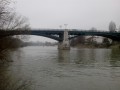
(S/E) On leaving the station, head right towards the junction of Avenue du Mesnil and Avenue du Bac. Take the latter, heading towards the Marne, for 500 metres. At the Pont de Chennevières, admire the views of the river on both sides, particularly the tree-lined river island of Casenave. Turn left onto Rue de Champigny. On the hillside and along the banks of the Marne, take in the Anglo-Norman-style villas and the Art Nouveau millstone-built houses, including part of the Château de l’étape complex at No. 4. Before 1865, Chennevières was reached via a ferry that docked nearby.
(1) Continue along the D219 to the restaurant l’Ecu de France.
(2) Walk 500 metres to No. 118 and turn right onto the Sentier de la Gorgette. At the end of the footpath, after climbing a few steps, cross Rue du Chemin de la Croix Saint-Vincent and continue straight on, climbing the narrow staircase. When you reach the top, head left up Rue du Sentier des Hélaines, then turn right at the junction onto Rue Gabriel Péri. Nearby, a small paved area marks the site of a former wash house.
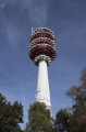
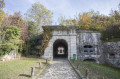
(3) Continue. At No. 15, turn left into Rue Baudin, and take thesecond right, Rue Jules Viejo, to the Corot School Complex. At the gate, follow the Splendide Panorama footpath on your left, running alongside the school. At the junction with Ruelle Colombert, turn left onto the footpath crossing a lawn towards the Hertzian Tower, visible in the distance. Completed in 1972 and standing 100 metres tall, it serves as an antenna for digital television and mobile telephony. Continue along this route for 200 metres, crossing the green space on Rue Place Mon Idée. At the junction with Rue Aristide Briand, carry straight on, slightly to your left, until you reach No. 143, opposite the entrance to the Fort de Champigny. Its name derives from the fact that it was used to protect the town of Champigny-sur-Marne. A fine example of19th-century military architecture, and part of the second fortified belt around Paris built around 1880, the site covers 4 hectares.
(4) Cross the road at the pedestrian crossing and perhaps stop for a while in the wooded surroundings of the Parc du Fort. Various paths allow you to view from the outside some buildings that are still well-preserved, including the barracks for troops and officers, and the powder magazine.
Go round the semi-buried building on the right via the footpath that runs alongside the ditches.
(5) When you emerge on the other side, turn right onto the Route de la Libération D4. Cross the road at the first pedestrian crossing and follow the left-hand pavement for 900 metres.
(6) When you reach a major junction, continue straight on towards Vitry-le-François, staying on the Route de la Libération. At the next junction, turn left onto Rue des Bordes. After 850 metres, on your right, you’ll find the Parc départemental de la Plaine des Bordes, which features an orienteering course and offers a picnic area. On site, mini-golf equipment, rackets and balls are available for public use.
(7) Retrace your steps and, at the first junction, turn left onto Avenue Champlin. 150 metres further on, on your right, is the Centre Technique et Régional de Tir à l'Arc, one of the largest archery centres in the world. Established here for 160 years, the centre can accommodate groups by booking to introduce them to this sport of precision and concentration.
(8) Continue to the roundabout and take Avenue de l’Hippodrome on your right.
(9) At the next roundabout, turn right onto Avenue de Pince-Vent. Then go straight on. At the end of the street, at the passable roundabout, turn left onto Rue du Chemin des Sonnettes. Then turn right onto Rue du Bois.
(10) At the junction with Route de Provins, cross at the pedestrian crossing to reach Rue Danielle Casanova on the other side, which curves slightly to the left for 700 metres. At the end of this street, turn right onto Avenue de Pince-Vent.
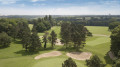
(11) At the next traffic-light junction, turn left onto Rue du Chemin du Belvédère and head towards the Ormesson Golf Club. At the entrance to the golf club, on your right, take the grassy path running alongside the estate’s stone wall. Known successively as Chemin de la Queue-en-Brie and Rue du Champ de l’Alouette, it leads onto Rue de l’Église. Continue along the wall, and at the end of this street you will find the Church of Notre-Dame-de-l’Assomption, a building partly constructed inthe 18th century and housing numerous ancient tombstones.
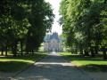
(12) At the junction with Avenue Wladimir d’Ormesson, turn left and head towards the main entrance of Château d’Ormesson, where you can enjoy the finest view of the building from the gate.Dating fromthe 16th and17th centuries and built of cut stone and brick, it remains the property of the illustrious family. Opposite the château, head up the wide, plane-tree-lined Avenue du Général de Gaulle for nearly 900 metres until you reach the second roundabout.
(13) Opposite, take Rue de la République towards Saint-Maur-des-Fossés, and turn right at the second junction onto Rue du Général de Gaulle. In the heart of old Chennevières, after 200 metres, on your left, the Espace Charles de Gaulle, recognisable by its turret, houses the wedding hall. Nearby, the music conservatoire occupies a stone-built building. 220 vines from the Clos Saint-Vincent are terraced below the garden. At the far end of the car park, the former town hall of Chennevières-sur-Marne, built in 1886, now houses an exhibition hall.
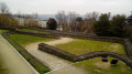
(14) Behind this building, on a hillside overlooking the Marne, the Terrasses de Chennevières offer one of the most remarkable panoramic views of the Paris region. On a clear day, you can see the Eiffel Tower or even the Sacré-Cœur. Opposite the car park, continue along Rue Durmersheim and take a look at the rear of the 13th-century Saint-Pierre de Chennevières Church , whose apse is listed as a Historic Monument.
(16) Continue tothe second junctionand turn left into Rue Aristide Briand. After 200 metres, go straight across the large traffic-light-controlled junction near the theatre car park, and take the first street on the left, Avenue de la Plaine. At the end of the street, turn left into Rue du Général de Gaulle, then a few steps further on, take Rue Liborel on your right. At the end, turn left onto Rue de Bry, then in the bend, after the beautiful half-timbered house, take the footpath on the right leading onto Rue d’Houin, then walk down to the junction with Avenue de la Gare. Turn left and at No. 34, you’ll find the old railway station. Built in 1929 on the “Grande Ceinture de Paris” line, clad in salmon-pink brick, with a cut-stone base and light green ceramic decoration, this building bears the inscription “Chemin de Fer de Ceinture”.
(16) Continue up Avenue de la Gare for 400 metres until you reach the junction with Rue du Pont. Walk down this street, cross the Pont de Chennevières again, then continue straight on along Avenue du Bac for 600 metres, until you reach your destination: the La Varenne-Chennevières RER station (S/E).

 Visorando Member
 Easy
Easy 
 Local authority