Along the Seine from Choisy-le-Roi to Alfort

An urban walk that starts on the elevated quays and continues along the towpath, right by the river. After the confluence, the walk ends by following the Marne upstream for the final kilometre.

Adjust your route according to flood levels on the Seine or the Marne: see the practical information section.

This walk is part of a multi-day hike: En suivant la Seine à travers l'Ile-de-France

Details

4129684
Creation:
Last update:
Last review:
  • Walking
    Activity: Walking
  • ↔
    Distance: 4.68 mi
  • ◔
    Average duration: 2h 10 
  • ▲
    Difficulty: Easy

  • ⚐
    Back to start: No
  • ↗
    Ascent: + 23 ft
  • ↘
    Descent: - 20 ft

  • ▲
    Highest point: 128 ft
  • ▼
    Lowest point: 92 ft
  • ⚐ Country: France
  • ⚐ City: Choisy-le-Roi (94600)
  • ⚑
    Start: N 48.764467° / E 2.410881°
  • ⚑
    End: N 48.814907° / E 2.422335°
  • ❏
    IGN map(s): Ref. 2314OT, 2315OT, 2415OT
  • Hour-by-hour weather

Photos

Description of the walk

Starting point and access: Choisy-le-Roi station.
- RER – Line C, on the section between Paris-Austerlitz and Massy-Palaiseau/Étampes/Dourdan. Take the Avenue du 8 Mai 1945 exit.

The route follows a section ofthe GR®2and a few sections of the PR®. Signposting, which is rather sparse, is only indicated here where necessary.

(S) On leaving the station, turn immediately right, cross a road, go under a road bridge and walk up a one-way street (Rue du Chemin de Fer). At the top, note the old station on your right and climb a flight of steps. Cross the D86 at the traffic lights opposite.

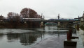
(1) Turn right and cross the bridge over the Seine (marked ‘Pont de l’Appel du 18 Juin 1940’ on site and ‘Pont de Choisy’ on the map). At the end of the bridge, go down a flight of steps on the left to a pedestrian quay (do not go down to the towpath).

(2) Follow the quay to the right (red and white markers). Stay above the level of the river and walk with the houses and then the blocks of flats on your right. Ignore all turn-offs to the right. Pass under a motorway bridge and emerge onto a road.

(3) Follow the road to the left (yellow arrow) and cross over a branch of the river. Walk along the Quai de la Révolution, either on the cycle path or, further to the left, on the footpath running parallel to it. Further on, take the narrow pavement running parallel to the cycle path. Pass under some high-voltage power lines and continue on the cycle path (shared with pedestrians).

(4) After a large car park on the left-hand side, take thefirst flight of steps leading down to the left to reach the towpath. Follow the river on your left along this path, which is initially paved with flagstones and then cemented.

(5) Pass under the Pont du Port à l’Anglais and walk alongside the lock of the same name. Continue along a wide, compacted path. Further on, rejoin Quai Blanqui and take the cycle path again (pedestrians are given priority here, but caution is advised).

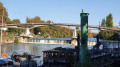
(6) About 250 m further on, at a sign for Port d’Alfortville, turn left to head down to river level (see an alternative route in the practical information section). Follow a tarmac quay. Pass under a footbridge and cross a small patch of earth by the riverbank (damp section). Return to the concrete towpath and continue straight ahead. Go round the concrete steps on the left, taking the lowest step (which is also the narrowest). Once past this obstacle, continue along the towpath, which is first paved and then wooden (the wooden walkway is slippery in wet weather). At the end of the wooden walkway, climb up a cobbled path and rejoin the tarmac just before the Pont d’Ivry.

(7) Pass under the bridge, go past a river landing stage and pass under the large building housing a Chinese restaurant to reach the confluence of the Seine and the Marne.

(8) Then turn right and walk alongside the Marne, still passing beneath the building. Pass a red and white barrier and go down the steps opposite (do not take the Quai d’Alfortville further up). Follow the towpath and pass successively under a footbridge, a railway bridge, a metro bridge and finally a road bridge. Continue straight on along the Promenade Paul Cézanne, keeping as close to the river as possible. After about 200 m, climb a wide flight of steps on the right. At the top, cross the Quai Fernand Saguet and head straight ahead into a lane between two blocks of flats. Pass under a porch, turn left and you’ll immediately come to the metro station (E).

To get back home:
- Metro – Line 8.
- Bus – Routes 24, 103, 104, 107, 125, 181 and 325.

Waypoints

  1. S : mi 0 - alt. 112 ft - Gare de Choisy-le-Roi
  2. 1 : mi 0.11 - alt. 128 ft - Choisy Bridge - Pont de l'Appel du 18 Juin 1940
  3. 2 : mi 0.28 - alt. 105 ft - Quai Pompadour - Seine [la]
  4. 3 : mi 1.04 - alt. 121 ft - Quai de la Révolution
  5. 4 : mi 1.84 - alt. 112 ft - Towpath - Seine [la]
  6. 5 : mi 2.59 - alt. 102 ft - Pont du Port à l'Anglais
  7. 6 : mi 3.19 - alt. 108 ft - Port d’Alfortville
  8. 7 : mi 3.87 - alt. 98 ft - Pont d'Ivry
  9. 8 : mi 4.05 - alt. 95 ft - Confluence of the Seine and the - Marne (la)
  10. E : mi 4.68 - alt. 115 ft - Metro station - École Vétérinaire de Maisons-Alfort

Notes

Train timetables: see the Transilien website.

A good pair of trainers is sufficient for this urban walk.

There is a drinking fountain shortly after the Port à l’Anglais lock. Bars and shops can be found around Choisy-le-Roi station (S).

The route is very straightforward (following the Seine and then the Marne) but a detailed map is always useful (at the very least, the one accompanying this description).

Alternative routes, particularly in the event of the Seine or Marne rising:
- At (4) and (6), and shortly after (8), if the towpath is flooded, stay on the higher quay.
- At (6), even when there is no flooding, if you wish to avoid narrow sections along the riverbank, continue straight on along Quai Blanqui. Just before the Pont d’Ivry, turn left to rejoin the main route at (7).
- Between (6) and (7), there are staircases at regular intervals which, although steep, allow you to return to the higher quay.

Walk completed by the author on 21 December 2020.

Worth a visit

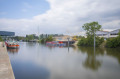
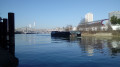
- The route runs as close as possible to the river.
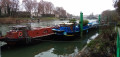
- Houseboats moored.
- Confluence of the Seine and the Marne.

Always be cautious and plan ahead when you're outdoors. Visorando and the author of this route cannot be held responsible for any accidents occurring on this route.

The GR® and PR® markings are the intellectual property of the Fédération Française de Randonnée Pédestre.

Reviews and comments

4.7 / 5
Based on 3 reviews

Reliability of the description
5 / 5
Ease of following the route
5 / 5
Route interest
4 / 5
Yannick Barbeau
Yannick Barbeau

Overall rating : 4.3 / 5

Date of your route : Mar 29, 2025
Reliability of the description : ★★★★★ Very good
Ease of following the route : ★★★★★ Very good
Route interest : ★★★☆☆ Average
Very busy route : No

The route isn’t very interesting; you just follow the Seine as far as the Marne, though not always right by the water’s edge.
It’s rather ugly and noisy.
Fortunately, the sun was shining brightly.

Machine-translated

Didier. Prenier
Didier. Prenier

Overall rating : 4.7 / 5

Date of your route : Feb 17, 2025
Reliability of the description : ★★★★★ Very good
Ease of following the route : ★★★★★ Very good
Route interest : ★★★★☆ Good
Very busy route : No

A pleasant, easy walk. We did it on a Saturday morning. I think Sunday morning is better – there are fewer cars, so it’s quieter.

Machine-translated

Kyla
Kyla

Overall rating : 5 / 5

Date of your route : Apr 03, 2022
Reliability of the description : ★★★★★ Very good
Ease of following the route : ★★★★★ Very good
Route interest : ★★★★★ Very good
Very busy route : No

The route along the Seine may not hold many surprises, but it is never monotonous.
The riverbanks take on different forms: wild or landscaped, overlooking the river or right on the water’s edge, where the noise of the city seems to be softened by the soothing murmur of the water.

Machine-translated

Other walks in the area

For more walks, use our search engine .

The GPS track and description are the property of this route's author. Please do not copy them without permission.