


OT des 1000 Étangs

 Tourist office
PRO  Premium user
Premium user - 7 Grande Rue, 70310 Faucogney-et-la-Mer
- Tel:03 84 63 22 80
- Website: https://www.les1000etangs.com/
Sign up:
Published route(s)
 From Noie Villerand to Grand Rosbeck
 4.89 mi
 +459 ft
 -463 ft
 2h 40
2h 40
 Easy
Easy
 Departure from Mélisey (Haute-Saône)
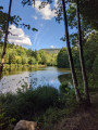
This family hiking route, on the outskirts of Mélisey, will allow you to discover the Plateau des 1000 Étangs (Plateau of 1000 Ponds) via small wooded paths. The ponds located along the route will amaze you, such as the Grand Rosbeck, one of the most beautiful in the Southern Vosges.
Amidst ponds and meadows on the Grilloux plateau
 2.20 mi
+108 ft
-118 ft
1h 05
Easy
Departure from Servance (Haute-Saône)
2.20 mi
+108 ft
-118 ft
1h 05
Easy
Departure from Servance (Haute-Saône)
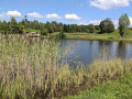
Amidst peat bogs and ponds, forests and meadows, you’ll discover the immense biodiversity of the Plateau des 1000 Étangs.
The Esmoulières route via La Saulotte
 5.42 mi
+446 ft
-430 ft
2h 55
Easy
Departure from Esmoulières (Haute-Saône)
5.42 mi
+446 ft
-430 ft
2h 55
Easy
Departure from Esmoulières (Haute-Saône)
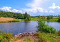
As you wander along old paths and small roads, you will enjoy a landscape of moors, meadows and forests interspersed with streams and ponds. You will pass through small hamlets with houses characteristic of the Plateau des 1000 Étangs. A remarkable and unique natural heritage to discover.
Bois des Hauts trail
 7.42 mi
+400 ft
-384 ft
3h 45
7.42 mi
+400 ft
-384 ft
3h 45
 Moderate
Departure from Belmont (Haute-Saône) (Haute-Saône)
Moderate
Departure from Belmont (Haute-Saône) (Haute-Saône)
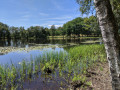
This fairly shaded hiking route will allow you to discover the historical heritage of the villages of Belmont and La Lanterne-et-les-Armonts, as well as the surrounding ponds such as the Grand Pas Saint-Martin, not to mention the La Lanterne river, which rises in the village and flows into the Saône at Conflandey.
Époissets route in Écromagny
 4.16 mi
+315 ft
-315 ft
2h 10
Easy
Departure from Écromagny (Haute-Saône)
4.16 mi
+315 ft
-315 ft
2h 10
Easy
Departure from Écromagny (Haute-Saône)
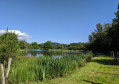
Starting from Écromagny, this family route will charm you with the beauty of the sites it passes through, including the Viaux peat bog (a veritable Noah's Ark of plants), the remarkable Pellevin and Dame ponds, views of the Vosges mountains and traces of life in the past with the Bégeot mill. A change of scenery guaranteed! Once you've finished your hike, set off to explore the village with a 1.5 km discovery route.
The schoolchildren’s trail at Château-Lambert
 4.63 mi
+1,073 ft
-1,076 ft
3h 05
Moderate
Departure from Haut-du-Them-Château-Lambert (Haute-Saône)
4.63 mi
+1,073 ft
-1,076 ft
3h 05
Moderate
Departure from Haut-du-Them-Château-Lambert (Haute-Saône)
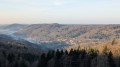
Follow in the footsteps of schoolchildren from days gone by as they made their way to the old school in Belmont. Stunning panoramic views await you along the path. Make the most of your visit to Château-Lambert by popping into the Mountain Museum and the Espace Nature Culture.
The Tour of Belfahy via the Col des Chevrères
 5.00 mi
+722 ft
-732 ft
2h 55
Moderate
Departure from Belfahy (Haute-Saône)
5.00 mi
+722 ft
-732 ft
2h 55
Moderate
Departure from Belfahy (Haute-Saône)
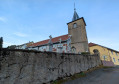
Perched at an altitude of 850 metres, the village of Belfahy is the highest in Haute-Saône and the Vosges Mountains. The village's name comes from the local word "foyard", meaning beech tree. Ideally located between the Ognon and Rahin valleys, in the heart of the Ballons des Vosges Regional Nature Park, Belfahy has become a popular destination for snowshoeing and hiking enthusiasts. This circular route will take you through coniferous forests with beautiful views of the valley.
Le Circuit du Rochenoz à Faucogney
 2.77 mi
+512 ft
-512 ft
1h 45
Moderate
Departure from Faucogney-et-la-Mer (Haute-Saône)
2.77 mi
+512 ft
-512 ft
1h 45
Moderate
Departure from Faucogney-et-la-Mer (Haute-Saône)
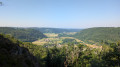
This circular takes you through the woods to discover the wonderful forest landscapes of the Southern Vosges. The view from Rochenoz is unforgettable! Don't leave without taking a thorough tour of the Falconian village, a Burgundy Franche-Comté Town of Character! Restaurants and shops in Faucogney.
Loop of the ponds in Beulotte-Saint-Laurent
 7.51 mi
+712 ft
-719 ft
4h 05
Moderate
Departure from Beulotte-Saint-Laurent (Haute-Saône)
7.51 mi
+712 ft
-719 ft
4h 05
Moderate
Departure from Beulotte-Saint-Laurent (Haute-Saône)
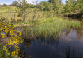
A variety of trails, some of which run through the woods, and forest paths will take you from the picturesque village of Beulotte-Saint-Laurent to the Plateau des Grilloux, passing through the hamlet of La Grande Rocholle. You will walk through a hilly landscape of peat bogs and ponds. On the way back via the long circuit, you will discover the remains of the old Moulin du Hanneau mill and take the small road that runs alongside the Ruisseau du Beuletin stream to return to the village.
Saint-Blaise Chapel as seen from Miellin
 5.99 mi
+1,309 ft
-1,302 ft
3h 55
Moderate
Departure from Miellin (Haute-Saône)
5.99 mi
+1,309 ft
-1,302 ft
3h 55
Moderate
Departure from Miellin (Haute-Saône)
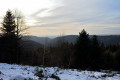
The highest point in the commune of Miellin, at an altitude of 850 m, Saint-Blaise Chapel offers visitors a magnificent and mysterious setting. At its foot lies a spring renowned for its therapeutic properties, said to soothe sore throats and eye ailments. As the saying goes: “Saint-Blaise water soothes all ailments”.
“Le Roséria” route in La Rosière
 6.32 mi
+860 ft
-830 ft
3h 40
Moderate
Departure from La Rosière (Haute Saône) (Haute-Saône)
6.32 mi
+860 ft
-830 ft
3h 40
Moderate
Departure from La Rosière (Haute Saône) (Haute-Saône)
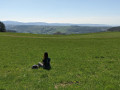
Set off to explore the heritage: crosses, calvaries, fountains and old farms of the Southern Vosges adorn this route, which winds its way between the hamlets scattered throughout the commune. Throughout this route, you will enjoy numerous views of the valleys and surrounding landscapes.
"Les Grilloux" route on the Grilloux Plateau
 9.73 mi
+594 ft
-610 ft
5h 00
Moderate
Departure from Servance (Haute-Saône)
9.73 mi
+594 ft
-610 ft
5h 00
Moderate
Departure from Servance (Haute-Saône)
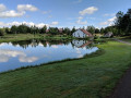
Located in the heart of the 1000 Étangs region, this route is suitable for both hikers and mountain bikers. From the Plateau des Grilloux, where you can picnic, you will discover magnificent views of the Ballon de Servance and a multitude of ponds that make this region a unique natural site. We guarantee that your hike will be unforgettable!
Little Finland on the Plateau des 1000 Étangs
 3.14 mi
+180 ft
-180 ft
1h 35
Easy
Departure from Servance (Haute-Saône)
3.14 mi
+180 ft
-180 ft
1h 35
Easy
Departure from Servance (Haute-Saône)
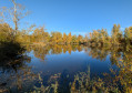
Between peat bogs and ponds, forests and meadows, you will discover the immense biodiversity of the Plateau des 1000 Étangs.
The Bois d'Arfin
 7.87 mi
+856 ft
-856 ft
4h 20
Moderate
Departure from Faucogney-et-la-Mer (Haute-Saône)
7.87 mi
+856 ft
-856 ft
4h 20
Moderate
Departure from Faucogney-et-la-Mer (Haute-Saône)
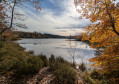
Starting from La Mer, more precisely from the Pause Paysage "Au fil de l'eau", you will discover the small paths connecting the various localities and hamlets located between Faucogney and Esmoulières. Small paths through woods and undergrowth will lead you to ponds, streams and Saône-style farms with carts. The highlight of the route is the Étang d'Arfin, the largest pond on the Plateau des 1000 Étangs (21 hectares).
La Bormillière
 5.06 mi
+758 ft
-787 ft
3h 00
Moderate
Departure from Fresse (Haute-Saône)
5.06 mi
+758 ft
-787 ft
3h 00
Moderate
Departure from Fresse (Haute-Saône)
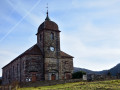
Fresse is a semi-mountainous area with scattered settlements comprising around thirty hamlets. This route will take you from the banks of the Raddon to the heights of the Montagne de Fresse.
Mont Cornu
 6.71 mi
+1,624 ft
-1,627 ft
4h 30
Moderate
Departure from Servance (Haute-Saône)
6.71 mi
+1,624 ft
-1,627 ft
4h 30
Moderate
Departure from Servance (Haute-Saône)
Whilst Servance is known for its lakes, this side of the valley offers a chance to explore mid-mountain landscapes, through the woods of Mont Cornu, which rises to an altitude of 800 metres, and the steep-sided valley of the Doue de l’Eau.
 Le Cygle
 14.97 mi
+984 ft
-981 ft
2.5 hrs
Moderate
Departure from Mélisey (Haute-Saône)
14.97 mi
+984 ft
-981 ft
2.5 hrs
Moderate
Departure from Mélisey (Haute-Saône)
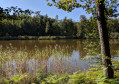
Access the Plateau des 1000 Étangs via easy trails! You will appreciate the tranquillity of the surroundings. From the ponds to the sandstone plateau of the cygle, everything inspires mystery amid the moors and forests. Here and there, a few stone walls still emerge, remnants of a bygone era. Accessible by mountain bike, gravel bike and cyclocross bike! Electric bike hire at the 1000 Étangs Tourist Office in Melisey!After your ride, come and relax at the "La Praille" leisure area in Melisey: swimming pool and water games in summer; sports and outdoor activities all year round, mini golf, picnic areas. Restaurants and shops in Melisey.
Route de la Noie Villerand to Grand Rosbeck
 3.45 mi
+253 ft
-223 ft
1h 50
Easy
Departure from Mélisey (Haute-Saône)
3.45 mi
+253 ft
-223 ft
1h 50
Easy
Departure from Mélisey (Haute-Saône)
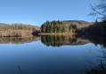
This family-friendly route on the outskirts of Melisey will allow you to discover the Plateau des 1000 Étangs (Plateau of 1000 Ponds) via small wooded paths. The ponds along the route will amaze you, such as the Grand Rosbeck, one of the most beautiful in the Southern Vosges. After your walk, come and enjoy the Praille leisure area: swimming pool and water games in summer, mini golf, picnic areas. Restaurants and shops in the local area.
Trail des Monts Rocheux
 8.54 mi
+1,375 ft
-1,375 ft
5h 05
8.54 mi
+1,375 ft
-1,375 ft
5h 05
 Difficult
Departure from Faucogney-et-la-Mer (Haute-Saône)
Difficult
Departure from Faucogney-et-la-Mer (Haute-Saône)
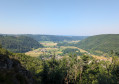
Starting from Faucogney, this trail route will allow you to discover the natural and cultural heritage of this charming town in Bourgogne-Franche-Comté. Starting from Place du Champ de Foire, you will reach Saint-Martin Chapel and its cemetery overlooking the valley. You will then set off to explore the ponds of the Oroz area, which bear witness to the rich fauna and flora of the region of 1,000 ponds. The end of the route will take you to the Rochenoz viewpoint.
"Le Mont du Breuchin" circular from Faucogney-et-la-Mer
 15.58 mi
+568 ft
-564 ft
2 hrs
Easy
Departure from Faucogney-et-la-Mer (Haute-Saône)
15.58 mi
+568 ft
-564 ft
2 hrs
Easy
Departure from Faucogney-et-la-Mer (Haute-Saône)
Starting from Faucogney-et-la-Mer, the route climbs to La Voivre towards the ruins of the Annegray monastery, the first foundation on the European continent by the Irish monk Saint Columbanus in the6th century.The paths then take you on a journey of discovery through the forests, ponds and farms typical of the 1000 Étangs and the Southern Vosges.
"Le Beuletin" circular from Faucogney-et-la-Mer
 17.56 mi
+1,814 ft
-1,801 ft
2.5 hrs
Difficult
Departure from Faucogney-et-la-Mer (Haute-Saône)
17.56 mi
+1,814 ft
-1,801 ft
2.5 hrs
Difficult
Departure from Faucogney-et-la-Mer (Haute-Saône)
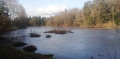
After the Breuchin plain followed by a beautiful climb, you will travel through the Beuletin valley and the unique landscapes of the 1000 Étangs with its stretches of water, peat bogs, viewpoints, small villages, crosses and calvaries. Then, at the end of the route, you will discover the site of the Saint-Martin Church overlooking the village of Faucogney. An unforgettable viewpoint!
La Boucle des Bruyères
 6.74 mi
+436 ft
-436 ft
3h 30
Moderate
Departure from La Bruyère (Haute-Saône)
6.74 mi
+436 ft
-436 ft
3h 30
Moderate
Departure from La Bruyère (Haute-Saône)
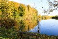
With an accessible 11 km route, the Bruyères circular path offers an immersion in a preserved and diverse natural heritage. The trail winds through landscapes alternating between shady forests, meadows, ponds, streams and memorials. There are two variants to shorten the route: 5.5 km and 9 km.
At the start, a path descends from the car park to the ponds and the communal orchard, running alongside the river through meadows where you can enjoy the rich diversity of flora and trees. Depending on the season, take the time to observe the multitude of habitats and the astonishing variety of flowers, frogs, mosses and mushrooms in the undergrowth.
The Brimbelles Trail from Belfahy
 4.23 mi
+846 ft
-823 ft
2h 40
Difficult
Departure from Belfahy (Haute-Saône)
4.23 mi
+846 ft
-823 ft
2h 40
Difficult
Departure from Belfahy (Haute-Saône)
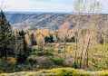
Perched at an altitude of 850 metres, the village of Belfahy is the highest in Haute-Saône and the Vosges Mountains. Starting from Place des Brimbelles, the route takes you to the Ballons Comtois Nature Reserve and the Col Sans Nom, at an altitude of 1,000 metres, before descending to the Chapel of St Blaise in Miellin and then returning to the Col des Chevrères.
Please note that the descent to the Chapelle Saint-Blaise is technically challenging (for experienced hikers).
 La Mer Circular Route
 17.64 mi
+1,066 ft
-1,056 ft
2 hrs
Moderate
Departure from Faucogney-et-la-Mer (Haute-Saône)
17.64 mi
+1,066 ft
-1,056 ft
2 hrs
Moderate
Departure from Faucogney-et-la-Mer (Haute-Saône)
The sea in Haute-Saône! The Mer circular (no. 4) will prove it to you!Discover the villages of Faucogney (a Burgundy-Franche-Comté town of character) and Mélisey. This route also takes you on a journey of discovery through the Plateau des 1000 Étangs, particularly near the villages of Écromagny and La Mer.
"La Petite Finlande" circular from Faucogney-et-la-Mer
 23.69 mi
+2,031 ft
-2,031 ft
2.5 hrs
Difficult
Departure from Faucogney-et-la-Mer (Haute-Saône)
23.69 mi
+2,031 ft
-2,031 ft
2.5 hrs
Difficult
Departure from Faucogney-et-la-Mer (Haute-Saône)
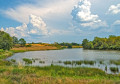
The Petite Finlande circular route will reveal the unique landscapes of the 1000 Étangs, an exceptional setting in the Vosges Mountains.Between peat bogs, ponds, forests, mountains and meadows, you can admire the immense biodiversity of the Plateau.You can also discover Faucogney-et-la-Mer, a Burgundy-Franche-Comté Town of Character, the picturesque little village of Beulotte-Saint-Laurent, the typical farms of the Southern Vosges, and the crosses and calvaries (500 are listed in the 1000 Étangs area).The Mer (no. 4) and Belles Filles (no. 21) circulars share sections with the Petite Finlande circular. You can therefore adapt the route to suit your needs and make it more challenging.
Electric bikes can be hired from the Tourist Office in Faucogney.
Circular Tour of the Belles Filles from Servance
 40.28 mi
+5,764 ft
-5,761 ft
4 hrs
40.28 mi
+5,764 ft
-5,761 ft
4 hrs
 Very difficult
Departure from Servance (Haute-Saône)
Very difficult
Departure from Servance (Haute-Saône)
Like a Tour de France climber!
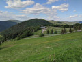
If you enjoy sporting challenges, then La Planche des Belles Filles is for you! Now a legendary climb in the Tour de France and a real challenge for cyclists, it offers a demanding ascent and spectacular views. At 5.9 km long with an average gradient of 8.5% and an elevation gain of over 600 metres, this demanding climb leaves no one indifferent.
But before that, you'll have to tackle the Col des Chevrères and its steep gradients (an 8 km climb with an average gradient of 6.5% and sections of 12%), then return to Servance via the Ballon de Servance... an 18 km climb with an average gradient of 5% and sections of 12%.
Get ready for an unforgettable experience!