La Bormillière

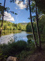
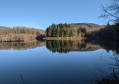
Fresse is a semi-mountainous area with scattered settlements comprising around thirty hamlets. This route will take you from the banks of the Raddon to the heights of the Montagne de Fresse.

Details

3806369
Creation:
Last update:
Last review:
  • Walking
    Activity: Walking
  • ↔
    Distance: 5.06 mi
  • ◔
    Average duration: 3h 00 
  • ▲
    Difficulty: Moderate

  • ⚐
    Back to start: Yes
  • ↗
    Ascent: + 758 ft
  • ↘
    Descent: - 787 ft

  • ▲
    Highest point: 2,182 ft
  • ▼
    Lowest point: 1,391 ft

Photos

Description of the walk

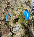
Yellow Ring marked trail

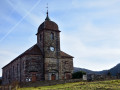
(S/E) Starting from Fresse church, with the car park on your left, take the D97 towards Mélisey. Cross the bridge over the Raddon to reach a wayside shrine.

(1) At the wayside shrine, turn left towards Mont de Vannes. Cross the bridge, then turn immediately right onto a dirt track. Follow the Raddon, then continue along the track until you reach a junction.

(2) Turn right, cross the bridge, then walk past the Auberge la Bormillière. When you reach the D97, turn left until you come to a crossroads.

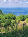
(3) Leave the road and turn right onto the ascending track. At the Fork in the road, turn left and continue up a very steep slope. Turn right twice. Halfway up the slope, there is a viewpoint over Ternuay and the southern part of the 1,000 Étangs. Then continue straight on until the end of the track at Dame Louise.

(4) At the crossroads, turn right onto the tarmac road leading downhill. Pass the farm. At the junction, turn right and follow the road downhill to the crossroads in the village with Rue du Fouilli Vollon.

(5) Turn left onto this road and rejoin the main road, the rue principale, just before the wayside shrine you passed on the way out.

(1) Turn left and return to the starting point by following the route in reverse (S/E).

Waypoints

  1. S/E : mi 0 - alt. 1,539 ft - Church
  2. 1 : mi 0.24 - alt. 1,509 ft - Oratory. Junction of the circular loop - Le Raddon de Fresse (rivière) - Affluent du Rhône par l'Ognon
  3. 2 : mi 1.04 - alt. 1,394 ft - Junction towards La Bormillière
  4. 3 : mi 1.48 - alt. 1,490 ft - Junction on the path
  5. 4 : mi 3.04 - alt. 2,165 ft - La Dame Louise
  6. 5 : mi 4.48 - alt. 1,575 ft - Rue des Fouillies Vollon
  7. S/E : mi 5.06 - alt. 1,539 ft - Finish

Worth a visit

Mont de Vannes: follow the road leading from the oratory; once you reach the summit, you’ll find a paragliding launch site, which offers one of the finest views of the Plateau des 1000 Étangs.
A little further on, near the road, stands the former Mont de Vannes Abbey (now a private residence).

Reviews and comments

4.2 / 5
Based on 3 reviews

Reliability of the description
4.7 / 5
Ease of following the route
4.7 / 5
Route interest
3.3 / 5
S BOEHRER
S BOEHRER

Overall rating : 4 / 5

Date of your route : Sep 18, 2025
Reliability of the description : ★★★★☆ Good
Ease of following the route : ★★★★☆ Good
Route interest : ★★★★☆ Good
Very busy route : No

The walk takes us to a viewpoint overlooking the thousand ponds and Ternuay
A beautiful climb to reach this viewpoint. Walk completed in 2½ hours with a few breaks during the climb

Machine-translated

randobolgir
randobolgir

Overall rating : 4.3 / 5

Date of your route : Jul 28, 2025
Reliability of the description : ★★★★★ Very good
Ease of following the route : ★★★★★ Very good
Route interest : ★★★☆☆ Average
Very busy route : No

Hello,
An interesting route for the views over Ternuay and the Plateau des Mille Étangs.
However, the section on the road is too long to warrant an extra star.
Randobolgir

Machine-translated

Goretex
Goretex

Overall rating : 4.3 / 5

Date of your route : Nov 24, 2024
Reliability of the description : ★★★★★ Very good
Ease of following the route : ★★★★★ Very good
Route interest : ★★★☆☆ Average
Very busy route : No

A lovely walk starting from Fresse, undertaken as a recce in preparation for taking a group there in January.
Reliable signposting.
A gentle start, followed by a lovely, fairly steep and quite long climb, but easily manageable.
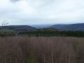
Some lovely views in the distance once you reach the top.
You’ll definitely need the full 3 hours allowed for the walk.
Thank you for suggesting this route.

Machine-translated

Other walks in the area

For more walks, use our search engine .

The GPS track and description are the property of this route's author. Please do not copy them without permission.