Mont Cornu

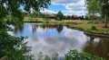
Whilst Servance is known for its lakes, this side of the valley offers a chance to explore mid-mountain landscapes, through the woods of Mont Cornu, which rises to an altitude of 800 metres, and the steep-sided valley of the Doue de l’Eau.

Details

3869986
Creation:
Last update:
Last review:
  • Walking
    Activity: Walking
  • ↔
    Distance: 6.71 mi
  • ◔
    Average duration: 4h 30 
  • ▲
    Difficulty: Moderate

  • ⚐
    Back to start: Yes
  • ↗
    Ascent: + 1,624 ft
  • ↘
    Descent: - 1,627 ft

  • ▲
    Highest point: 2,667 ft
  • ▼
    Lowest point: 1,309 ft

Photos

Description of the walk

Marked path – Yellow Rings

(S/E) At the far end of the church car park, cross the two bridges, then turn left onto Rue du1er Bataillon de Choc.

(1) Before the cemetery, turn left to continue along the street, then keep to the right at the next two junctions onto a fairly steep road. Ignore the access road to Les Oiseaux on the right and you’ll soon reach a crossroads.

(2) Carry on to the left, passing the Pré Saint-Jean farm and, further up, the Fache chalet.

(3) At the junction, turn right until you reach the next crossroads.

(4) Turn left to reach the monument erected in memory of the soldiers of the Bataillon de Choc, following the Liberation of 1944.
Turn back.

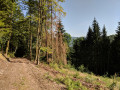
(4) Resume the route, heading due south along a poorly marked track. You’ll come out onto a forest road; follow it to the right to reach the D133.

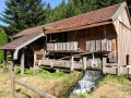
(5) Follow this road to the right for about 250 metres. On your left, you’ll see the Martin sawmill, followed by a fish farm. Just after that, turn left up the small road leading to the Envers de la Grève farm.

(6) Do not go all the way to the farm but continue left through the woods to reach the Champey bridge over the Doue de l’Eau.

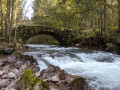
(7) Cross the bridge, then turn left onto a path that runs alongside the stream at a distance. Look out for the Champey waterfalls on your left. You’ll come out onto the D486; turn right.

(8) Pass the Saut de l’Ognon car park and head towards Servance.

(9) At the first houses, turn right towards the hamlet of Bourgagotte.

(10) Do not continue on to the cemetery, but turn left onto Rue du Breuil. Cross the bridge over the Ognon and follow Rue des Ponts to Servance church (S/E).
Waypoints

  1. S/E : mi 0 - alt. 1,348 ft - Église de Servance
  2. 1 : mi 0.32 - alt. 1,368 ft - Turn left at the fork
  3. 2 : mi 1.16 - alt. 1,903 ft - Crossroads
  4. 3 : mi 2.1 - alt. 2,287 ft - La Fache
  5. 4 : mi 2.93 - alt. 2,559 ft - Elevation 820
  6. 5 : mi 3.83 - alt. 1,549 ft - Memorial stone
  7. 6 : mi 4.43 - alt. 1,772 ft - D133 road
  8. 7 : mi 5.27 - alt. 1,375 ft - Pont de la - Doue de l'eau (ruisseau)
  9. 8 : mi 5.8 - alt. 1,335 ft - Car park at the - Saut de l'Ognon
  10. 9 : mi 5.88 - alt. 1,342 ft - Village entrance
  11. 10 : mi 6.44 - alt. 1,355 ft - Rue du Breuil
  12. S/E : mi 6.71 - alt. 1,348 ft - Servance Church - Ognon (rivière)

Worth a visit

(8) Just before the entrance to the village, a footpath starting from a small roadside car park takes you to the Saut de l’Ognon (15 minutes there and back).

Reviews and comments

3.4 / 5
Based on 5 reviews

Reliability of the description
3.8 / 5
Ease of following the route
3.4 / 5
Route interest
3 / 5
Nono 88
Nono 88

Overall rating : 1.7 / 5

Date of your route : Apr 16, 2025
Reliability of the description : ★★☆☆☆ Disappointing
Ease of following the route : ★☆☆☆☆ Very disappointing
Route interest : ★★☆☆☆ Disappointing
Very busy route : No

Hello
This route should never have been published!....The section after the old sawmill, leading up to the 820 mark, was thrown together in a hurry!
There are loads of Yellow Circles missing!.... After that, it’s fine.
The person must have had to do the same as us to find their way back, but shouldn’t have published it!......Lots of people will do the same and end up disappointed, just like us.......
See you, Nono.
l

Machine-translated

ombrageux
ombrageux

Overall rating : 4.3 / 5

Date of your route : Jul 23, 2023
Reliability of the description : ★★★★☆ Good
Ease of following the route : ★★★★☆ Good
Route interest : ★★★★★ Very good
Very busy route : No

Hello,

A lovely walk to do in fine weather, with beautiful scenery, unusual spots and a great area for blueberries, mushrooms and blackberries.

It’s worth noting that the route passes close to the Ognon waterfall on one side and, shortly afterwards, the Saut de l’Ognon, both of which are well worth a detour.

Thanks to the person who mapped out the route.

Machine-translated

chatounette
chatounette

Overall rating : 3.7 / 5

Date of your route : Mar 30, 2021
Reliability of the description : ★★★★★ Very good
Ease of following the route : ★★★★★ Very good
Route interest : ★☆☆☆☆ Very disappointing
Very busy route : No

Hello,
This walk is completely uninteresting; you go up and down steeply through the woods without seeing a thing – there are no views at all.
As for the difficulty, I wouldn’t call it moderate but rather difficult and exhausting; you’re walking through ravines.
We reckoned it was 12.5 km
The only highlight is the Pont de Champey
But I’m proud to have finished it anyway!!
Happy walking, everyone

Machine-translated

Werth
Werth

Overall rating : 4.7 / 5

Date of your route : Oct 29, 2020
Reliability of the description : ★★★★★ Very good
Ease of following the route : ★★★★☆ Good
Route interest : ★★★★★ Very good
Very busy route : No

A wonderful walk to enjoy in fine weather. Thank you all

Machine-translated

petitlapin70
petitlapin70

Overall rating : 2.7 / 5

Date of your route : Oct 26, 2020
Reliability of the description : ★★★☆☆ Average
Ease of following the route : ★★★☆☆ Average
Route interest : ★★☆☆☆ Disappointing
Very busy route : No

It’s true; this walk isn’t particularly interesting, apart from the sight of a memorial stone commemorating soldiers executed by the Germans during their retreat in late 1944; but in this region, such memorials are, unfortunately, all too common.Furthermore, the stated difficulty level is an understatement, at least for hikers of a certain age like us, and the poorly signposted section at the top of the 820-metre hill led us astray, meaning we ended up walking nearly 8 km further than intended.In short, we missed the summit, which was perhaps the only highlight of this walk: a view of the Vosges mountains. I would not recommend it, especially as there are many more trails in this region amongst the thousands of lakes, which are far more attractive, particularly at this time of year, with its myriad autumnal colours.

Machine-translated

Other walks in the area

For more walks, use our search engine .

The GPS track and description are the property of this route's author. Please do not copy them without permission.