


kcnarf

 Visorando Member
 Premium user
 - Gender: man
Sign up:
Published route(s)
 The Ventoux valleys: a rollercoaster ride
 16.50 mi
 +5,338 ft
 -5,308 ft
 12h 15
 Difficult
 Departure from Bédoin (Vaucluse)
A rollercoaster-like route through the Combes de l’Obscure and de Malaval (or Maraval), then the Vallon du Baume du Chat, on the south-western face of Mont Ventoux.
Circular route offering varied scenery, allowing you to see part of the range of landscapes offered by Mont Ventoux. The route is dotted with rock shelters and small caves… all, of course, on stony ground.
Gorge d'Omblèze - Canyon des Gueulards
 14.33 mi
+4,291 ft
-4,262 ft
10h 20
Difficult
Departure from Omblèze (Drôme)
14.33 mi
+4,291 ft
-4,262 ft
10h 20
Difficult
Departure from Omblèze (Drôme)
Randonnée permettant de parcourir sur la journée l'ensemble des cascades et des particularités des gorges.
Gorge de la Méouge - Crête Saint-Cyr
 13.07 mi
+3,930 ft
-3,914 ft
9h 25
Difficult
Departure from Saint-Pierre-Avez (Hautes-Alpes)
13.07 mi
+3,930 ft
-3,914 ft
9h 25
Difficult
Departure from Saint-Pierre-Avez (Hautes-Alpes)
Tour des Gorges de la Méouge au départ de Saint-Pierre-Avez en traversant l'intégralité de la crête de la Montage de Saint-Cyr, afin de réaliser un itinéraire un peu plus sportif.
Montagne de Lure, southern ascent
 17.24 mi
+3,976 ft
-3,980 ft
11h 25
Difficult
Departure from Saint-Étienne-les-Orgues (Alpes-de-Haute-Provence)
17.24 mi
+3,976 ft
-3,980 ft
11h 25
Difficult
Departure from Saint-Étienne-les-Orgues (Alpes-de-Haute-Provence)
Ascent of Montagne de Lure from Saint-Étienne-les-Orgues. Circular route to the summit via Notre-Dame de Lure and the resort of Lure, covering part of the ridges of Montagne de Lure.
This route offers varied landscapes, crossing a beech forest, alpine meadows and dwarf junipers on the ridges, all offering panoramic views of Mont Ventoux and the Albion Plateau, the Southern Alps and the peaks of the Écrins.
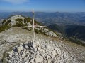
Montagne de la Clavelière and the summit of La Vanige
 14.89 mi
+4,826 ft
-4,856 ft
11h 05
Difficult
Departure from Saint-Auban-sur-l'Ouvèze (Drôme)
14.89 mi
+4,826 ft
-4,856 ft
11h 05
Difficult
Departure from Saint-Auban-sur-l'Ouvèze (Drôme)
A beautiful hike in the Baronnies (Drôme Provençale) starting from Saint-Auban-sur-l'Ouvèze. This route takes you to the little-known summit of La Vanige and along the ridges of the Montagne de la Clavelière. Panoramic views of Mont Ventoux, the Vercors, the Montagne d'Angèle and the Dévoluy massif.
Montagne de Lure
 18.76 mi
+5,627 ft
-5,627 ft
7 hrs
18.76 mi
+5,627 ft
-5,627 ft
7 hrs
 Very difficult
Departure from Saint-Vincent-sur-Jabron (Alpes-de-Haute-Provence)
Very difficult
Departure from Saint-Vincent-sur-Jabron (Alpes-de-Haute-Provence)
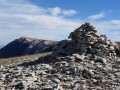
Ascent of Montagne de Lure from Saint-Vincent-sur-Jabron. A beautiful circular route allowing you to reach the summit via the north-facing slope of Lure and its marl, then cross most of the ridges of Montagne de Lure from east to west.
Magnificent panorama of the Écrins, the Dévoluy (Plateau de Bure, Grand Ferrand), the Vercors and the Diois.
The Archier and Maraysse Mountains
 14.37 mi
+5,679 ft
-5,682 ft
6 hrs
Very difficult
Departure from Rosans (Hautes-Alpes)
14.37 mi
+5,679 ft
-5,682 ft
6 hrs
Very difficult
Departure from Rosans (Hautes-Alpes)
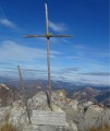
A challenging hike between the Drôme and Hautes-Alpes departments, taking you to the summit of the Montagne de l’Archier via Le Fourchat and onto the Maraysse ridges.
360° panoramic views over the Rosanais region, from Mont Ventoux in the south to the Dévoluy and the Vercors in the north.
Nearby, views of the Vanige, the Clavelière, Raton and Aup mountains.
Montagnes des Gravières and Montagne du Raton
 15.45 mi
+5,056 ft
-5,046 ft
6 hrs
Very difficult
Departure from Rémuzat (Drôme)
15.45 mi
+5,056 ft
-5,046 ft
6 hrs
Very difficult
Departure from Rémuzat (Drôme)
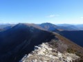
A ridge hike between the Drôme and Hautes-Alpes, ascending Montagne des Gravières via the Aiguilles de Rémuzat, then crossing the entire length of Montagne du Raton to Col de Pommerol (or Col de la Fromagère).
360° panoramic views of the Rosanais region, from Mont Ventoux in the south to the Dévoluy and the Vercors in the north. Nearby, views of the Montagnes de la Lance and d’Angèle, the Montagne de l’Archier and the 3 Becs.
Montagne de la Lance from Venterol
 17.90 mi
+6,260 ft
-6,263 ft
6 hrs
Very difficult
Departure from Venterol (Drôme) (Drôme)
17.90 mi
+6,260 ft
-6,263 ft
6 hrs
Very difficult
Departure from Venterol (Drôme) (Drôme)
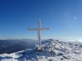
A very long, challenging circular route around the Montagne de la Lance, easily recognisable by its long, curved shape.
A 360° panoramic view from its summit at over 1,300 metres. To the west, a view over the Rhône valley (Tricastin, Donzère wind turbines); to the east, a wilder, more mountainous landscape featuring the Southern Pre-Alps, notably the Montagne d’Angèle and Mont Cougard; also the Diois region with the Trois Becs to the north; and finally, Mont Ventoux and the Dentelles de Montmirail to the south.
From Fontaine-de-Vaucluse to the Hermitage of Saint-Gens
 16.29 mi
+4,439 ft
-4,439 ft
6 hrs
Very difficult
Departure from Fontaine-de-Vaucluse (Vaucluse)
16.29 mi
+4,439 ft
-4,439 ft
6 hrs
Very difficult
Departure from Fontaine-de-Vaucluse (Vaucluse)
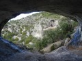
A circular route on sometimes demanding terrain, starting from the ridges above Fontaine-de-Vaucluse and ending at the Hermitage of Saint-Gens.
Crossing wild valleys and the Vallon de Valescure (arch and karstic cave). Beautiful panoramic views of the Vaucluse mountains and Mont Ventoux.
Voie Gombault and Marcel Estruch Trail
 12.11 mi
+3,970 ft
-3,950 ft
5 hrs
12.11 mi
+3,970 ft
-3,950 ft
5 hrs
 Extremely difficult
Departure from Plan-d'Aups-Sainte-Baume (Var)
Extremely difficult
Departure from Plan-d'Aups-Sainte-Baume (Var)
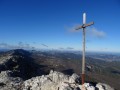
This is a "hiking-climbing" route along the Voie Gombault and the Marcel Estruch trail on the north-east face of the Sainte-Baume massif. Direct access to the ridges via a vertical route, then a complete crossing of the balcony trail from east to west. Undergrowth, ridges, ledges and cave visits also feature on this aerial route.
⚠️ This hike should not be undertaken between 15 February and 15 July in order to respect the tranquillity of the area and not compromise bird reproduction on the Marcel Estruch trail.
Triple ascent of the south-west face of Sainte-Victoire
 9.55 mi
+5,295 ft
-5,285 ft
6 hrs
Extremely difficult
Departure from Saint-Antonin-sur-Bayon (Bouches-du-Rhône)
9.55 mi
+5,295 ft
-5,285 ft
6 hrs
Extremely difficult
Departure from Saint-Antonin-sur-Bayon (Bouches-du-Rhône)
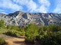
A challenging and demanding route that sometimes straddles the line between hiking and light climbing.The route involves a triple ascent of Sainte-Victoire via the three marked trails to the south-west of the massif: the Black, Green (Forcioli) and finally Yellow trails.Then continue along the ridges to the east, crossing the plateau’s characteristic sharp limestone pavement, to the Brèche du Clapier.(__Please note: see important warning in the description__)
Marseilleveyre Massif: the 9 Steps
 12.51 mi
+6,309 ft
-6,309 ft
7 hrs
Extremely difficult
Departure from Marseille (Bouches-du-Rhône)
12.51 mi
+6,309 ft
-6,309 ft
7 hrs
Extremely difficult
Departure from Marseille (Bouches-du-Rhône)
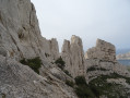
This route takes you around the Marseilleveyre massif via aerial and challenging sections. A few caves dot the route, all set against the stunning backdrop of the Calanques de Marseille.
You are in the Calanques National Park, which is subject to specific regulations. Failure to comply with these regulations may result in a fine of up to €1,500.
Grande Traversée des Dentelles de Montmirail
 17.91 mi
+6,027 ft
-6,014 ft
7 hrs
Extremely difficult
Departure from Lafare (Vaucluse)
17.91 mi
+6,027 ft
-6,014 ft
7 hrs
Extremely difficult
Departure from Lafare (Vaucluse)
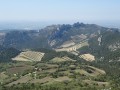
This is a long hike that takes you around the entire massif.
The ascent of the Crête Saint-Amand, crossings of the Grande Montagne (or Grand Travers chain), the Dentelles Sarrasines (south then north faces), the Grand Montmirail and the Clapis are all on the programme.
The Chambre du Turc and the Belvédère du Rocher du Midi are also included.
Fire hazard and hunting: risk of fines! Make sure you are familiar with the local regulations in the practical information section.
Ascent of Mont Ventoux and crossing of the north face
 19.04 mi
+6,588 ft
-6,562 ft
7 hrs
Very difficult
Departure from Bédoin (Vaucluse)
19.04 mi
+6,588 ft
-6,562 ft
7 hrs
Very difficult
Departure from Bédoin (Vaucluse)
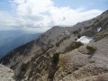
Ascend Mont Ventoux from the south, then cross the north face via theGR®9. Panoramic view of the entire Toulourenc valley from the mountainside.
From Les Cantilènes to the Grand Couloir
 8.45 mi
+4,652 ft
-4,623 ft
6 hrs
Extremely difficult
Departure from Saint-Antonin-sur-Bayon (Bouches-du-Rhône)
8.45 mi
+4,652 ft
-4,623 ft
6 hrs
Extremely difficult
Departure from Saint-Antonin-sur-Bayon (Bouches-du-Rhône)
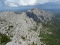
Circular loop around La Marbrière. A challenging and demanding route, sometimes straddling the line between hiking and light climbing.
Route involving a west-to-east traverse of Sainte-Victoire via high-altitude paths and, at times, completely off-trail. Pas de l’Oppidum and Pas du Chat are also on the itinerary.
07/11/2024: Hikes temporarily inaccessible: the black and green routes on Sainte-Victoire are closed by municipal order due to rockfalls. See practical information.
East of the Dentelles de Montmirail
 20.96 mi
+5,046 ft
-5,030 ft
6 hrs
Very difficult
Departure from Lafare (Vaucluse)
20.96 mi
+5,046 ft
-5,030 ft
6 hrs
Very difficult
Departure from Lafare (Vaucluse)
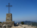
This circular route allows you to climb and cross the entire Crête Saint-Amand, then the Crêtes d'Arfuyen and Crêtes des Gippières. Panoramic views of the Dentelles de Montmirail, Mont Ventoux and Barroux throughout the route.
Fire hazard and hunting: risk of fines! Make sure you are familiar with the local regulations in the practical information section.
Mont Ventoux via the Saint-Basile Chapel
 21.79 mi
+5,636 ft
-5,617 ft
6 hrs
Very difficult
Departure from Saint-Léger-du-Ventoux (Vaucluse)
21.79 mi
+5,636 ft
-5,617 ft
6 hrs
Very difficult
Departure from Saint-Léger-du-Ventoux (Vaucluse)
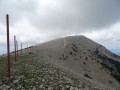
Circular allowing you to climb the north side of Mont Ventoux, then cross the ridges to Tête de la Grave and reach Col de la Frache further east.
Route allowing you to discover the beech forest and cliffs of the north face.
Mont Ventoux via Savoillan
 22.59 mi
+5,341 ft
-5,335 ft
7 hrs
Very difficult
Departure from Savoillan (Vaucluse)
22.59 mi
+5,341 ft
-5,335 ft
7 hrs
Very difficult
Departure from Savoillan (Vaucluse)
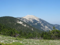
Circular route allowing you to climb Mont Ventoux from the east, following the entire ridge line.
A route allowing you to explore the cliffs, scree slopes and beech forest of the north face via theGR®9.
Sumiou Mountain and Lure Ridge
 19.31 mi
+5,837 ft
-5,807 ft
7 hrs
Very difficult
Departure from Valbelle (Alpes-de-Haute-Provence)
19.31 mi
+5,837 ft
-5,807 ft
7 hrs
Very difficult
Departure from Valbelle (Alpes-de-Haute-Provence)
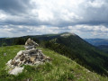
Circular ridge walk in the Jabron valley on the Montagne de Sumiou and on the eastern side of the Montagne de Lure.
Pass through the small rock-cut chapel of Saint-Pons on the cliff face.
Magnificent views on a clear day of the Écrins, the Dévoluy (Bure plateau), the Vercors and the Diois.
Mont Ventoux via the Sommet de la Plate and the Rochers de Cachillan
 20.50 mi
+6,220 ft
-6,220 ft
6 hrs
Very difficult
Departure from Beaumont-du-Ventoux (Vaucluse)
20.50 mi
+6,220 ft
-6,220 ft
6 hrs
Very difficult
Departure from Beaumont-du-Ventoux (Vaucluse)
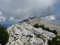
Alternative ascent of Mont Ventoux via the Sommet de la Plate and the Col de Comte.
Then cross the ridges from east to west via the Rochers de Cachillan. This route has many poorly marked sections.
The Sommet de la Plate and the Montagne de Bluye
 18.52 mi
+5,466 ft
-5,486 ft
6 hrs
Very difficult
Departure from Saint-Léger-du-Ventoux (Vaucluse)
18.52 mi
+5,466 ft
-5,486 ft
6 hrs
Very difficult
Departure from Saint-Léger-du-Ventoux (Vaucluse)
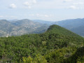
Circular route around the Toulourenc Valley, across the ridgelines of the Sommet de la Plate and the Montagne de Bluye, marking the border between the Drôme and the Vaucluse.
Panoramic views of the Toulourenc and the north face of Mont Ventoux, as well as Buis-les-Baronnies, Rocher Saint-Julien and the Drôme Provençale.
Tour of the Montagne de Bluye
 23.47 mi
+6,657 ft
-6,647 ft
8 hrs
Very difficult
Departure from Mollans-sur-Ouvèze (Drôme)
23.47 mi
+6,657 ft
-6,647 ft
8 hrs
Very difficult
Departure from Mollans-sur-Ouvèze (Drôme)
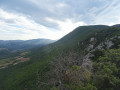
Situated between the imposing massifs of Mont Ventoux and the Baronnies, the Montagne de Bluye marks the boundary between the departments of Vaucluse and Drôme. Along this route, there are sweeping panoramic views of the surrounding valleys of the Toulourenc and the Ouvèze.
The northern face of Mont Ventoux and the Baronnies Provençales mountain range are visible throughout the route.
From the Grand Couloir to the Vallon de l'Aigle
 10.45 mi
+5,801 ft
-5,787 ft
5 hrs
Extremely difficult
Departure from Puyloubier (Bouches-du-Rhône)
10.45 mi
+5,801 ft
-5,787 ft
5 hrs
Extremely difficult
Departure from Puyloubier (Bouches-du-Rhône)
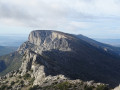
A physically demanding route, sometimes straddling the line between hiking and climbing. The route involves a west-to-east traverse across the easternmost part of Sainte-Victoire, taking in a few off-trail sections. The route is dotted with numerous caves and cavities, including the Grotte aux Champignons.
The Saint Ser black trail is closed by municipal order from 1 February to 15 July each year.
The green trail is closed by municipal order between 1 February and 15 July each year (to protect the breeding of birds, butterflies, reptiles, etc.). See practical information.
Circuit of the Cirque de Morgon from Savines-le-Lac
 16.81 mi
+7,060 ft
-7,047 ft
7 hrs
Very difficult
Departure from Savines-le-Lac (Hautes-Alpes)
16.81 mi
+7,060 ft
-7,047 ft
7 hrs
Very difficult
Departure from Savines-le-Lac (Hautes-Alpes)
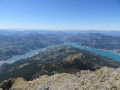
A lovely climb through the forest to the Portes de Morgon, followed by a challenging ridge walk to circumnavigate the Cirque de Morgon in its entirety. Access to the Pic de Morgon, the summit of the Tête de la Vieille, then on to the Pic de Charance, before completing the circuit of the cirque via the Pic de Martin Jean.
The ridges offer sweeping views over Lake Serre-Ponçon and all the surrounding mountain ranges.
Le Vieux Chaillol from Les Borels
 18.93 mi
+7,776 ft
-7,776 ft
15h 30
Very difficult
Departure from Champoléon (Hautes-Alpes)
18.93 mi
+7,776 ft
-7,776 ft
15h 30
Very difficult
Departure from Champoléon (Hautes-Alpes)
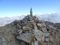
Overlooking the Champsaur valley and the southern Valgaudemar, the Vieux Chaillol offers a fantastic rocky setting and a dazzling panorama of a large group of mountains: Dévoluy, Vercors and Écrins. The view even extends as far as Mont Ventoux and the Lure mountain.
The ascent to the Col de Côte Longue is made from the east, starting from the Champoléon valley.
This hike is reserved for experienced and trained mountain hikers.
Rhêmes-Golette Glacier and Lake
 15.72 mi
+6,293 ft
-6,276 ft
5 hrs
Very difficult
Departure from Val-d'Isère (Savoie)
15.72 mi
+6,293 ft
-6,276 ft
5 hrs
Very difficult
Departure from Val-d'Isère (Savoie)
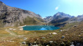
Situated in the Haute Tarentaise massif, this small lake nestles at the foot of the Rhêmes-Golette glacier.
Dominated by the peaks of Grande Sassière (3,747m) and Tsanteleina (3,602m) on the Italian border, this route takes you through a high-mountain landscape, between lakes and glaciers.
This hike is reserved for experienced and fit mountain walkers.
Pic de Bure via Pas de Paul and Tête des Pras Arnaud
 9.90 mi
+5,144 ft
-5,125 ft
5 hrs
Extremely difficult
Departure from Montmaur (Hautes-Alpes)
9.90 mi
+5,144 ft
-5,125 ft
5 hrs
Extremely difficult
Departure from Montmaur (Hautes-Alpes)
1 November 2025: a user reports => this concerns the route between the wps (6), (7), and (8).Geoportal (Biotope protection decrees)
(!) WARNING (!) This hike crosses the perimeter of the prefectural decree for the protection of the Plateau de Bure biotope, in which it is STRICTLY FORBIDDEN to leave the marked trails, under penalty of a 4th class fine of €750. For the time being, the agents of the French Office for Biodiversity, responsible for enforcing this decree, are taking a preventive approach, but they will surely soon move on to enforcement.
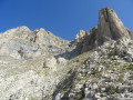
Access to the Plateau de Bure off the beaten track. This alpine hike via the Pas de Paul offers an unusual and wild setting, through devolved steps, vertical corridors marked by large staircases. This variant allows you to reach the westernmost peaks of the Bure plateau, the Tête des Pras Arnaud and the Tête de la Cluse, before the Pic de Bure.
Pic de Bure via the Coste Belle Caves
 11.83 mi
+6,053 ft
-6,024 ft
5 hrs
Very difficult
Departure from Saint-Étienne-en-Dévoluy (Hautes-Alpes)
11.83 mi
+6,053 ft
-6,024 ft
5 hrs
Very difficult
Departure from Saint-Étienne-en-Dévoluy (Hautes-Alpes)
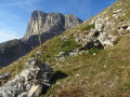
A unique route to the Bure Plateau through the geological features of the Dévoluy massif. This alpine hike offers an unusual route through the Coste Belle Caves, before following the ridges.La Baume Noire adds a highlight to the return route through the Vallon de Corne.
This hike is reserved for experienced mountain walkers with a keen sense of direction.
Les Trois Becs: a different perspective
 9.86 mi
+7,431 ft
-7,434 ft
6 hrs
Extremely difficult
Departure from Chastel-Arnaud (Drôme)
9.86 mi
+7,431 ft
-7,434 ft
6 hrs
Extremely difficult
Departure from Chastel-Arnaud (Drôme)
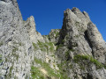
Overlooking the southern Diois region, the Saoû perched syncline, with its main peaks of the Trois Becs (the Veyou, the Signal and Roche Courbe), forms a must-see and much-visited mountain range in the Drôme.
However, there are still a few wilder routes featuring steep sections, which are rarely used and require sure-footedness. These routes also allow you to fully enjoy the panoramic views on offer, through the cliffs and other points of interest in this massif.Caution: the section between (6) and (7) is off-trail near rocky outcrops! Please read the route description carefully!
Please note: the route passes through a wildlife sanctuary. Certain sections are off-limits between 15 May and 15 July. Specific signage and a diversion from the GR®9 have been put in place to guide walkers; seehere.