Country:

 City:


Access:
- From Montélimar:
Head towards Dieulefit via the D540. In Dieulefit, turn right towards Valréas via the D538. After about 3 km, turn left towards La Paillette via the D130.
Drive through La Paillette and continue straight on towards Teyssières via the D130. In Teyssières, turn right towards the old village. Park on the right in the car park at the entrance to the old village. Not far from the starting marker visible by the roadside.
- From Nyons:
Head towards Gap, following the Eygues valley via the D94. 1 km after passing through Les Pilles, turn left towards the Gorges de Trente Pas. Then follow the D70 local road to the village of St-Ferréol-Trente Pas. Drive through the village towards the gorges, then continue left towards Teyssières on the D130 local road. From Teyssières, turn left towards the old village.
Park on the right in the car park at the entrance to the old village. Not far from the starting marker visible by the roadside.
(S/E) From the car park, head back down along the access road to the old village. Pass the hiking marker and continue straight on, staying on the tarmac section. Follow theGRP® ‘Tour du Pays de Dieulefit’ trail.
Cross the bridge over the Le Lez stream, then head up to the left towards the church. Take the Chemin des Maquis de la Lance (ignore the wide path on the left). You’ll soon reach a spring.
You will then pass below a water retention basin.
(1) After the reservoir, leave the small tarmac road leading to the church by turning left. Head uphill along a cutting (passing some broom bushes). You’ll soon reach a spring catchment point. Continue to the left, still heading uphill.
The track eventually fades away, partly into the grass. Keep heading west, climbing gently towards the undergrowth.
(2) In the undergrowth, you’ll come to an old footpath. Head northwards uphill. After about a hundred metres, ignore the cairn and the small track branching off to the right. Continue uphill through the undergrowth.
(3) You’ll reach a small clearing marked by a cairn. Continue to the left, then quickly turn right at the Fork in the road ahead. Follow the single track as it gradually climbs to the “Le Château de Concourdet” promontory, where you’ll find yourself facing the rocky eastern face of the Montagne de la Lance.
Then descend along the same single track.
(4) At the foot of the descent, you’ll reach the “Col de Courdet” signpost. Turn left, then immediately right onto the path that leads into the undergrowth (Yellow Cross). After about a hundred metres, oldGRP®-style markings appear in yellow and red. The trail is also dotted with numerous cairns. The path climbs quite steeply in places (the route deviates from the IGN map).
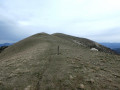
You’ll reach a beautiful maple tree several hundred years old. Go round it to the left, then behind it. Continue the ascent via a series of small switchbacks. You’ll find yourself below La Lance, out of the tree cover. Continue climbing up slopes of varying steepness. You’ll then emerge onto the ridge line near the summit.
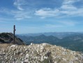
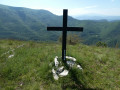
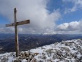
(5) You’ll soon reach the cross marking the summit of La Lance. Continue for 250 m towards Rocher Garaux to the north.
Turn back towards the south and descend along the ridge for nearly 2 km.
Follow the white/red markings ofthe GR®9.
(6) Reach the “La Grille” signpost. Turn left towards Col Lachaud. Then take theGRP® Tour du Pays de Dieulefit trail. Descend very quickly until you come to a fence. Follow the fence to the left, then go through the attractive metal gate.
(7) At the bottom of the descent, you’ll come out onto a track at Col Lachaud. Continue straight on along the visible path through the grass, heading east. There are no markings.
After 250 m, the ascending path curves south-east. At times, the track is barely visible. Generally speaking, stay on the open ground running between the broom bushes (on your right, slightly below) and the trees (on your left). You will then follow a ridge partly obscured by vegetation.
(8) As you follow the edge of the vegetation on the left, take the section of the path that leads over to the other side. Head downhill. A makeshift fluorescent green marker appears. You’ll emerge into a clearing. Continue straight on for 150 m until you reach a Fork in the road.
(9) Join theGRP® ‘Tour du Pays de Dieulefit’ trail and continue to the right. Yellow/red markings.
You’ll reach a fenced-off meadow just before the Col de la Pause (the corresponding marker is on the right, slightly below, as you enter the meadow). Cross the meadow diagonally, following the grassy track to the woodland (close the gates as you pass through). Yellow markings are visible in the woodland.
(10) You’ll soon reach the ‘Petit Herme’ signpost. Turn right towards the Col de Venterol. Yellow markings; the path now heads south. Follow thePR® for nearly 1 km.
(11) At Col de Venterol (marker), turn left towards La Pousterle. After 100 m, you’ll reach a bend in a track suitable for vehicles. Continue straight on, climbing very gradually along this same track. Yellow markings.
(12) At the “La Pousterle” signpost, leave the track by heading straight on towards Cougoir along the ridges. After 120 m, head straight on immediately. Cross over and descend, following the path marked by the Yellow Cross.
(13) At the bottom of the descent, you’ll reach a small crossroads of paths, marked by a cairn. Continue straight ahead along the path. Follow the side of a slightly sloping, gravelly section before reaching a track below.
(14) At the fork in the road, turn left. Follow the track for about 100 m, then take the path that climbs to the left. There are yellow markings. Join a grassy path. This soon begins to climb. Although narrow in places, the path is clearly marked on the ground (with a few cairns). Follow it until you reach the Pas du Loup, where the slope becomes steeper as you approach the cliffs of the Rochers du Clos du Buis.
(15) On emerging from the Pas du Loup, quickly cross through some small boxwood bushes. Turn sharply left to climb – quite steeply at first – up the ridges of the Rochers du Clos du Buis across the grassy pastures. You will find yourself on the cliff face as you cross the pasture area. Follow the cliffs until you reach a well-marked path.
(16) You’ll arrive just below the summit of the Montagne de la Croix. Continue towards it, then cross a short stretch of vegetation (elevation 1221).
Join the marked path (yellow), coming from the west (from the Col de la Pause), then continue to the left.
Descend slightly and reach the “Cougoir” marker below. Then climb straight up towards the summit.
(17) After a short climb, you’ll reach the summit of the Cougoir, marked by its IGN boundary stone. The promontory offers a beautiful 360° panorama. Turn back, descend, then climb once more to the summit of the Montagne de la Croix (elevation 1221). Set off again towards the Rochers du Clos du Buis on the right after passing through the small wooded area of the Montagne de la Croix.
(16) Veer slightly to the left across the pastures. Head towards the summit at elevation 1069. You’ll soon reach Clos du Puits (elevation 1091). Stay on the contour line along the ridge, where several cairns are lined up. Follow it to the end.
(18) Descend, veering to the right. The path is barely marked (a few small cairns) at the start, winding through small hairpin bends (rocky and gravelly in places). You will then reach the ridge of the Montagne de Sauveginoux through the woodland (boxwood, holm oak). Follow the correct path down towards the north-east until you reach the track at the Col de Fonturière.
(19) At the Col de Fonturière, marked by a junction of trackways, take the trackway on the left (marked with yellow mountain bike signs). Descend for almost 1 km, heading north-north-west, to the Auberge de Mielandre. During the descent, ignore all other paths you come across.
(20) When you reach the sign for “Auberge de Miélandre”, follow signs for Teyssières to the left. Take the D130 local road as far as the bridge, which runs alongside several lavender fields and passes close to a distillery. Carry on straight ahead along the slightly uphill dirt track (yellow mountain bike signposting), heading west. You’ll come to a three-way junction near the fields.
(21) Continue to the right, following the wide path. You’ll reach a field, then go round it on the left, following the path and crossing a small marl-covered stretch.
Reach the bottom of the valley, which follows a stream. Then turn left whilst crossing the stream at the ford. Continue westwards; further on, the path turns south-west to reach the junction with the GRP® Tour du Pays de Dieulefit at the “Pied Pourtier” signpost.
(22) Carry on straight ahead towards Teyssières, staying on the track suitable for vehicles. Yellow/red markings for the GRP® Tour du Pays de Dieulefit. Walk for about 400 m to reach the car park at the entrance to the village (S/E).


 Visorando Member

 Difficult


 Moderate