Country:

 City:
City:


Access: From Saint-Auban-sur-l’Ouvèze, take the D65 towards Montauban-sur-l’Ouvèze. Drive through the small village and head towards the Col de Perty. Then continue on the D65A to the right, towards the hamlet of Somecure (a fairly narrow road).
Enter the hamlet on the right, then park on the lawn behind the small chapel (there is no other non-private parking elsewhere).
(S/E) From the Somecure chapel, take the Chemin du Grand Étable (street sign on the corner of the house) and head up the tarmac road.
(1) Continue slightly to the right along this same road, following the signs for L’Eydoux (signpost), then carry on to the end of the tarmac road.
After the last houses, the tarmac road turns into a track suitable for vehicles.
(2) At the fork in the road, take the grassy track on the left which goes uphill (a track that’s just about passable by car), then walk for about 150m.
(3) Turn right. Please note that the path is not marked at all at the start. You are on the edge of a very sparse, sloping woodland. As you proceed, the track becomes more visible.
A few old cairns (many of which have collapsed) and small stone walls show the way forward. You must, however, remain vigilant.
The vegetation consists mainly of broom on stony ground. The track allows you to climb quickly, heading due east (landmark: the mobile phone mast is situated opposite you, slightly to the left). Continue along this track for about 1,500 metres, climbing.
(4) At the edge of a clearing (scattered broom, short grass, at an altitude of 1,180 m), follow the edge of the forest to the left, which soon leads onto a track suitable for vehicles. Continue along this track for about 900 m.
(5) At the junction with a wide track suitable for vehicles, turn right and continue uphill along the same track. After 150m, ignore the turn-off to the right.
(6) At the junction after 500m, carry on straight ahead along the track. There are yellow markings.
(7) At the next junction, carry on straight ahead. The track climbs and becomes rockier, but remains accessible to 4x4 vehicles. Yellow markings.
(8) At the junction on the plateau, carry on straight ahead, following the yellow markings. You’ll cross a meadow after 250m. The markings are spaced out across several rocks. The track faces south.
(9) After walking for about 600m, at the junction, take the path that climbs to the left (the path is just before a section with box trees). The entrance is marked by several successive cairns. Yellow markings.
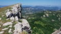
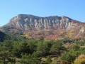
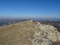
The path leads to the ridges of the Montagne de Chamouse. More or less regular cairns and yellow markings make it easy to find your way. The path runs along the edge of the cliff.
The landscape quickly changes to high-altitude pasture. Continue along the ridges until you reach the summit, marked simply by a sealed granite boulder.
(10) After the summit, continue along the north-west-facing ridges (downhill section), following the yellow markings, until you reach La Tussie.
(11) At the ‘La Tussie’ sign, turn right towards ‘Sous la Tussie’. Yellow markings. The path descends rapidly through boxwood before crossing a beautiful beech forest.
(12) At the “Sous la Tussie” sign, turn left towards “La Borel”. Yellow markings. The path runs through the forest. The track descends steeply at first as a single track, then widens until it becomes passable by vehicle at the end.
Ignore the few side tracks you come across and stay on the track following the yellow markings.
(13) At “Borne 182”, at the junction with a wide track suitable for vehicles, turn right and continue to the next junction, ignoring any side tracks. Yellow markings.
(14) At “Marker 123”, at the junction of two tracks suitable for vehicles, turn right. Ignore the turn-off to the left after 200m and the one to the right after 500m. Stay on the track suitable for vehicles following the yellow markings. The terrain climbs.
(15) After 1.6 km, turn left onto the path running alongside a fenced pasture (watch out for sheepdogs). The junction is also at the change in gradient (there is a slight levelling-off at this point). The path goes round the edge of the pasture.
(16) At the first junction, turn right to continue downhill. You’ll go round a pasture (with cows). After 300 metres, the path passes over a marl deposit.
Follow this path downhill until you reach the farm (visible below).
After 600m, the track widens and becomes suitable for vehicles.
(17) As you leave the farm, at the junction with the tarmac road, turn right. Yellow-red markings (GRP®). Continue along the road to the village of Izon-la-Bruisse. The road goes round the Montagne de Garre.
(18) On reaching the village of Izon-la-Bruisse, at the reservoir, turn right onto the small tarmac road, heading towards the town hall.
At the ‘Izon-la-Bruisse’ sign, follow the signs for ‘Col d’Izon’ (yellow markings). You’ll find yourself on a track suitable for vehicles that climbs steadily. Stay on this main track until you reach the Col d’Izon.
(19) At the “Col d’Olun” sign, turn right towards “Col d’Izon”. Ignore the two turn-offs to the right after 250 metres. Continue along this wide track. There is a picnic table at the pass.
Yellow markings; this track is shared with the MTB route (specific markings: a Yellow Triangle and two dots).
(20) After about 700m, at the Fork in the road, keep right. The track remains suitable for vehicles.
Carry on following the yellow markings. Ignore the only turn-off to the right you come across.
(21) At the ‘Col d’Izon’ sign, turn left towards ‘Pas de Bouvrègues, Ruissas’. Yellow markings. You’ll find yourself on the ridges, with your back to the Montagne de Chamouse.
(22) At the “Clos de Pitoye” sign, carry on straight ahead towards “Col de la Trappe”. Yellow markings. Continue the descent along the ridges.
(23) After about 700m, carry on straight ahead along the ridges, leaving the wide track to your left. The path narrows to a single track.
(24) At the Col de la Trappe, turn right onto the track suitable for vehicles leading downhill. Yellow markings. After 700m, pass the Bergerie de la Trappe and ignore any small side tracks you may come across, staying on the wide track.
(25) At the Fork in the road of trackways, take the track on the right which leads uphill. Leave the track on the left and the yellow markings behind.
Continue along this wide track, ignoring all side tracks. The track climbs steadily all the way.
(26) When you reach a junction on a slight plateau (altitude 1,066 m), carry on straight ahead, ignoring the turn-offs to the left and right. Continue straight ahead, then after 100 m ignore the path on the right, and after 300 m ignore the path on the left (poorly marked).
You will then walk alongside fields of lavender.
(27) Carry on along the edge of the fields and take the path slightly to the left at the edge of the forest. This is an old logging track.
The slope is very steep at the start. The path passes through a gravel pit after a 250m rapid descent.
(28) Continue the descent to the left until you come to a grassy track suitable for vehicles. Head for the Fork in the road at the exit of L’Eydoux.
(2) Turn left to return to the hamlet of Somecure and reach the car park behind the chapel (S/E).

 Visorando Member
 Moderate
 Difficult