Country:

 City:
City:


Access:
- From Gap, take the D994 towards Veynes. 6 km after La Roche-des-Arnauds, turn right onto the D937 towards the Col de Festre and the Dévoluy ski resorts. Continue on the D17 to Saint-Étienne-en-Dévoluy.
- From Veynes, follow the D994 towards Gap. About 3 km further on, turn left at the junction for the Col du Festre (D937). Continue on the D17 to Saint-Étienne-en-Dévoluy.
Drive through Saint-Étienne-en-Dévoluy (D17) then follow signs for L’Enclus/IRAM to the Pont du Villard. Follow signs for the Bure cable car and drive up to the INRAM cable car building (via the small D417 road). Park in front of the memorial.
(S/E) From the cable car building, head up to the left along the small tarmac path.
After 300m, you’ll soon reach a Fork in the road. Continue left onto the track suitable for vehicles, heading south. You’ll see orange signposting, as well as red mountain bike markings. You’ll arrive at the “Combe de Corne” signpost.
(1) Continue to the right towards Vallon d’Âne. Take the track. Leave this after about 100 metres. Continue left along the path at the signpost, towards Vallon d’Âne. You will then pass through an uphill section through the woodland. Yellow markings.
Emerge from the wooded area, then after 350m heading south, reach a fork in the road at a slight clearing.
(2) The Fork in the road is simply marked by a wooden post with no sign. Continue straight on in an east-south-easterly direction towards the sheepfold (a clearly visible building on the left). You will soon reach the Pied de Corne (marked by a hiking signpost).
Off-trail route with no markings or signposts.
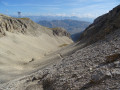
(3) Take the valley heading due south. There are a few scree slopes and steep sections to negotiate during the ascent. Go round the small ledge (on the right) to the left.
After rounding the ledge, you’ll emerge onto a small meadow. A red line is visible on a large loose boulder.
Continue to the left to reach the ridge (northern start of the Coste Belle ridge, large cairn). A cave is visible directly ahead. Pass to the left of it.
Still heading south, stay on the ridge, then follow the mountainside. You’ll reach a more or less marked path. Cairns will appear. Then climb clearly up the grassy slope to the right. You’ll arrive at the entrance to the Coste Belle Cave.
(4) A large cairn with a stick marks the northern entrance to the cave you are to cross (see § Practical Information).
(5) On emerging from the cave, follow the rock face on your right. Head westwards, climbing up a small grassy gully, to reach the summit of the Crête de Coste Belle.
(6) Follow the ridge north-north-east for nearly 500 metres. The descent is steep, over grassy and stony terraces. Continue down until you can pass to the left beneath a large rocky outcrop, heading west. Then cross a scree slope and reach the path leading up towards Denflairar.
(7) Turn left. Red markings. You’ll emerge onto a small grassy pass after a 500-metre climb.
(8) Turn slightly left towards the south. You’ll soon join theGR®® de Pays Tour du Dévoluy trail. Yellow/red markings. Enter the first section of the Combe Ratin.
After a 1.1 km climb, you’ll reach a small pass with grass. Begin the second section of the Combe Ratin. The stony path is in slightly poorer condition. You’ll find yourself below the arrival station of the Bure cable car.
Emerge onto the plateau after a 1.2 km climb through scree slopes. You’ll arrive near the INRAM buildings and the radio telescopes.
(9) Turn sharply left (staying outside the marked construction site area), then begin a long traverse towards the east-southeast. Join the GR® de Pays Tour du Dévoluy. Yellow/red markings. The path is slightly off-course due to ongoing works on the plateau. The new route is well marked with cairns and clearly visible. Descend a little to reach the Selle (alt. 2,511 m).
(10) At the junction with the Combe d’Aurouze path (marked by a cairn), leave theGRP® Tour du Dévoluy. Follow the cairn-marked track to the summit of the Pic de Bure, heading east-southeast. Reach the summit and its large cairn after just over 1 km,
(11) There is an orientation table here (part of it is damaged). The Pic de Bure offers sweeping views across the whole of the Dévoluy, part of the Vercors (Glandasse, etc.) and the high peaks of the Écrins.
Head back down the easy path you took on the way up, to the junction with the GR® de Pays Tour du Dévoluy.
(10) Retrace your steps back to the Observatory buildings.
(9) Turn right, then descend the scree slopes of the Combe Ratin for 2.1 km along the path taken on the way up. Reach the small grassy pass above Denflairar.
(8) Continue to the left, heading west for about 600 metres, until you reach the upper part of the Vallon de Corne. Stay on theGRP®® de Pays Tour du Dévoluy.
(12) When theGRP®® begins to turn north, leave the marked path. Continue westwards, climbing up to reach the rocky ridge.
Approach the cliff face, then follow it on your left-hand side above the wide scree slope of the Baume Noire. The Baume is situated roughly directly beneath the cable car cables below the cliff. Cross the entire scree slope, and take a ‘chamois trail’ towards the Baume Noire.
(13) From the Baume, descend through the entire scree slope to join theGR®® de Pays further down.
Continue the descent into the Vallon Corne. Pass to the left of a pen (with a drinking trough). After more than 1 km along the path, you’ll come out onto a wide, carriageable track, in front of a cable car pylon.
(14) Carry on straight ahead. Further down, leave the path you took on the way up to your right, turn left and continue the descent along the track. It is possible to cut across the hairpin bends (trails marked with trail running signs). You will reach the “Combe de Corne” marker.
(1) Turn left onto the track and then immediately right at the next Fork in the road to complete the descent. You’ll reach the IRAM station (S/E).
 Visorando Member
 Moderate
 Easy
Easy 
 Difficult