Country:

 City:
City:


Access:
- From Embrun, take the N94 towards Gap. Pass through Savines-le-Lac then continue straight on along the D954 towards Pontis / Le Sauze du Lac. After approximately 1.2 km, you will reach the Le Grand Large campsite at Les Eygoires. Park in the designated areas.
- From Gap, take the N94 towards Embrun. Cross the Serre Ponçon bridge at the entrance to Savines-le-Lac, then turn right onto the D954 towards Pontis / Le Sauze du Lac. After about 1.2 km, you’ll reach Le Grand Large campsite at Les Eygoires. Park in the designated areas along the road.
(S/E) Slightly set back, opposite the entrance to the “Le Grand Large” campsite, take the south-facing track suitable for vehicles. There are no signposts. After a few metres, take the ascending path branching off to the left. There is a wooden sign with a hiker painted in blue on it.
(1) At the fork in the road, continue to the right towards Pierre Arnoux (indicated by a wooden sign). At the next fork (not shown on the map), marked by a cairn, continue to the right. The number 7 is painted in red on a white background on a tree trunk (forest plot number). The path continues through the woodland.
(2) You’ll come out onto the Naudet forest road. Continue left along the forest road, then quickly turn right onto the path that joins it. There is a hiking sign here. TheGRP®’s yellow-and-red markings appear (these do not correspond to the IGN map). You’ll come out onto the Route Forestière des Blaches.
(3) Continue to the right along this road for a few steps. Turn left onto the path. Follow the yellow-redGRP® markings. The path winds upwards. Ignore the path coming from the left. Continue to the right, following theGRP® markings. You’ll reach the Route Forestière des Blaches again.
(4) Continue straight on along the path, which climbs steeply through the forest. There are no markings.
You’ll arrive at the Pierre Arnoux car park. Cross the Route Forestière des Blaches.
(5) Carry on straight ahead, following the Empuyère route (wooden sign). The path descends. Orange mountain bike markings are also present.
(6) At the Pré de la Fontaine (spring), carry on straight ahead.GRP® markings: yellow and red. Walk through a beautiful coniferous forest. You’ll come out onto a forest track a few hundred metres further on. Pass the source of the Pignée.
(7) On the forest track, turn left then immediately right onto the path that appears. Leave theGRP® markings behind. A sign reads ‘difficult access to Le Morgon’.
The climb becomes steeper as it winds through several hairpin bends in the forest (see practical information 1). The path takes you closer to the cliffs. A section equipped with a metal ladder allows you to cross. The climb continues at a fairly steep gradient through several hairpin bends. You’ll reach a clearing.
(8) Then follow the stream (if it is flowing). Look out for the hiking marker on the right. Continue to the left towards the Portes du Morgon to enter the cirque (see practical information 2).
Head towards the sheepfold. Pass the watering point (long trough). The track leading to the summit sometimes offers several possible routes, resembling a dry stream bed. It is best to climb up on the right, where there are several cairns. This path also joins the one coming directly from the clearing.
Shortly before the final stretch of the ascent, there is a small flat area. Reach the small viewpoint and then continue along the ridge to reach the summit and its orientation table.
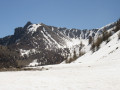
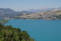
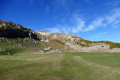
Old markings are sometimes visible (blue or yellow dots). The route remains fairly straightforward right up to the summit. The path is clearly marked. The Pic de Morgon offers a 360° view of Lake Serre-Ponçon and the Cirque de Morgon.
(9) From the summit, continue along the ridges towards the south-east (see practical information 3). The path is clearly visible.
::10;; The first section is downhill, following a path carved into the red rock.
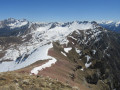
After about 1.2 km, ignore the path on the left which descends into the cirque towards Lake Saint-Pierre. Continue along the ridge, heading south-east. When the path starts to veer more towards the east, you will approach the 2368-metre mark (see practical information 4). The rocky escarpment is just before you reach the Tête de la Vieille. Cross this small pass and then reach the summit of the Tête de la Vieille, marked by a small cairn.
(11) Continue along the ridges. These then turn north-east towards the Pic de Charance. Further on, to reach the 2378-metre peak, you’ll come to another rocky escarpment. The summit is marked by a small cairn. It is easily crossed by going round the Ubaye side (right) and then veering back to the left. Continue along the ridge towards the north-east. Reach the Pic de Charance, whose summit is marked by a cross and a boundary stone.
(12) Take the path on the left leading down into the cirque (old red markings are sometimes visible). Reach the Col de la Baisse, at the crossroads of paths.
(13) Carry on straight ahead towards Pic Martin Jean. You’ll reach it easily.
(14) From the summit, head slightly to the left, skirting the edge of the forest. Stay on the boundary between the forest and the ‘rocky’ ground, heading north-west. There is no marked trail on the ground. The path running below in the cirque is visible. Use this to help you find your way.
You’ll reach the track leading from the Grand Clos car park, then pass in front of the cross known as ‘des Portes’.
(15) From the ‘des Portes du Morgon’ cross, take the track on the right. Follow it downwards until you reach the Grand Clos car park. Cross the car park area to the left whilst continuing along the track.
(16) Leave the track to the left after crossing the Grand Clos car park.
Take theGRP® Tour du Lac de Serre-Ponçon, marked in yellow and red (orange mountain-bike markings are also present). You’ll come to a Fork in the road.
(17) Continue to the left onto the Sentier de la Magnane (wooden sign). Follow the yellow-redGRP® markings (orange mountain bike markings are also present).
Please note: The routehere differs from the IGN map.
Proceed through the woodland. You’ll reach a forest track suitable for vehicles.
(18) You’ll arrive at a small picnic area (just before a torrent that can be crossed); turn left onto the track. Ignore the offshoots at the hairpin bend; stay on the forest track. Follow the yellow-redGRP® markings. The route continues uphill. Reach the Font d’Aubers (small car park, picnic area).
(19) Continue along the track, following theGRP®(Yellow-Red markings), and you will soon reach the junction at the source of the Pignée.
(7) Leave the track by turning right towards Savine. Then follow the same route as on the way out to return to the car park at the Grand Large campsite (S/E).

 Visorando Member
 Average
 Easy
Easy 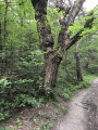

 Difficult