Country:

 City:
City:


Access:The route starts from the hamlet of Les Clops.
Drive through Bédoin, heading towards Chalet Reynard and Mont Ventoux on the D974. At the Station des Lavandes, turn left onto the Chemin de la Montagne. At the Fork in the road, go to the right of the Maison Forestière des Cèdres, then take the Chemin des Clops on the left. Follow the road to the end.
Park in the small dirt-surfaced lay-bys (parking limited to 4 or 5 vehicles).
(S/E) From the car park, take the first track on the far left until you reach the track suitable for vehicles at Les Combarets.
(1) When you reach the ‘Les Combarets’ sign, take the wide track on the left. You’ll find yourself on theGR®91. White/red markings. You’ll come to a junction just before the Pierravon drinking-water reservoir.
(2) Carry on straight ahead along the track (ignore the track leading uphill to the right), passing the reservoir. Take a left-hand bend, then a right-hand bend, and you’ll come to another bend.
(3) Ignore the track going uphill to the right and carry on for about 50m until you reach the “Maraval” sign. Leave the track and continue along theGR®91to the right towards Le Paty. Carry on for about 100m until you reach another junction.
(4) Once again, ignore the track leading uphill to the right and continue along the hillside for about 800 metres, taking a detour to go round Pierravon. Carry on straight ahead until you reach the next junction.
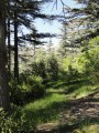
(5) Once again, ignore the path climbing up to the right and take a slight left turn. A series of ups and downs then follows over varied terrain (stony, a carpet of pine needles, etc.). Stay on theGR®91, which is regularly signposted (paint markings and concrete markers) all the way along and continues to follow the mountainside.
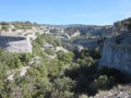
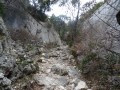
(6) At “Paty or Pâtis” (as shown on the map), turn right towards the Combe de l’Ase. Stay on theGR®91. This point marks the entrance to the Combe Obscure. The first part of the ascent is over rugged terrain (scree, rock, cliffs) where there are several cavities.
In front of the climbing wall, follow the cliff face to the right and continue the ascent up the valley. The second part of the traverse takes place through woodland on softer ground.
(7) At the sign for “Combe de l’Ase or l’Aze on the map”, carry on straight ahead towards Malaucène. Stay on theGR®91.
(8) When you reach the “Combe Obscure” Fork in the road, continue to the right towards Bramafan. Discreet yellow markings. Walk along an old forest track (marked by felled timber).
(9) At the edge of a small clearing, turn right. Continue along the track suitable for vehicles, marked with a Yellow Cross. Carry on along this track until you reach the foot of the climb, where there are numerous cut branches. Climb until you come to a small track running perpendicular to it, where there is a cairn.
(10) Turn left onto the narrow single-track path. There are no markings. Follow this path for about 600 metres. Due to dense vegetation (broom, boxwood), the path is relatively narrow in places.
(11) At the junction, take the old logging track which climbs to the right. Be careful, as this is barely visible because vegetation is overgrowing it (brambles, holm oak). There are no markings. On the flat section, continue to the left along the small, faintly marked path. There is a very discreet blue marking. Be careful to follow the blue markings for about 300m. If the track descends steeply, turn back. The track to follow runs almost along a contour line and faces due east (towards the summit of Mont Ventoux).
(12) After 300m from the previous fork, carry on straight ahead. The path is hidden amongst the vegetation. The section is a little tricky for about fifteen metres, before quickly emerging at the edge of the woodland and into a very open area.
A barely marked path is visible, with a few cairns in place. The terrain is very stony.
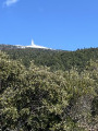
Carry on straight ahead towards the east (with the summit of Mont Ventoux directly in front of you) until you reach a fenced-off field. Go round the field on the left, follow its edge and continue along the narrow path. You should find yourself almost directly opposite a small car park on the D974 (the road coming from Malaucène).
(13) You’ll come to a second fenced-off area; walk past it, going round to the right. The terrain then slopes downwards, facing south. You’ll emerge onto a clearly visible single track marked by cairns. The path descends (quite steeply at times) for about 2.8 km.
When the path crosses a wider track (be careful not to go right at the foot of the descent), turn left. You’ll find yourself back on theGR®91, a section you took earlier on the route. White/red markings.
(5) Then head left up theGR®91, which you have previously followed, for about 900 metres.
(4) Take the track on the left, which climbs quite steeply. The track then turns into a footpath. Blue markings are very sporadic.
Continue the ascent to the plateau (Tête du Gros Charne).
(14) At the large cairn, take the path on the right which descends steeply. Yellow markings. The Baumes des Rochers du Midi are visible ahead.
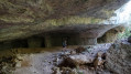
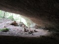
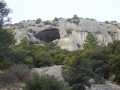
(15) At the ‘Rochers du Midi’ sign, turn right towards Combe de Malaval. The path winds its way beneath impressive limestone arches through lush vegetation. Continue across the Combe de Malaval until you come out onto the wide track you took earlier (GR®91).
(3) On the track, turn left to follow theGR®91uphill for about 400 metres.
Walk past the Pierravon drinking-water reservoir.
(2) After the water reservoir, take the track on the left which climbs steeply. At the start of the ascent, the track is fairly wide and clear. It narrows to a narrow path as you climb. The steep gradient remains fairly consistent throughout the climb. No signposting.
(16) At the junction with theGR®91B, just before the end of the climb, continue straight on along theGR®91B. White/red markings.
(17) At the “Collet Rouge” sign, continue to the right on theGR®91Btowards Collet Rouge Haut.
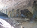
(18) At the “Collet Rouge Haut” sign, turn right (towards Mazanet) onto the wide track suitable for vehicles, then immediately take the path on the right, the entrance to which is marked by a cairn. No markings. Walk past the Baume du Chat. Continue down the Vallon de Baume du Chat through beautiful vegetation (ivy, moss, etc.). The bottom of the descent leads onto theGR®91track.
(19) Take the path straight ahead (no signposting) to reach the car park directly (S/E).


 Visorando Member
 Moderate
 Easy
Easy