Country:

 City:
City:


Access:
- From Saillans, head towards the Col de la Chaudière via the D156. Take the road leading up to the pass. Pass through the hamlet of Les Auberts. Then, after 3.5 km (alt. 844 m), park on the left-hand side near the recycling bins, just before the access road leading to the village of La Chaudière.
- From Bourdeaux, take the access road to the Col de la Chaudière via the D156. Cross the pass (altitude 1,047 m). Drive past the car park leading to the Pas de la Sierra. After a 2.7 km descent, park on the right-hand side near the recycling bins.
(S/E) From the car park, head uphill to the left along the D156 towards the Col de la Chaudière for approximately 900 m. You will come to a small area set back from the road on the right, where a sign indicates the start of the path and warns of its relative difficulty.
(1) From the wooden post marked with a blue dot, follow a fairly wide, ascending track for about 100 metres, then you will soon enter the forest.
You’ll reach a fork in the road marked by a small cairn; continue left onto the path leading into the undergrowth. Red dot markings.
Pass a small stone wall. The path begins to climb steeply in switchbacks through the forest over a carpet of leaves and across numerous roots, on fairly earthy ground. During the ascent, the markings change to blue dots, some of which are partially faded. The track is relatively well marked and punctuated from time to time by cairns.
The track eventually emerges from the tree cover (a small viewpoint on the left) as it reaches the foot of a scree slope and the scree cone of the Passage de la Picourère. There are cairns on the scree slope. However, keep to the left of it, continuing along the path—which is partly overgrown—to avoid walking on the unstable scree.
You’ll reach the foot of the Pas de la Picourère (two arches are visible to the south, easily accessible via a short detour.
(2) Cross the first rocky outcrop with ease. The route follows several small rocky steps. To exit the pass, simply follow the path, which ends on a grassy section and leads onto the synclinal plateau between Roche Courbe (to the right) and Le Signal (to the left).
(3) Head towards Le Signal, following the well-maintained path, and you’ll soon reach the summit of Le Signal.
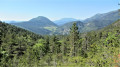
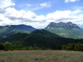
(4) A panoramic view of the Saoû syncline and its ‘perched boat’ shape. On a clear day, the panorama stretches from the Vercors, through the Dévoluy and the Champsaur, over the peaks of the Baronnies Provençales, to Mont Ventoux further south.
Continue southwards to cross over to the Veyou via a descent and a quick climb.
(5) The southernmost peak, and the first of the Trois Becs when approaching from the Col de la Chaudière via the Pas de Siara, it is, unsurprisingly, very popular with walkers.
It offers a fine view of the Montagne de Couspeau and the nearby summit of the Grand Delmas, the Montagne de la Lance, the Cougoir and the Montagne d’Angèle.
Descend along the well-maintained and stabilised path (which deviates from the IGN map) to the Pas de Siara, marked by its hiking signpost.
(6) From the Pas de Siara, follow the path uphill towards Roche Rousse, heading west. Pass the path leading to the Pré de l’Âne. Continue straight on, following a clearly visible track through the grass.
Keep as close as possible to the cliff on your left.
Pass successively alongside several small rocky outcrops; the second of these has a small grassy path leading downwards, which you must not take (the path then comes to an end). Continue climbing above a third rocky outcrop where there is a very slight ledge (a flat rock slab on the ground) with a small cairn. The upper ledge is very exposed; do not venture onto it.
Then take the path heading up the south-west face. At the first bend, you’ll pass an old stone shelter. If you haven’t passed it shortly after leaving the marked section, turn back.
Off-trail route with no markings or signposting whatsoever, requiring a good understanding of the terrain (see § Practical Information)
The grassy track is initially marked with cairns and is wide. The cairns are visible if you look carefully to work out the route to follow. The track is always clearly marked. Generally speaking , do not stray too far from the cliff. The route winds its way across grassy, sloping terrain, alternating between short ascents and descents.
You then pass beneath the distinctive Roche Rousse cliffs, below the western pillar.
From there, the path is barely visible, if at all, due to the tall grass.
Generally speaking, head towards the various visible outcrops, whilst trying to stay more or less at the same altitude, despite the succession of ascents and descents.
The end of the traverse takes you across slightly rockier terrain, requiring you to use your hands briefly from time to time.
Reaching the base of the Pas de Floréal involves crossing a large rock slab.
(7) You’ll emerge onto the meadows of the Pas de Floréal (the hiking marker is visible 50 metres below). Take the path visible on the right, which leads into the woodland.
This path takes you above the forest track (GR®4). Initially heading north-east for 500 m, the path then turns east for 800 m, leading you close to the Virage du Pré de l’Âne, below Les Becs.
Then turn left onto the gently descending path.
(8) At the Virage du Pré de l’Âne (hiking marker), cross the forest track.
Descend into the Grande Combe towards the Auberge des Dauphins. Yellow markings.
This relatively narrow valley remains in the shade and therefore boasts lush vegetation (be careful, as the ground may be slippery).
Continue through this beautiful valley, descending for about 1 km.
(9) Leave the valley just before it curves sharply westwards. The start of the path on the right is barely visible through the thicket of stinging nettles.
Climb over the small hump at the start, where there is plenty of moss. On the other side, you’ll emerge into an old riverbed at the bottom of the valley. The ground is heavily covered in leaves (the route deviates slightly from the IGN map). The path is clear and unambiguous.
You’ll come to a ridge that appears impassable. At the far end, on the left-hand side of the slope, grab hold of an old steel cable (be careful, as part of it is frayed) to climb over the top. The ground is earthy and slippery.
Continue the ascent along the path covered in leaves.
(10) Cut across the forest track onto the GR®9. Continue climbing straight ahead through a clear-cut area. You’ll soon join the wide GR®9 track.
(11) At the fork in the road, stay on the GR®9 and follow the signs for the Rocher de la Laveuse; you’ll soon reach the hiking marker.
(12) Turn left for 100 m to reach the promontory facing the arch at Rocher de la Laveuse.
Access to the arch is restricted to walkers who are comfortable on rocky terrain.
Retrace your steps; facing the signpost, take the path that descends slightly to the north. You can then access the arch directly by making your way across and climbing the rock slabs in front of it.
After a brief visit beneath the arch, retrace your steps once more.
Follow the path running along the cliffs of the north face towards the Col des Auberts. It offers a beautiful vantage point over the entrance to the Diois, the Drôme valleys and the summit of Roche Courbe.
Join the PR® trail again, then climb up to the final peak of the Trois Becs, Roche Courbe (or La Pelle).
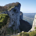
(13) From here, there is a beautiful view of the sculpted cliffs on the eastern face of the syncline.
Head back down towards the south until you reach the exit of the Passage de la Picourère, which you took on the way up.
(3) Descend the Passage de la Picourère until you reach the small ledge which you must climb down to, arriving above the scree cone.
(2) Turn sharply left onto the scree cone. Descend quickly and skirt round the base of the cliff until you reach a wooded area.
Then step onto the ledge. The path is clearly visible from the start. The route presents no technical difficulty, but the track remains narrow and grassy, with a constant exposure to the drop-off.
Follow the ledge running beneath the cliffs of Roche Courbe, over slightly sloping terrain. After skirting part of Roche Courbe, the large arch of the Baume Annibal comes into view.
(14) Below a wooded area, turn left at a small Fork in the road, then follow the path uphill over sandy ground to reach the Baume Annibal.
After exploring this large cave, head back down to the flat area at the Fork in the road.
(14) Then turn left and walk for about ten metres, staying within the wooded area. Look out for the fixed rope on a tree trunk at the edge of the cliff, which you can use to help you descend.
The descent is very steep over loose, crumbly earth. The rope then runs diagonally beneath the rocky outcrop before swinging round to the other side.
Follow the visible track which then heads to the right and approaches the ravine. Descend alongside the ravine whilst staying above it.
When you reach a point almost directly below the ravine, cross it. Make your way through an area of small scree. There are gabions here. A very stony track then comes into view. Follow this track and, after about 250 m, you’ll reach a forest track.
(15) Continue to the right along this track. Carry on descending gently, staying on the track for nearly 1 km. You’ll come out onto the Col de la Chaudière road (D156). Head up to the right to reach the car park (S/E).


 Visorando Member
 Moderate
 Difficult
 Easy
Easy  Local authority