Country:

 City:
City:


Access:
- From Sisteron/Gap, head towards Laragne-Montéglin via the Route Napoléon (D1085 / N85). Follow signs for Barret-sur-Méouge via the D942 (Route des Gorges de la Méouge). Park on the right-hand side in the town hall square, opposite the hotel-restaurant.
- From Nyons/Vaison-la-Romaine, head towards Sédéron/Gap. Then take the D542 local road to Salérans. Continue on the D942 local road towards Barret-sur-Méouge. As you enter the village, park on the left in the town hall square, opposite the hotel-restaurant.
(S/E) From the town hall square, exit the car park on the left. Walk alongside the D942, passing the primary school. You will soon reach the war memorial. Turn left onto the Montée de Barret le Haut. At the next Fork in the road, which you’ll come to straight away, continue uphill to the left along the small tarmac road. The white/red markings ofthe GR®946will then be visible.
(1) After 200 metres, leave the Montée de Barret road. Take the small ascending path that runs alongside a ravine. Follow theGR®946. You’ll come out onto a track suitable for vehicles and continue left along it. After three hairpin bends, you’ll reach the ruins of the Chapelle des Pénitents, next to an old cemetery. Continue along the track, which then turns into a footpath.
(2) At the three-way junction, marked by a cairn, continue to follow theGR®946by turning right. The path descends, then crosses a small stream at the lowest point of the bend. On the path that climbs back up through the coniferous trees, water may also run across the route depending on the season.
After an ascent of around 900 metres, you’ll emerge onto a wide, level stretch. Take the track suitable for vehicles heading north-west, whilst staying on theGR®946, and arrive at the Col de la Croisette (marked as ‘la Crousette’ on the map), where a fire tank is partially buried (tank no. A3).
(3) Ignore the two tracks and take the path heading north, following the sign for “Col Saint-Ange/Circular Crête de Chabre” (hiking marker). Yellow and white/red markings for theGR®946.
The path climbs more steeply through sparse woodland. The vegetation becomes lower as you proceed. After a 1.4 km climb, you’ll reach a wooden marker (no. 366) situated just below the pass.
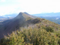
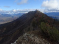
(4) Turn right here and follow the sign for “Les Espranons”. Yellow markings. This path joins the ridge and then follows the entire ridge line of the Montagne de Chabre for nearly 6.5 km (see § Practical Information).
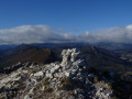
The path winds mainly through broom and boxwood, then through oak trees in places. The markings are old and barely visible in some areas. The poorly maintained path is obscured by vegetation in places. In any case, the route runs along the ridge or slightly below it, always facing south. Reach the summit of Les Espranons, marked by a cairn.
(5) Continue north-eastwards and you will immediately reach the gliding take-off site. Stay on the descending ridge, whilst walking above the track. Pass the orientation table. Continue along the path heading east.
(6) At the “Crête de Chabre” signpost, carry on straight ahead towards Barret-sur-Méouge. Yellow markings.
The path continues eastwards for nearly 2 km, gradually descending to the edge of the Montagne de Chabre. It offers a view overlooking the town of Laragne-Montéglin. The path then turns south and becomes a track suitable for vehicles.
(7) Leave the lovely track by turning right. Follow the mountain bike markings. Walk through the forest and across a cleared area. You’ll reach the ruins of Piloubeau after about 400 metres, then come out onto the track that forms part of theGRP® Tour du Büech, marked in yellow and red.
(8) Continue to the right along this same track. After 200m, you’ll reach another wide track at a hairpin bend. Follow the track on the left as it descends.
(9) Pass the “Serre de la Croix” signpost. Carry on straight ahead, staying on the track and following theGRP® Tour du Büech route. Descend gradually to the hamlet of Pomet (wash house, small chapel) after 2.5 km.
(10) Turn right, then left about fifty metres further on to take the small tarmac road leading into the hamlet. Continue downhill and you’ll begin to catch sight of the Méouge Gorges. Pass the Banc du Bouc viewpoint, where you can cross over the D942 at the small road tunnel. Join the D942 departmental road.
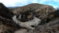
(11) Cross the road carefully, then turn right to follow it along. Next, take the small path leading down to the left (passing between a low stone wall). Walk down to the Romanesque bridge (you can explore the rocky banks of the Méouge). Cross the bridge (on the right bank are the ruins of the old mill) and follow the path on the left which climbs back up, quickly reaching the “La Pinède” signpost.
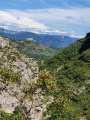
(12) Continue to the right towards Saint-Pierre-Avez. Follow the signposted path (yellow markings andGRP® Tour du Büech-Méouge). Ignore the path on the left that appears shortly afterwards. You will then cross the entire Méouge Gorges on the right bank. Follow the meanders of the Méouge, mostly staying above the river. The path alternates between ascents and descents.
During the final third of the crossing, there are several ravines to cross, some of which have a slight overhang (see § Practical Information).
Pass at the foot of the Rocher du Château, which is partly obscured by vegetation. At this point, the route does not correspond to the IGN map. Cross the Gourgouriou ravines and reach the “Gourgouriou” signpost.
(13) Continue to the left towards Saint-Pierre-Avez. Follow the yellow and yellow/red markings ofthe GRP® Tour du Büech-Méouge. Head back up towards the village, leaving the Gorges de la Méouge behind. As you approach the village, the path turns into a track suitable for vehicles. You’ll reach the “Serre Ballon” marker.
(14) Continue straight on towards Saint-Pierre-Avez. You will pass the “Vallon d’Ourse” and then the “Torrent d’Ourse” signposts in turn (a ford may be required), then take a small tarmac road, still following theGRP® Tour du Büech-Méouge, and enter the village.
(15) At the “Saint-Pierre-d’Avez” signpost (opposite the wash house), go straight on towards Barret-sur-Méouge,following theGRP® markings. Head downhill and pass in front of the cemetery along the small tarmac road.
(16) After 500m, leave the road and follow the track on the left: theGRP® route does not correspond to that shown on the IGN map. Then turn right after 650-+
m, cross the small clearing and head downhill. At the bottom of the descent, turn left. Follow the track, marked by the GRP®.
Continue westwards, fording the Bigarière torrent, then follow the Méouge river again along the right bank on a narrow path. Follow the GRP® markings.
(17) At the “Purgatoire” signpost, turn right towards Barret-sur-Méouge to cross the bridge.
Then turn right after the bridge and head up the small road towards the centre of Barret-sur-Méouge.
(18) Once you reach the “Barret-sur-Méouge” signpost, turn left to return to the town hall square (S/E).
 Visorando Member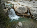
 Moderate
 Difficult