Country:

 City:
City:


Access:
- From Valréas via the D941, at the second roundabout (before reaching the hamlet of Novézan), turn left onto the D538 then take the first track on the right. A sign points towards the ‘Les Terrasses Provençales’ campsite.
- From Nyons, head towards Valréas via the D538. After passing the hamlet of Novézan, at the roundabout, turn right, continuing on the D538, then take the first track on the right. A sign points towards the “Les Terrasses Provençales” campsite.
(S/E) From the car park at the entrance to the small campsite, follow the tarmac Chapelus track to the left, heading south-east then north, right to the end, passing various houses along the way. At the end of the track, continue along the track suitable for vehicles, which climbs gradually up the Chapelus ravine. There are no signposts.
(1) Carry on straight ahead, continuing the ascent along the ravine (ignore the small turn-off to the right, slightly higher up than the track, marked by a cairn with blue markings; this will be the return route). Ignore the turn-off to the left after 300 metres, continuing straight ahead to keep climbing. The track then turns into a single-track path.
(2) Once you reach a flat stretch, take the single track to the left. Follow a variant ofthe GR®9(old, very sporadic white and red markings).
(3) At the Col de la Sausse, turn right to join a wide track running alongside fields and an orchard. No signposting.
(4) After 400m, at the Fork in the road, continue along the track on the right.
(5) At the junction with a wide track, take the track on the left and rejoin theGR®9.
(6) At the junction, carry on straight ahead (north) along the GR®.
(7) At the junction, follow the path that climbs to the left, staying on theGR®9. The path to the right is not very visible.
(8) At the fork in the road, continue along theGR®9to the left. You’ll find yourself on a track suitable for vehicles, partly grassy.
(9) At the next Fork in the road, turn right, staying on theGR®9. You’ll be on a single track.
(10) Continue to the right on theGR®9along the track. The terrain slopes downwards.
(11) After 500m, at the next Fork in the road, leave theGR®9to take the track on the left (no signposting). From this point, the terrain climbs. At a T-junction, turn right.
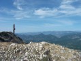
(12) At the next junction, turn right to reach the ridge of the Montagne de la Lance. rejoin theGR®9and follow the ridge northwards. You’ll reach the summit of the Lance, marked by an iron cross.
(13) Descend along the ridge, heading north-north-west, then north-west and finally west, simply following theGR®9.
(14) At the sign pointing towards a lodge, take the path that veers slightly to the right (north-north-west) and leave theGR®9. No signposting.
(15) After 300m, at the crossroads of tracks, continue straight on (north-west). No signposting.
(16) At the edge of a small clearing, take the path on the far right which leads uphill. No signposting.
(17) After 600m, on a slight plateau, turn right (the entrance to the track on the left is obscured by the copses). The route runs across a grassy area for the first 500m, after which the track is better marked. The path leads to the north face of La Lance. On the descent, head deep into the forest. No signposting.
(18) At the junction with a wider track (on a short, gently sloping section), turn right. No signposting.
(19) When you reach a hairpin bend, leave the wide track to take the small path straight ahead through the undergrowth, then immediately turn left at a cairn (do not follow the path straight ahead marked with yellow signposting). The path is quite narrow (with dense vegetation in places) but the route is relatively well marked.
(20) When you reach the foot of the descent, take the track to the right (south). No markings.
(21) At the fork in the road, continue to the left, then straight on. Ignore the paths branching off to the right and then to the left. The path turns into a track suitable for vehicles. Join theGRP® Tour de Pays de Dieulefit, marked in yellow and red, and continue to the right.
(22) When you reach the tarmac road, continue along it, turning right (GRP®).
(23) At the next junction, turn right, still following the GRP®.
(24) At the sign for “Les Lunières” (a ruined house on the right-hand side of the road), leave the tarmac road and continue to the right towards Col de Concourdet. Yellow markings. Ignore the poorly marked turn-offs to the left. Head up the Ravin de la Grand Combe then turn south to climb the Col de Concourdet.
(25) Carry on straight ahead. The track widens. On the descent, ignore a path branching off to the left. Continue following the yellow markings all the way until you cross a ford.
(26) At the ‘Les Favières’ sign, take the track on the right towards the Col de Lachaud. There are no markings. The track remains passable by vehicle all the way to the pass.
(27) At the Col de Lachaud, take the track on the right (yellow and red markings). The single track leads to the foot of the ridges of the Montagne de la Lance. The final part of the climb consists of hairpin bends with a fairly steep gradient.
(28) At the ‘La Grille’ sign at the summit, turn left towards Venterol and rejoin theGR®9, marked in white and red.
(11) When you reach the track you took on the way there, turn left and follow theGR®9back along the same route.
(6) Leave theGR®9by turning right. The track runs alongside a fenced-off field and orchard.
(4) Carry on straight ahead to reach the Col de la Sausse.
(3) Turn left (south-south-east) then right (west).
(2) Carry on straight ahead along theGR®9alternative route, marked intermittently with red and white signs (do not turn right onto the path you took on the way there).
(29) Carry on straight ahead and leave theGR®9variant. No markings. The single track descends steeply and leads to the track at Ravin de Chapelus.
(1) Follow the track to the left and continue downhill. Take the reverse route of the outward journey and head back to the campsite car park (S/E).

 Visorando Member
 Moderate
 Easy
Easy 
 Difficult