


jab31

 Visorando Member
 Premium user
 - Gender: man
Sign up:
Published route(s)
 From Tescou to the west of Sivens
 12.81 mi
 +699 ft
 -699 ft
 6h 30
6h 30
 Difficult
 Departure from Salvagnac (Tarn)
This hike alternates between agricultural areas and the Sivens Forest and is therefore quite shaded for much of the route.
It alternates between marked trails (PR® andGRP®) and unmarked but well-marked passages.
No particular difficulties, apart from the distance. This hike can be enjoyed in all seasons.
Between gariottes and fountains
11.69 mi
+591 ft
-587 ft
5h 55
 Moderate
Departure from Promilhanes (Lot)
Moderate
Departure from Promilhanes (Lot)
This hike on the Limogne plateau allows you to discover the rich rural heritage of this region, including the beautiful traditional Quercy houses with their distinctive gabled roofs.
Most of the route is not officially marked, but it always follows well-marked rural stone paths.
Two Puechs south of Albi
10.34 mi
+1,089 ft
-1,060 ft
5h 40
Moderate
Departure from Le Sequestre (Tarn)
A varied hike between hills (les Puechs) and valleys in the woods and fields south of Albi. You will explore the Albi countryside via several hiking trails (PR®) and unmarked connecting routes.
Going up the Aveyron river
 14.04 mi
+1,368 ft
-1,365 ft
7h 40
Difficult
Departure from Laguépie (Tarn-et-Garonne)
14.04 mi
+1,368 ft
-1,365 ft
7h 40
Difficult
Departure from Laguépie (Tarn-et-Garonne)
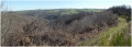
A long circular route that follows the course of the Aveyron river via theGR®36and gently returns to Laguépie from the plateau dotted with hamlets and livestock farms.
Going up the River Aveyron from Laguépie
9.19 mi
+1,033 ft
-1,007 ft
5h 10
Moderate
Departure from Laguépie (Tarn-et-Garonne)
Follow theGR® 36 trail up the Aveyron river, then take the small country roads back to the village of Laguépie.
Dolmen and fountains in the Vaour region
 10.36 mi
+1,404 ft
-1,378 ft
6h 00
Moderate
Departure from Vaour (Tarn)
10.36 mi
+1,404 ft
-1,378 ft
6h 00
Moderate
Departure from Vaour (Tarn)
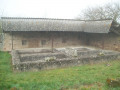
This hike in the Vaour region, between Quercy and Albigeois, alternates between Celtic and Roman paths in a Causse landscape dotted with dolmens and numerous fountains.
Several pretty villages: Saint-Michel-de-Vax, Roussayrolles and Peyralade have remarkable buildings.
The hike offers beautiful panoramic views between the Grésigne forest and the Aveyron valley to the north.
Moderator's note problem in (8), see reviews 02/08/2022
Above the Vère
10.94 mi
+1,716 ft
-1,742 ft
6h 30
Moderate
Departure from Larroque (Tarn) (Tarn)
The route alternates between passages through the Grésigne forest and paths on the Causse plateaus, offering beautiful views of the Vère valley. To the north, you walk along a small stream lined with caves that are not accessible from the path. A shortcut is also available when the Vère is low at the ford.
This hike is a longer version of the "Around the Vère from Saint-Martin d'Urbens" hike published on Visorando.
Around the Pech de Rossignol
10.00 mi
+1,060 ft
-1,053 ft
5h 30
Moderate
Departure from Saint-Beauzile (Tarn)
This route heads into the Grésigne forest via a wide forest track towards Sainte-Cécile du Cayrou to the south. It then returns through vineyards and fields towards Saint-Beauzile across undulating countryside criss-crossed by numerous streams.
A well-maintained wash house provides a useful shelter halfway along the route for a picnic in bad weather!
This walk is a longer version of the “Around Saint-Beauzile” walk published on Visorando.
Between Causse and Ségala
11.43 mi
+1,266 ft
-1,243 ft
6h 20
Moderate
Departure from Castanet (Tarn-et-Garonne) (Tarn-et-Garonne)
Hike through agricultural land, alternating between the stony paths of the Causse plateau to the west and the chestnut forests typical of the Ségala region to the south-east.
Remarkable rural heritage punctuates the trail: cazelles and garriottes, stone bread ovens, wash houses and Quercy houses with conical roofs.
This route is marked along its entire length: aPR®: yellow markings (namedPR®2on the wooden signs) which sometimes follows theGRP® route: red and yellow markings.
From the Tarn to Puech Mergou
10.50 mi
+1,345 ft
-1,319 ft
6h 00
Moderate
Departure from Saint-Juéry (Tarn) (Tarn)
Starting from Les Avalats on the banks of the Tarn, climb up to the agricultural plateau towards Cunac and then head back east towards Marsal through the woods on the left bank of the Tarn.
After the Puech Mergou farm, the return journey is downhill through the woods towards the river and then along the riverbank on a path isolated from the D172.
The route is poorly signposted. The use of GPS is recommended.
The Deer Trail (long version)
11.32 mi
+2,110 ft
-2,103 ft
7h 05
Difficult
Departure from Paulinet (Tarn)
This route offers a wide variety of landscapes: fields, meadows, rivers and forests. Numerous crossings of valleys through which tributaries of the Dadou flow make this hike quite physically demanding. The villages on the hilltops, ridges or valley floors bear witness to farming and livestock rearing that is still active amidst unspoilt nature.
This route combines the Chemin des Bergers in the north with the Sentier du Chevreuil in the south, already described on Visorando, returning via theGR® 36.
The short version of the Méridienne trail
 7.94 mi
+1,109 ft
-1,109 ft
4h 35
Moderate
Departure from Sérénac (Tarn)
7.94 mi
+1,109 ft
-1,109 ft
4h 35
Moderate
Departure from Sérénac (Tarn)
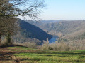
Hike in the Ségala Tarnais, which offers a variety of agricultural and forest landscapes on a schistose subsoil deeply carved by numerous streams and rivers that flow into the Tarn.
This route descends towards the Tarn valley, which you follow for a while before returning to the plateau via the right bank of the Aygou.
This is a yellow-markedPR® trail with signposts at major crossroads.
The long version of the Méridienne trail
 9.95 mi
+1,598 ft
-1,594 ft
6h 00
Moderate
Departure from Sérénac (Tarn)
9.95 mi
+1,598 ft
-1,594 ft
6h 00
Moderate
Departure from Sérénac (Tarn)
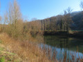
A walk through the Ségala Tarnais, offering a variety of agricultural and woodland landscapes on schist bedrock deeply carved by numerous streams and tributaries of the Tarn.
This route descends towards the Tarn valley, which you follow for a while before returning to the plateau via the left bank of the Aygou.
See practical information regarding the shorter version of this walk.
From (10 to 11) there are no signposts. After that,PR® signposts lead you back to the starting point.
The Miners’ Trail
7.76 mi
+620 ft
-594 ft
4h 05
Moderate
Departure from Tarn
A short walk starting in the north of Albi, following theGR® 36, which has been converted into a greenway.
For most of the route, it is a return walk. This route was once used to transport coal from the Cagnac mines to the Pélissier thermal power station.
From the Aveyron to Bonnan via the Causses
12.23 mi
+2,467 ft
-2,474 ft
7h 45
Difficult
Departure from Montrosier (Tarn)
This hike is a longer version of the hike. The start and finish are the same (points 1 to 7 and 9 to 14 of the short route).
A rugged and fairly challenging hike through magnificent landscapes and natural surroundings.
From Cérou to Zère via Saint-Hippolyte
 9.41 mi
+715 ft
-732 ft
4h 55
Moderate
Departure from Monestiés (Tarn)
9.41 mi
+715 ft
-732 ft
4h 55
Moderate
Departure from Monestiés (Tarn)
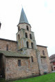
A varied hike through woods, fields and meadows that joins the Zère, a tributary of the Cérou, passing by the Château de Saint-Hippolyte, built in the 14th century and since restored.
Two medieval villages offer an interesting heritage: Monesties, one of the most beautiful villages in France, and Salles-sur-Cérou with its picturesque red sandstone houses.
Black wood, white wood in Quercy
12.02 mi
+1,063 ft
-1,070 ft
6h 25
Difficult
Departure from Puylagarde (Tarn-et-Garonne)
This hike combines two shortPR® trails published by the Quercy-Rouergue Community of Communes, linked by a road and aGRP® trail. Through oak woods, fields and meadows, the route offers typical examples of Quercy rural architecture: bolet houses, dovecotes, wash houses and old farms.
The Tarn’s Tuscany
19.10 mi
+1,339 ft
-1,342 ft
9h 55
Difficult
Departure from Lisle-sur-Tarn (Tarn)
A beautiful, long walk that begins by crossing the Gaillac AOC vineyards, then climbs up the wooded slopes north of Lisle-sur-Tarn, passing several hamlets and chapels.
Boxwood and fountains in Quercy Blanc
9.09 mi
+935 ft
-938 ft
5h 00
Moderate
Departure from Touffailles (Tarn-et-Garonne)
A lovely walk through fields and small woods, along paths lined with Causse oaks and box trees. Numerous springs bubble up at the edge of the plateau, forming fountains and wash houses. The limestone outcrops and the colour of the stones used in the houses are characteristic of Quercy Blanc and the Pays de Serres.
The Sentier des Puechs, long route
 11.01 mi
+1,066 ft
-1,089 ft
6h 00
Moderate
Departure from Montfa (Tarn) (Tarn)
11.01 mi
+1,066 ft
-1,089 ft
6h 00
Moderate
Departure from Montfa (Tarn) (Tarn)
This walk crosses agricultural plateaus, offering the chance to discover beautiful views over the Castraises plains to the south and the Lautrecaises plains to the west. You’ll pass through meadows, woodland and small hamlets along local footpaths or minor country roads.
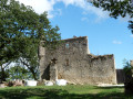
At the end of the walk, the path passes by the foot of Montfa Castle, which was once the home of the ancestors of the painter Henri de Toulouse-Lautrec. His father lived there until the early 20th century. Today, a local association is working to restore this remarkable site steeped in history.
The Sentier des Puechs, short version
7.80 mi
+705 ft
-715 ft
4h 10
Moderate
Departure from Montfa (Tarn) (Tarn)
This hike crosses agricultural plateaus offering beautiful views of the Castraises plains to the south and the Lautrecaises plains to the west. You will cross meadows, undergrowth and small hamlets via communal paths or small local roads.
At the end of the hike, the trail passes by the Château de Montfa, which was the home of the ancestors of the painter Henri de Toulouse-Lautrec. His father lived there until the early 20th century. Today, an association is working to rebuild this remarkable place steeped in history. The trail is markedPR® Yellow throughout.
From the Sentier des Candes to Le Catous
11.43 mi
+2,159 ft
-2,159 ft
7h 10
Difficult
Departure from Saint-Sever-du-Moustier (Aveyron)
A magnificent route at the junction of the Monts de Lacaune and the Rougier de Camarès. This circular route winds around a remarkable village where Art Brut and the Arts Buissoniers intermingle. The paths and forest tracks are often wide and shaded. 85 per cent of the route is off-road and offers beautiful panoramic views of southern Aveyron! The GPX track may prove very useful.