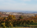
The Miners’ Trail

A short walk starting in the north of Albi, following theGR® 36, which has been converted into a greenway.

For most of the route, it is a return walk. This route was once used to transport coal from the Cagnac mines to the Pélissier thermal power station.

Details

3095373
Creation:
Last update:
Last review:
  • Walking
    Activity: Walking
  • ↔
    Distance: 7.76 mi
  • ◔
    Average duration: 4h 05 
  • ▲
    Difficulty: Moderate

  • ⚐
    Back to start: Yes
  • ↗
    Ascent: + 620 ft
  • ↘
    Descent: - 594 ft

  • ▲
    Highest point: 1,060 ft
  • ▼
    Lowest point: 541 ft

Description of the walk

Park in the small car park next to the Gaillaguès recycling centre.

(S/E) With your back to the recycling centre, set off along the greenway (Chemin des Mineurs), which also forms part of theGR® 36.

(1) At the junction with the small road to Milhars, carry straight on, going slightly uphill.

(2) Pass the Church of Saint-Dalmaze; at the bend, keep left onto the greenway, which leads to a junction on the edge of the solar farm.

(3) Turn left to cross the solar farm, then turn right onto the small road.

(4) Leave the road, turn left and head towards the Mining Museum.

(5) Turn back.

(4) Opposite, take the alternative route slightly to the left, which runs along the edge of the village of Cagnac-les-Mines. Follow the signs for “back to Albi”. About 150 metres further on, turn right into the meadow and continue to a sports ground.

(6) Veer right as you head downhill along a wide path.

(3) At the junction, turn left onto a footpath: follow the old route of theGR® 36 to rejoin the greenway.

(2) Once back on the greenway, turn left to return to Saint-Dalmaze Church.

(S/E) Walk back in the opposite direction to the recycling centre car park (S/E).

Waypoints

  1. S/E : mi 0 - alt. 551 ft - Gaillaguès recycling centre car park
  2. 1 : mi 1.02 - alt. 541 ft - Route de Milhars
  3. 2 : mi 2.42 - alt. 823 ft - Saint-Dalmaze Church
  4. 3 : mi 2.78 - alt. 853 ft - Junction of circular loop A/ left R/ left
  5. 4 : mi 3.39 - alt. 984 ft - Junction: L/ left – R/ straight ahead
  6. 5 : mi 3.57 - alt. 1,060 ft - Mining Museum
  7. 6 : mi 4.33 - alt. 978 ft - Sports ground, turn right onto the °°GR®°°36
  8. S/E : mi 7.76 - alt. 551 ft - Gaillaguès recycling centre car park

Notes

An easy route on a very well-maintained path.

If the recycling centre car park is full, you can use another car park next to point (1).

Worth a visit

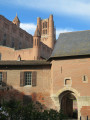
Saint-Dalmaze Church.

Cagnac Mining Museum. A lovely view of the Pyrenees in good weather!

Always be cautious and plan ahead when you're outdoors. Visorando and the author of this route cannot be held responsible for any accidents occurring on this route.

The GR® and PR® markings are the intellectual property of the Fédération Française de Randonnée Pédestre.

Reviews and comments

4.7 / 5
Based on 2 reviews

Reliability of the description
5 / 5
Ease of following the route
5 / 5
Route interest
4 / 5
Cyrilgdp
Cyrilgdp

Overall rating : 4.3 / 5

Date of your route : Jul 18, 2021
Reliability of the description : ★★★★★ Very good
Ease of following the route : ★★★★★ Very good
Route interest : ★★★☆☆ Average
Very busy route : No

This walk is easy. The path is very well maintained – too well, in fact, for my liking: it’s almost entirely tarmacked, so you don’t get to enjoy the coolness of the forest when you’re walking through it; in fact, the width of the path means you sometimes find yourself searching for a bit of shade.

The route is easy and the signposting clear, as you follow a ‘greenway’ almost all the way to the top. When I was there, access to the summit and the mine was closed off due to engineering works towards the end of the route.

Machine-translated

Thut
Thut
• Edited:

Overall rating : 5 / 5

Date of your route : Jun 26, 2020
Reliability of the description : ★★★★★ Very good
Ease of following the route : ★★★★★ Very good
Route interest : ★★★★★ Very good
Very busy route : Yes

A pleasant walk. The path is wide and offers some lovely views.
For the more adventurous: follow the signs for Sainte Marguerite and the GR36 to enjoy even more stunning scenery at the top of the hill near the paragliding launch sites. Walk around the solar farm.

For the very adventurous, there’s the option to carry on to Cap Découverte by following the GR6

Machine-translated

Other walks in the area

For more walks, use our search engine .

The GPS track and description are the property of this route's author. Please do not copy them without permission.