The Hautes Terres d’Oc – short version

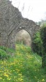
A fairly wild walk in the Monts de Lacaune. Much of the route is unmarked and, at times, runs alongside grazed meadows.
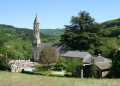
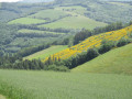
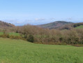
The route, through hilly countryside, often offers beautiful panoramic views; the village remains in sight as you walk.
At the end of the walk, as you descend towards the lake, numerous information boards help you discover the richness of the unspoilt natural landscape of the Monts de Lacaune.

Details

n°48089758
Creation:
Last update:
Last review:
  • Walking
    Activity: Walking
  • ↔
    Distance: 8.65 mi
  • ◔
    Average duration: 5h 05 
  • ▲
    Difficulty: Moderate

  • ⚐
    Back to start: Yes
  • ↗
    Ascent: + 1,240 ft
  • ↘
    Descent: - 1,234 ft

  • ▲
    Highest point: 2,241 ft
  • ▼
    Lowest point: 1,680 ft

Description of the walk

Start from the car park opposite the care home.

(S/E) Take the street on the right which slopes down slightly, then, very soon after, turn left onto Chemin des Acacias.

(1) At the first junction, head straight on along Rue de Verdun. At the next junction, continue straight on along Chemin de la Fabrié, passing through the next hamlet.

(2) At La Fabrié, a path leads down towards the stream. Cross it, then turn right and head uphill.

(3) Follow the path on the left, which climbs steeply towards the ridge. Turn left, heading broadly south, and reach the D 57.

(4) Follow it to the left for a short while, then turn right onto a small road that descends towards the hamlet of La Bardonnié.

(5) At the end of the hamlet, turn right onto the D 59, which descends towards the Ruisseau des Bardes.

(6) After the bridge over the stream, take a path on the left which climbs gradually, skirting a meadow, towards the Prohenquières farm. Please note: make sure you close the gates properly behind you! Pass through Prohenquières and turn right onto the tarmac road leading uphill.

(7) At the junction, take the path on the left, running alongside woodland and fields. When you reach a forest, follow the forest track eastwards, which leads to Château Bousquet.

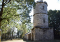
(8) Turn left, walk past the château and then, very soon after, head down to the left onto a path marked in yellow (PR®).

(9) You’ll reach a road. Cross it and continue along theGRP® Hautes Terres D’Oc (marked in yellow and red) as far as the Ruisseau du Frayssé.

(10) Follow the path (GRP®) to the left, which runs alongside this stream until you reach the D 57, on the outskirts of the village of Saint-Pierre-de-Trivisy.

(11) Turn right onto the D 57 for a short distance, then left onto the Chemin des Champs. Walk past the cemetery.

(12) Leave theGRP® and head downhill to the left onto aPR® through the forest until you reach a lake.

(13) At the far end, turn left, then right towards La Broussonié. At the road, turn left and begin the climb towards the village of Saint-Pierre-de-Trivisy.

(14) Take the path on the left which climbs up to the village. At the main road, turn right towards the car park of the care home (S/E).

Waypoints

  1. S/E : mi 0 - alt. 2,024 ft - Car park opposite the care home
  2. 1 : mi 0.17 - alt. 1,959 ft - Junction. Rue de Verdun
  3. 2 : mi 0.72 - alt. 1,749 ft - La Fabrié
  4. 3 : mi 0.99 - alt. 1,716 ft - Turn left as you go uphill
  5. 4 : mi 1.69 - alt. 1,906 ft - D 57
  6. 5 : mi 1.95 - alt. 1,841 ft - D 59
  7. 6 : mi 2.45 - alt. 1,739 ft - Junction. Path on the left
  8. 7 : mi 3.29 - alt. 1,982 ft - Junction. Path on the left
  9. 8 : mi 4.58 - alt. 2,218 ft - Château Bousquet
  10. 9 : mi 5.24 - alt. 2,221 ft - GRP
  11. 10 : mi 5.48 - alt. 2,126 ft - Stream and GRP
  12. 11 : mi 6.62 - alt. 2,047 ft - D 57, on the right
  13. 12 : mi 6.85 - alt. 2,024 ft - PR on the left
  14. 13 : mi 7.75 - alt. 1,703 ft - End of the lake
  15. 14 : mi 8.1 - alt. 1,821 ft - Junction. Path on the left
  16. S/E : mi 8.64 - alt. 2,024 ft - Car park opposite the care home

Notes

A GPS app may be useful, particularly on the first half of the route.

Always be cautious and plan ahead when you're outdoors. Visorando and the author of this route cannot be held responsible for any accidents occurring on this route.

The GR® and PR® markings are the intellectual property of the Fédération Française de Randonnée Pédestre.

Reviews and comments

4.7 / 5
Based on 1 review

Reliability of the description
5 / 5
Ease of following the route
5 / 5
Route interest
4 / 5
Alanax
Alanax

Overall rating : 4.7 / 5

Date of your route : Apr 25, 2025
Reliability of the description : ★★★★★ Very good
Ease of following the route : ★★★★★ Very good
Route interest : ★★★★☆ Good
Very busy route : No

A lovely route overall, very easy.
Not many panoramic views, but lovely paths through woods and meadows, past streams and lakes, farms and a castle.
Not too much tarmac, but there’s an unpleasant stretch on the D59 after the shelter for horses and donkeys. There isn’t much traffic, but cars do drive fast there.
The short circular loop at the end towards the lake is well worth a detour (follow the signs for the lake along the footpath rather than the forest track).
The route crosses farms and pastures, so watch out for animals – cows and calves can be unpredictable.
At the Fabrié farm, an adorable young border collie followed in my footsteps and kept me company throughout the walk.
She was very friendly and fairly well-behaved, and didn’t cause me any trouble.

Machine-translated

Other walks in the area

For more walks, use our search engine .

The GPS track and description are the property of this route's author. Please do not copy them without permission.