The Tarn’s Tuscany

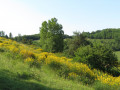
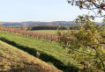
A beautiful, long walk that begins by crossing the Gaillac AOC vineyards, then climbs up the wooded slopes north of Lisle-sur-Tarn, passing several hamlets and chapels.

Details

40814400
Creation:
Last update:
Last review:
  • Walking
    Activity: Walking
  • ↔
    Distance: 19.10 mi
  • ◔
    Average duration: 9h 55 
  • ▲
    Difficulty: Difficult

  • ⚐
    Back to start: Yes
  • ↗
    Ascent: + 1,339 ft
  • ↘
    Descent: - 1,342 ft

  • ▲
    Highest point: 886 ft
  • ▼
    Lowest point: 404 ft
  • ⚐ Country: France
  • ⚐ City: Lisle-sur-Tarn (81310)
  • ⚑
    Start/End: N 43.851195° / E 1.810419°
  • ❏
    IGN map(s): Ref. 2142E, 2241SB, 2242SB
  • Hour-by-hour weather

Description of the walk

Car park on the church square.

(S/E) Head towards the central square (town hall).

(1) Walk along the square on the town hall side, following Rue du Vieil Hôpital. When you reach Place Emmanuel Turle, turn left and follow Avenue Jules Ferry. Walk past a school, then turn right towards the Tarn and walk past Château de Bellevue.

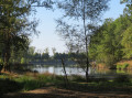
(2) Go round the lake on the right and, at the far end, turn left back towards the road. Leave the lakeside, cross the roundabout and take the Route de Saurs opposite, following it to the junction (cross).

(3) Turn left, then immediately right onto a path through the vineyards. At the junction with another path, turn left towards theGR®46.

(4) Follow theGR®46to the right, heading north, following the red and white markings. Further on, cross the D18.

(5) Shortly afterwards, leave theGR®46and head right along the paths between the vineyards, keeping a general north-easterly direction; turn right onto the road, then, before the junction, turn left again onto the paths between the vineyards, still keeping a general north-easterly direction. Turn right onto the road, then left at the junction and continue for about a hundred metres.

(6) Join theGR®®46 again and turn right.

(7) Cross a road in Saurs, then another 200 m further on, and continue for a further 800 m or so.

(8) Leave theGR®® via the second path on the left to cross the D18 and head up the opposite side towards the woods to the north as far as Grisou.

(9) Turn briefly left onto the road that leads downhill, then, after 100 m, turn right onto a narrow path through the woods. Go over a hill and follow the valley floor until you reach a road at Pétro.

(10) Follow it to the right until you reach a junction. Turn left onto the road that crosses the stream, then very soon take a path on the right.

(11) Follow this stony track, which heads towards Le Pouget. Pass through this hamlet and continue to the junction.

(12) Turn right onto the road to Montaigut, then left as you go downhill, and left again at the Fork in the road for 200 m.

(13) Turn left, heading due south, onto a grassy path that descends towards a small valley, then runs diagonally alongside a stream. You’ll reach a road.

(14) Head back up the road opposite and walk through the hamlet of Les Ravalisses to reach a crossroads.

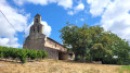
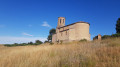
(15) Turn left, then go straight on round the bend in the road and, at the top of a short, steep slope, you’ll reach the Chapel of Montaigut.

(16) Return to the crossroads.

(15) Head straight on, then immediately, before the cemetery, turn right down the path, markedPR® Yellow. Join a road and follow it to the left for about 250 m.

(17) At the junction at the bottom of the valley, turn right and head uphill towards the hamlet of Les Alberts.

(18) Pass through the hamlet and continue along thePR® path, which leads into the forest on the hillside. Leave a path to Loubersac on your right.

(19) At the junction with a path, head down to the left towards the Ruisseau de Robisteau. Cross it and head back up towards Saint-Étienne de Vionan. Reach this hamlet.

(20) At the top, by the cross, follow the road to the left, continuing to follow thePR® markings. Keep left at the fork.

(21) Follow a path on the left which descends through the meadows. Keep to the yellow markings and, further up, you’ll reach a road.

(22) Follow it to the right, passing a road on your right, and you’ll reach the entrance to Saint-Salvy de Coutens.

(23) Do not go through the hamlet; instead, as soon as you enter, take the path on the right. Follow it to the D18.

(24) Carefully follow this road on the left for about 300 metres, then cross to the right to go round the Bernis estate, following the yellow markings. At the end of the street, on leaving Bernis, continue along the path in the same direction.

(25) Shortly afterwards, turn left onto a path between the vineyards. First turn left then right at the road and continue through the vineyards. You’ll reach a junction.

(26) Keep following thePR® trail, which veers slightly to the right, heading due south. Cross the D14, then carry on straight ahead until you reach the junction after Le Griffoulet.

(27) Take a small road on the right, then at the junction, take a path on the left that follows a stream. At the road junction, first turn right then left and carry on in the same direction.

(28) Cross the D988, go under the railway line, then turn left onto Rue de l’Enclos and then right onto Avenue de la Poste. You’ll arrive at the central square.

(1) Cross it diagonally to return to the church car park (S/E).

Waypoints

  1. S/E : mi 0 - alt. 407 ft - Church car park
  2. 1 : mi 0.1 - alt. 407 ft - Square, town hall
  3. 2 : mi 0.76 - alt. 413 ft - The lake
  4. 3 : mi 1.59 - alt. 430 ft - On the left: cross
  5. 4 : mi 2.2 - alt. 433 ft - To the right
  6. 5 : mi 3.48 - alt. 492 ft - Turn right off the GR
  7. 6 : mi 4.34 - alt. 512 ft - GR 46
  8. 7 : mi 5.43 - alt. 479 ft - Crossing the road
  9. 8 : mi 6.14 - alt. 472 ft - On the left, a narrow path
  10. 9 : mi 6.97 - alt. 876 ft - To the left
  11. 10 : mi 8.19 - alt. 620 ft - Road on the right
  12. 11 : mi 8.81 - alt. 630 ft - On the right: stony path
  13. 12 : mi 9.78 - alt. 886 ft - To the right
  14. 13 : mi 10.12 - alt. 837 ft - On the left: grassy path
  15. 14 : mi 10.82 - alt. 653 ft - Opposite
  16. 15 : mi 11.13 - alt. 699 ft - Round trip - Chapelle Montaigut Lisle sur Tarn
  17. 16 : mi 11.22 - alt. 768 ft - Chapelle Montaigut Lisle sur Tarn
  18. 17 : mi 11.69 - alt. 531 ft - To the right
  19. 18 : mi 12.13 - alt. 705 ft - The Alberts
  20. 19 : mi 12.91 - alt. 778 ft - To the left
  21. 20 : mi 13.66 - alt. 787 ft - Turn left (cross)
  22. 21 : mi 14.13 - alt. 807 ft - On the left: grassy path
  23. 22 : mi 14.94 - alt. 758 ft - To the left
  24. 23 : mi 15.41 - alt. 653 ft - On the right: footpath
  25. 24 : mi 15.98 - alt. 472 ft - D18
  26. 25 : mi 16.51 - alt. 456 ft - To the left: path
  27. 26 : mi 17.01 - alt. 443 ft - To the right
  28. 27 : mi 17.7 - alt. 430 ft - To the right
  29. 28 : mi 18.53 - alt. 410 ft - Crossing the D988
  30. S/E : mi 19.1 - alt. 407 ft - Church car park

Notes

Picnic shelter and beautiful views over the wine-growing valley at the Montaigut chapel.

Water point at the Montaigut cemetery.

The Visorando app is useful for the unmarked sections; given the length of this walk, you mustn’t get lost.

Worth a visit

In Lisle-sur-Tarn: 13th-century church and large covered square.

Always be cautious and plan ahead when you're outdoors. Visorando and the author of this route cannot be held responsible for any accidents occurring on this route.

The GR® and PR® markings are the intellectual property of the Fédération Française de Randonnée Pédestre.

Reviews and comments

4.6 / 5
Based on 3 reviews

Reliability of the description
4.7 / 5
Ease of following the route
4.7 / 5
Route interest
4.3 / 5
ha-thai81
ha-thai81
• Edited:

Overall rating : 3.7 / 5

Date of your route : Nov 18, 2025
Reliability of the description : ★★★★☆ Good
Ease of following the route : ★★★★☆ Good
Route interest : ★★★☆☆ Average
Very busy route : No

Given the distance, we started from point 3 (at the lake), avoiding a 30-minute walk through town. The morning route was uninteresting, winding endlessly through vineyards. Picnic lunch possible at the SAURS wine cellar, where there are benches and tables.
The afternoon was more enjoyable, with beautiful views from slightly higher ground. At point 15, we took a shortcut via the GR trail, which took us back to point 5
making it a hike of about 22 km.
Why the Tarn version of Tuscany?

Machine-translated

petitbob
petitbob

Overall rating : 5 / 5

Date of your route : Sep 24, 2024
Reliability of the description : ★★★★★ Very good
Ease of following the route : ★★★★★ Very good
Route interest : ★★★★★ Very good
Very busy route : No

A superb walk through the sun-drenched vineyards a few days before the start of the grape harvest,
then through streams and valleys overlooked by magnificent villas framed by century-old cypress trees…
Beautiful, exotic landscapes. Magnificent. petitbob.

Machine-translated

smaragdine62
smaragdine62

Overall rating : 5 / 5

Date of your route : Apr 15, 2024
Reliability of the description : ★★★★★ Very good
Ease of following the route : ★★★★★ Very good
Route interest : ★★★★★ Very good
Very busy route : No

A lovely walk in fine weather. Very varied scenery with lovely views and beautiful houses all along the way. We shortened it by 4 km.
Be careful at point 11/12, at a place called Le Pouget: a rather aggressive dog was barking and growling so much that we had to turn back and cut across the fields. Yet the owners were in the house – the door was open – but nobody came out to reassure us.
Perhaps it wasn’t actually vicious, but as a precaution we didn’t go any further.

Machine-translated

jab31
jab31

Good evening,

I can’t find this walk in Lisle-sur-Tarn on the Visorando website!

Never mind! I don’t think hikers will get it mixed up! You don’t set off on a hike of over 30km without checking first!
This walk may not be “officially recognised”, but it was very much enjoyed by all the walkers in my club!
What interests me is precisely combining marked trails (PR and GR) with unmarked paths that link them up and offer a chance to explore unspoilt nature!
Have a lovely evening!

Machine-translated

duabige
duabige

Not to be confused with “La Toscane Lisloise”, which is a certified route.
Although interesting, this route is not officially approved; it is a mix of different trails, some marked and some unmarked.

Machine-translated

Other walks in the area

For more walks, use our search engine .

The GPS track and description are the property of this route's author. Please do not copy them without permission.