Country:

 City:
City:


Park on Place de l’Église, opposite the town hall.
(S/E) Head left, walking down towards the river, the Toudoure.
(1) Turn right onto a small path along the riverbank, cross a small bridge and walk back up to the hairpin bend in the road.
(2) Leave this road and follow a path along the edge of a meadow by the river to the hamlet of Soulié.
(3) Turn right, then immediately left onto a small tarmac road. Continue until the road crosses the river via a bridge.
(4) Follow the path opposite, which crosses the Tourdoure and climbs up to a road; follow this to the right until you reach another bridge.
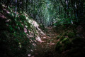
(5) Take a forest track that climbs to the left and carry on until you reach a hairpin bend.
(6) At the junction, turn left and continue northwards to a three-way junction.
(7) Take the second wide track on the right, which continues to climb, until you reach a crossroads of tracks.
(8) Carry on straight ahead, climbing gradually until you reach a clearing.
(9) At the next junction (the highest point of the walk), turn north onto the second track on the left until you reach the edge of the woodland.
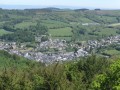
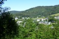
(10) Begin the descent to the right (stunning panoramic views) and follow a wide path through the pastures to the hamlet of Clapayrol, which you cross.
(11) Leave the road and follow a path to the left through the meadows: make sure you close the gates properly. You’ll come out onto the D74.
(12) Cross it carefully, go round the village hall, and cross the stream.
(13) Follow Chemin du Cimetière to the left. Head back towards the centre of the village.
(1) Turn right, pass the church on your right again and continue for about twenty metres.
(14) Turn right into Impasse du Puech.
(15) Take a path leading uphill to the left, as far as Malviès Farm.
(16) Go round the farm and follow the path towards Sallelles across the meadows. Follow the yellow PR® signposts.
(17) Continue along the path, still following the markings. Caution: there are several sheep tracks which can be confusing! The stony path climbs gradually, then descends to reach a fence.
(18) Turn right towards the hamlet of Les Catous, first along a track, then onto a small tarmac road. Follow the Toudoure valley.
(19) At Sallellou, leave the road and follow a narrow path opposite, running alongside the river, which leads to the cemetery.
(13) Opposite, take the Chemin du Cimetière again, which leads to the centre of the village.
(1) Turn right and return to the Place de l’Église (S/E).

 Visorando Member
 Moderate


 Easy
Easy