


gypaetus

 Visorando Member
 Premium user
 - Location: Marseille (13000)
- Gender: man
Sign up:
Published route(s)
 From Ax-les-Thermes to La Tour de Carol
 45.50 mi
 +13,317 ft
 -11,549 ft
 5 days
 Difficult
 Departure from Ax-les-Thermes (Ariège)
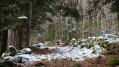
This beautiful Pyrenean hike takes five days; it is intended for hikers accustomed to high-altitude mountain terrain and confident in navigating. It does not present any major difficulties – the route is straightforward – but you do need to be comfortable in high-altitude mountain terrain.
The idea behind this hike is to set off from one railway station and head to another, thus completing a circular route easily without needing a car.
From Ax-les-Thermes to the Prat Redoun refuge
9.35 mi
+3,701 ft
-115 ft
7h 30
Difficult
Departure from Ax-les-Thermes (Ariège)
This hike forms the first stage of a five-day route between Ax-les-Thermes and La Tour-de-Carol. This first stage presents no difficulty unless weather conditions are poor. The start is at Ax railway station, where you follow the road and then a very pretty path that climbs up into the mountains to reach an unstaffed but very comfortable refuge.
This walk is only suitable for hikers accustomed to high-altitude mountain terrain and confident in navigating.
From the Pra Redoun Refuge to the Juclar Refuge
 5.47 mi
+2,884 ft
-1,168 ft
5h 00
5.47 mi
+2,884 ft
-1,168 ft
5h 00
 Average
Departure from Savignac-les-Ormeaux (Ariège)
Average
Departure from Savignac-les-Ormeaux (Ariège)
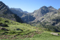
The second stage of the “Ax-les-Thermes to Latour-de-Carol” route; this is a beautiful high-mountain stage with magnificent scenery. Favourable weather is recommended.
This route follows a path which is initially very poorly signposted, climbing steeply towards the first pass, the Col de Behl, before reaching the Refuge de Ruhle, then the beautiful ascent to the Col de Juclar and finally the descent into Andorra towards the manned refuge of the same name.
From the Juclar Refuge to Pas de la Case
 9.19 mi
+1,762 ft
-2,421 ft
5h 45
Average
Departure from Canillo (Andorra)
9.19 mi
+1,762 ft
-2,421 ft
5h 45
Average
Departure from Canillo (Andorra)
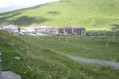
This third stage of the route linking Ax-les-Thermes to Latour de Carol takes you to Pas de la Case… and its hotels and refreshment stops; it is an easy, somewhat long stage that takes place at altitude, mainly along the gentle, grassy ridges of Andorra, but without any difficulty. It is best to tackle this stage in good weather, as landmarks can be misleading, especially if fog sets in.
From the Joaquim Folch i Girona mountain refuge to Latour-de-Carol
 12.57 mi
+951 ft
-4,688 ft
6h 35
Difficult
Departure from Meranges (Girona)
12.57 mi
+951 ft
-4,688 ft
6h 35
Difficult
Departure from Meranges (Girona)
The final stage of the route linking Ax-les-Thermes to Latour-de-Carol. A downhill stage through the valley, the return leg – pleasant but a little long – with a risk of getting lost as you approach the villages. You should also bear train timetables in mind.
From Pas de la Case to the Joaquim Folch i Girona Refuge
 8.68 mi
+4,058 ft
-3,114 ft
7h 30
Difficult
Departure from Porta (Pyrénées-Orientales)
8.68 mi
+4,058 ft
-3,114 ft
7h 30
Difficult
Departure from Porta (Pyrénées-Orientales)
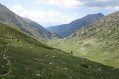
The fourth stage of the route linking Ax-les-Thermes to Latour-de-Carol. A beautiful high-mountain stage with no significant difficulties but featuring some elevation gain.
This stage sets off from Pas de la Case, followed by two small passes and then, a little further down, the Portella Blanca – the ‘white gate’ – which opens onto the descent into the Engaït valley before a final pass. It ends with the descent to the Jhaquim Floch i Girona refuge, which is in poor condition but offers a safe shelter.
From Étang de Soulcem to the Josep M. Monfort Baiau Refuge
 9.00 mi
+4,629 ft
-1,752 ft
8h 10
Difficult
Departure from Auzat (Ariège)
9.00 mi
+4,629 ft
-1,752 ft
8h 10
Difficult
Departure from Auzat (Ariège)
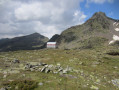
First stage of the 3-day hike that is circular and loops around the Étang de Soulcem. This beautiful, long stage will take us into Catalonia, first passing by small lakes and then through the Port de Bouet, through gentle high-mountain landscapes, over the grassy, undulating slopes of the Ariège and then Catalonia; we finally reach the unmanned Josep M. Monfort Baiau refuge, which is in perfect condition and offers safe shelter (sleeps 9).
Cross-border hiking in the Pyrenees
 24.36 mi
+10,646 ft
-10,650 ft
3 days
Difficult
Departure from Auzat (Ariège)
24.36 mi
+10,646 ft
-10,650 ft
3 days
Difficult
Departure from Auzat (Ariège)
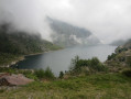
This beautiful Pyrenean route follows trails through Ariège, Catalonia and Andorra; it forms a lovely circular route around the Étang de Soulcem, the starting point of the hike. Accommodation is available, but these are unstaffed mountain huts. It is therefore advisable to bring a tent in case the huts are full or if bad weather forces you to stop.
From the Josep Maria Monfort Baiau refuge to the Les Fonts refuge
 6.49 mi
+2,684 ft
-3,717 ft
5h 20
Difficult
Departure from Alins (Lleida)
6.49 mi
+2,684 ft
-3,717 ft
5h 20
Difficult
Departure from Alins (Lleida)
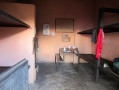
Second stage of the route around Étang de Soulcem. A beautiful high-mountain stage with no major difficulties, despite the Port de Baiau pass, which is impressive and very steep towards the end but poses no real danger if you remain cautious. This is followed by a descent into the valley before climbing back up to spend the night at the unmanned Les Fonts refuge, a typical Andorran refuge with iron beds, a fireplace and an outdoor water point. The view over the Andorran valley is splendid and restful after the exertions of the day.
From the Les Fonts refuge to the Étang de Soulcem
8.87 mi
+3,310 ft
-5,180 ft
7h 00
Difficult
Departure from La Massana (Andorra)
Third and final stage of the circular route around the Étang de Soulcem. A beautiful high-mountain stage that takes us along the long grassy ridge running alongside the Pic del Clot del Cavall before descending into the valley to the Estanys de l’Angonella. We then cross a first pass and then the Port de Rat, which allows us to leave Andorra and reach France and the Étang de Soulcem.
The Calanque de l'Érevine
 3.73 mi
+791 ft
-771 ft
2h 25
Average
Departure from Le Rove (Bouches-du-Rhône)
3.73 mi
+791 ft
-771 ft
2h 25
Average
Departure from Le Rove (Bouches-du-Rhône)
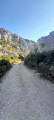
Here is one of the many possible circular routes that will take us to the wonderful Calanque de l’Érevine where you can have a swim; this lovely circular route presents no significant difficulty.However, the Sentier du Douanier, which is very busy at weekends, is steep in places and also features a few slightly exposed sections that require you to watch your step carefully and take extra care if children are present. It may also prove tricky for those prone to vertigo.
Please note: due to high footfall, the rocks can become slippery, even in sunny weather. Sturdy footwear and constant vigilance are essential.A walk best enjoyed in autumn or spring,
This walk is classified as moderate, but the slippery rocks can raise its difficulty level to ‘difficult’.
Ruhle Mountain Hut – Mérens-les-Vals
 7.75 mi
+1,339 ft
-5,069 ft
4h 45
Average
Departure from Ariège
7.75 mi
+1,339 ft
-5,069 ft
4h 45
Average
Departure from Ariège
The final stage of the journey. We set off from the refuge to descend back into the valley, passing through spectacular high-mountain scenery whilst following the well-markedGR®10. There are no particular difficulties apart from a few rather tricky scree slopes.
Le Mas - Amirat
 8.31 mi
+2,480 ft
-2,598 ft
6h 00
Average
Departure from Le Mas (Alpes-Maritimes)
8.31 mi
+2,480 ft
-2,598 ft
6h 00
Average
Departure from Le Mas (Alpes-Maritimes)
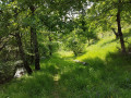
The first stage of the journey through the Haut Estéron region: the landscapes are magnificent and the area extremely wild; we didn’t come across a single other hiker. The trails are varied and well-marked. We’ll set off from the village of Le Mas to reach Amirat (lodge) via the Charamel mountain and the village of Les Mujouls.
Circular route in the Haut-Estéron region
 26.19 mi
+6,932 ft
-6,913 ft
3 days
Average
Departure from Le Mas (Alpes-Maritimes)
26.19 mi
+6,932 ft
-6,913 ft
3 days
Average
Departure from Le Mas (Alpes-Maritimes)
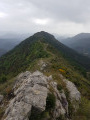
Spectacular landscapes, a remote, wild region, villages nestled in the mountains: you are in the Haut-Estéron region.
Three days’ hiking in this magnificent setting, alternating between paths and tracks through the woods, across the plains and along the ridges, whilst passing through some beautiful, isolated villages.
Amirat - Saint-Auban
 9.15 mi
+2,989 ft
-2,461 ft
6h 50
Difficult
Departure from Amirat (Alpes-Maritimes)
9.15 mi
+2,989 ft
-2,461 ft
6h 50
Difficult
Departure from Amirat (Alpes-Maritimes)
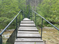
Second stage of the journey through the Haut-Estéron region. This stage takes you to Saint-Auban via the pretty villages of Gars and Briançonnet, then over the somewhat steep Col de l’Escoussier; a variety of landscapes and a trek through wild countryside await!
Saint-Auban - Le Mas
8.61 mi
+1,444 ft
-1,827 ft
5h 15
Average
Departure from Saint-Auban (Alpes-Maritimes)
The final stage of the hike in the Haut-Estéron region; this route mainly follows tracks through the woodland before reaching the ridge of Mount Charamel, which is well worth the detour in its own right: the view is sublime. You then descend gently back down to the village of Le Mas.
In Alta Rocca, around Zonza and Quenza
 9.14 mi
+1,755 ft
-1,772 ft
5h 45
Average
Departure from Zonza (Corse-du-Sud)
9.14 mi
+1,755 ft
-1,772 ft
5h 45
Average
Departure from Zonza (Corse-du-Sud)
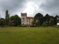
A beautiful walk in the Alta Rocca, following shaded paths cooled by the proximity of numerous streams. You also pass through the village of Quenza, where you can stop for a bite to eat. Best done in mid-season or even in summer when it is very hot.
I have been informed (September 2024) that the walk now starts from the restaurant La Ferme A Stadda, just below Zonza, 200 metres below point no. 1.
From Mérens-les-Vals to Étang de Pédourrés via Étang de Couard
 6.55 mi
+4,052 ft
-400 ft
6h 35
Difficult
Departure from Mérens-les-Vals (Ariège)
6.55 mi
+4,052 ft
-400 ft
6h 35
Difficult
Departure from Mérens-les-Vals (Ariège)
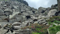
The first stage of the journey! We leave the village of Mérens-les-Vals to reach Étang de Pédourès via the rugged slopes of the Ariège mountains; the scenery is magnificent and very wild. The main difficulty lies between the Étang de Comte and the Étang de Couard, where the well-marked path follows a very long and at times arduous scree slope; once you reach the Étang de Couard, the beauty of the scenery makes up for the hard work.
Walk around Sivergues
 3.93 mi
+587 ft
-568 ft
2h 20
3.93 mi
+587 ft
-568 ft
2h 20
 Easy
Departure from Buoux (Vaucluse)
Easy
Departure from Buoux (Vaucluse)
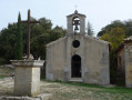
This pleasant walk will allow you to discover the beautiful village of Sivergues and its surroundings while enjoying the coolness along the Aiguebrun and the magnificent site of the Buoux cliffs. It can be done in all seasons and is accessible to all.
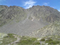
Tour du Carlit starting from Lac des Bouillouses
 12.27 mi
+3,556 ft
-3,556 ft
8h 45
Difficult
Departure from Angoustrine-Villeneuve-des-Escaldes (Pyrénées-Orientales)
12.27 mi
+3,556 ft
-3,556 ft
8h 45
Difficult
Departure from Angoustrine-Villeneuve-des-Escaldes (Pyrénées-Orientales)
A beautiful, long and demanding day’s hike, set in the spectacular, listed landscape of Lac des Bouillouses and Puig Carlit. This hike is only suitable for hikers confident in their navigation skills, as part of the route is off-trail. Best undertaken in good weather, preferably in summer, setting off early. The path leading to Puig Carlit, which is very well marked and safe, features some slightly exposed sections that may pose difficulties for those prone to vertigo.
In the Pays d'Aigues: from Grambois to La Bastide-des-Jourdans
 9.34 mi
+1,358 ft
-1,365 ft
5h 30
Average
Departure from Grambois (Vaucluse)
9.34 mi
+1,358 ft
-1,365 ft
5h 30
Average
Departure from Grambois (Vaucluse)
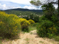
A walk through the Provençal countryside in the magnificent landscapes of the Luberon Regional Nature Park. This route, linking two typical villages in the Pays d'Aigues, follows unmarked paths, often through woodland and away from any traffic.
The landscapes are varied and reflect the richness of the flora and a past that can be glimpsed.
Please note: follow the directions carefully; using a GPS device can provide additional safety.
Circular loop around the village of La Souche
 1.72 mi
+400 ft
-407 ft
1h 10
Easy
Departure from La Souche (Ardèche)
1.72 mi
+400 ft
-407 ft
1h 10
Easy
Departure from La Souche (Ardèche)
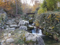
This walk takes you along one of the countless paths winding through the chestnut groves; best enjoyed in autumn, when the stunning colours are at their best. It is truly enchanting!
This walk is an invitation to continue exploring this magnificent Ardèche heritage.
April 2023: route modified at the request of a chestnut grove owner.
This change means walkers will have to cover a little more tarmac road (alas!)
The Petarelle valley, the ridge and the Rocher gorge
 6.91 mi
+1,670 ft
-1,667 ft
4h 40
Average
Departure from Sivergues (Vaucluse)
6.91 mi
+1,670 ft
-1,667 ft
4h 40
Average
Departure from Sivergues (Vaucluse)
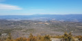
A walk that begins with a refreshing stroll along the Aiguebrun, then climbs up to the ridge of the massif via the Vallon de Petarelle. The descent follows a path that passes through the Rocher Gorge. The scenery is splendid and soothing.
Throughout this walk, you’ll come across numerous remains from a time when this massif was a place of life and sustenance. Best undertaken in spring or autumn.
According to other walkers, it may be better to park in the car park in the village of Sivergues; from there, follow the signposted GRP® route north-eastwards to reach the waypoint (1) via a paved slanting street that descends towards l’Aiguebrun. On the return journey, it is then possible to avoid the short stretch of road and head directly back to Sivergues via the Castelas Equestrian Lodge; you need to turn off after the waypoint (8).
Finally, I have been informed that there are three aggressive dogs between waypoints (3) and (4).
The Cirque des Walkyries via the Homme Mort plateau and the Col de Cortiou
 4.07 mi
+1,739 ft
-1,709 ft
3h 25
Difficult
Departure from Marseille (Bouches-du-Rhône)
4.07 mi
+1,739 ft
-1,709 ft
3h 25
Difficult
Departure from Marseille (Bouches-du-Rhône)
Please note: on 30 September 2025, I was informed that the trail leading to the Pas supérieur de la Melette is now closed, and I do not know for how long.
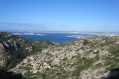
Short but physically demanding, this hike through the Marseilleveyre massif takes us to the Plateau de l'Homme Mort, then to the Col de Cortiou, before climbing the impressive Cirque des Walkyries. There are no exposed sections, but there is a small vertical passage equipped with a rope (Pas supérieur de la Melette) at the end of the climb up the Cirque des Walkyries, where you will need to use your hands to help you. Not recommended for those who are afraid of heights.The magnificent sea view accompanies us for much of the walk.
You are in the Calanques National Park, which is subject to specific regulations. Failure to comply with these regulations may result in a fine of up to €1,500.