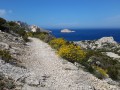
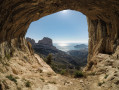
The Vallon de la Jarre via the Trois Arches, starting from Callelongue

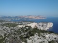
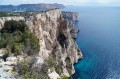
This lovely walk has the advantage, apart from taking place in the magnificent setting of the calanques, of not requiring a car; the whole journey can be made by public transport, so there are no traffic jams on the return journey from Callelongue.
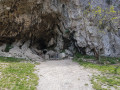
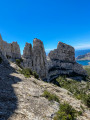
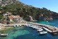
We’ll set off from the pretty little harbour of Callelongue, walking along the coast before climbing up to the Plateau de l’Homme Mort via the Malvallon Médian and the Trois Arches. This is followed by the descent to the Vallon de la Jarre and the return journey by bus.
You are in the Calanques National Park, which is subject to specific regulations. Failure to comply with these regulations may result in a fine of up to €1,500.
In March 2023, a hiker (see Alti’s post) informed me that the historic path had been slightly altered beyond the Trois Arches; I will update the route accordingly as soon as possible.

Details

n°1983506
Creation:
Last update:
Last review:
  • Walking
    Activity: Walking
  • ↔
    Distance: 4.79 mi
  • ◔
    Average duration: 3h 25 
  • ▲
    Difficulty: Difficult

  • ⚐
    Back to start: No
  • ↗
    Ascent: + 1,401 ft
  • ↘
    Descent: - 1,184 ft

  • ▲
    Highest point: 1,217 ft
  • ▼
    Lowest point: 10 ft

Photos

Description of the walk

See the ‘Practical Information’ section for directions to Callelongue.

(S) From Callelongue, follow theGR®51eastwards; this is the ‘sentier des douaniers’ (customs officers’ path) which runs alongside the sea. Continue to the Marseilleveyre calanque.

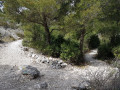
(1) Take the Green trail heading north, passing first through the Plan des Cailles and then climbing gently until you reach the first junction with the Yellow trail, which branches off to the right.

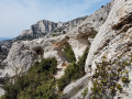
(2) Take this Yellow Trail and very quickly leave the Green Trail, which branches off to the right. Continue along the Yellow Trail up the very steep climb leading to the western summit of the Plateau de l’Homme Mort, passing through the Trois Arches. You will then join the Blue markings, which run alongside the Yellow markings.

(3) Turn right and follow the yellow and blue markings together towards the south-east until you reach a junction. Let the blue trail branch off to the right and continue to follow the yellow trail. Carry on along the hillside until you reach a junction with the green trail.

(4) Take the green trail on the left, down a fairly steep descent through scree in the Vallon de l’Homme Mort. You’ll reach a junction with several trails (green, red and brown). Take the red trail, which quickly leads to the Fontaine de Voire.

(5) Continue along the Red Trail, pass the first barrier, ignore the path branching off to the left at the three-way junction, and reach a second barrier, behind which the car park is located.

Continue along the road (Boulevard Louis Pierotti) until you reach the junction. From here, you can see the shopping centre. Cross the road and wait for bus no. 23 next to the petrol station (E).

Waypoints

  1. S : mi 0 - alt. 13 ft - Callelongue
  2. 1 : mi 1.39 - alt. 10 ft - Marseilleveyre Cove
  3. 2 : mi 2.47 - alt. 404 ft - Junction with the Yellow Trail
  4. 3 : mi 2.99 - alt. 1,217 ft - Blue signpost junction, turn right
  5. 4 : mi 3.49 - alt. 1,053 ft - Junction with the Green Trail
  6. 5 : mi 3.92 - alt. 433 ft - Fontaine de Voire
  7. E : mi 4.79 - alt. 226 ft - Shopping centre, bus stop for route 23

Notes

To get to Callelongue, you need to take bus no. 20, after taking bus no. 19 to the terminus (Madrague de Montredon). Unfortunately, bus no. 20 runs infrequently, so be sure to check the timetables and set off early to avoid the crowds.
On the return journey, bus no. 23 runs much more frequently.

The Yellow Trail, which climbs to the Plateau de l’Homme Mort via the central Malvallon, is very steep and requires a good level of fitness. There is also a slightly exposed section which is not suitable for those prone to vertigo. For this reason, I have chosen to classify this walk as difficult, despite the minimal elevation gain.

Finally, you must take plenty of water – at least one and a half litres per person; this walk is best undertaken in mid-season.

Always be cautious and plan ahead when you're outdoors. Visorando and the author of this route cannot be held responsible for any accidents occurring on this route.

The GR® and PR® markings are the intellectual property of the Fédération Française de Randonnée Pédestre.

Reviews and comments

4 / 5
Based on 2 reviews

Reliability of the description
4 / 5
Ease of following the route
3 / 5
Route interest
5 / 5
gypaetus
gypaetus

Hello
Thank you for your feedback. It is always valuable to have several perspectives on the same passage, as everyone experiences difficulties differently.
Your testimony may help hikers who are apprehensive about the difficulties specific to the Calanques massif.
It seemed to me that the passage from point 2 to point 4 was much easier, but I may be mistaken.
We look forward to hearing feedback from future hikers.
Have a good evening.

Machine-translated

kkzzbb
kkzzbb

Yes, that's what I tried to do (go directly to point 4), but I didn't succeed either...

Machine-translated

gypaetus
gypaetus

Hello Kk
Thank you for your feedback
I don't remember there being an exposed section at point 3, but it could indeed be quite daunting.
To avoid it, you can turn right at point 2 and then join point 4 on the Plateau de l'Homme Mort. It's easier.
Thanks again
Kind regards

Machine-translated

kkzzbb
kkzzbb

Overall rating : 3.7 / 5

Date of your route : Nov 28, 2025
Reliability of the description : ★★★☆☆ Average
Ease of following the route : ★★★☆☆ Average
Route interest : ★★★★★ Very good
Very busy route : No

Warning! The passage to point 3 to cross the pass is really very difficult, you almost end up climbing over scree: I couldn't find the last yellow markings to be sure of the route and it seemed quite dangerous to me, so I ended up turning back... I recommend not going alone and allowing yourself enough time to turn back if necessary.

Machine-translated

gypaetus
gypaetus

Hello Alti.
It’s possible that this route was deemed dangerous because there’s a section that’s slightly exposed… I’d actually mentioned this in the description.
It seems to me that routes aren’t always altered for safety reasons, but sometimes also to preserve areas where walkers no longer go and where wildlife can enjoy more peace and quiet.
I’m thinking of the two green trails that have sadly disappeared, notably the one that climbed up to Béouveyre via the Pas de la Cabre, and the second one that headed towards the Plateau de l’Homme Mort at the Calanque de Podestat.
It’s a shame – I really liked that steep climb through the scree!
Kind regards

Machine-translated

gypaetus
gypaetus

Thank you, Alti, for your valuable information.
I’ve noted this in the walk description and will update the route as soon as possible.
Of course, the route as it has been amended does not yet appear on the IGN maps.
Kind regards

Machine-translated

gypaetus
gypaetus

Mer Ran, it’s true, lunch at ‘Titou et Ninou’ is a truly wonderful experience… but shhh… it’s a secret!

Machine-translated

• Edited:

The user account associated with this content has been deleted.

Other walks in the area

For more walks, use our search engine .

The GPS track and description are the property of this route's author. Please do not copy them without permission.