Country:

 City:
City:


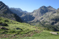
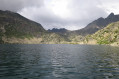
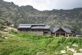
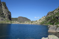
(S) After locking the refuge to prevent animals from entering, we head towards the Col de Belh. This section of the route, which is hardly signposted at all, is, however, clearly marked on the map. It is easy but should only be tackled in clear weather. Heading south-west, follow the stream that flows to the refuge as far as the pass, which is clearly visible and a little steep towards the end.
We continue the ascent along the left bank of the Ruisseau du Najar.
.
(1) You’ll then come across the well-marked GR®10, which heads south-west to the Ruhle refuge via the Terre Negre pass. Here you can enjoy a very unobstructed view, notably of the Ruhle refuge below.
(2) We stay on theGR®10in the same direction to reach the Refuge de Ruhle quickly.
You can stock up on supplies here.
(3) Head straight south along a pleasant hillside path which takes you to the first lake, the Aston.
(4) Continue along the path to Lake Estagnol.
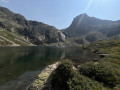
(5) We go round it to the west, then start the climb to the right of the rocky ridge, taking a well-constructed and clearly signposted mule track that climbs steeply up the scree. We emerge at Lac de Juclar.
(6) Continue by skirting the lake to the left, then crossing some scree, which is a bit of a struggle. This magnificent high-mountain landscape makes up for the difficulty. You then easily reach the Collada de Juclar.
(7) You descend by following the path, first down the fairly steep southern slope, then passing between the two lakes: the Primer de Juclar on the right and the Segon de Juclar on the left.
(8) You then climb a little to bypass a difficult section. The route continues easily to the manned Juclar mountain hut (E).
 Visorando Member
 Difficult