From Ax-les-Thermes to La Tour de Carol

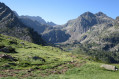
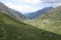
This beautiful Pyrenean hike takes five days; it is intended for hikers accustomed to high-altitude mountain terrain and confident in navigating. It does not present any major difficulties – the route is straightforward – but you do need to be comfortable in high-altitude mountain terrain.

The idea behind this hike is to set off from one railway station and head to another, thus completing a circular route easily without needing a car.

Details

1577647
Creation:
Last update:
Last review:
  • Walking
    Activity: Walking
  • ↔
    Distance: 45.50 mi
  • ◔
    Average duration: 5 days 
  • ▲
    Difficulty: Difficult

  • ⚐
    Back to start: No
  • ↗
    Ascent: + 13,317 ft
  • ↘
    Descent: - 11,549 ft

  • ▲
    Highest point: 8,816 ft
  • ▼
    Lowest point: 2,215 ft

Photos

Stages of the route

This route needs several days, find the details below:

  1. S
  2. 2
  3. 3
  4. 4
  5. E

Notes

I chose to set off from Ax-les-Thermes and head for La Tour de Carol. There are many other options available, but the basic idea remains the same: to travel from one railway station to another along the Toulouse–Ax-les-Thermes line.

This hike takes five days and accommodation is generally available. However, as is always the case in the high mountains, it is safer to take a tent in case the unstaffed mountain huts are full or if bad weather forces you to stop and camp out.

Always be cautious and plan ahead when you're outdoors. Visorando and the author of this route cannot be held responsible for any accidents occurring on this route.

Reviews and comments

4.6 / 5
Based on 3 reviews

Reliability of the description
4.7 / 5
Ease of following the route
4 / 5
Route interest
5 / 5
gypaetus
gypaetus

Thank you, Menthol, for this long and detailed comment, which perfectly describes the walk.
Indeed, I did it in July and conditions in October are very different in the high mountains. In July, there were no muddy paths leading up to the lovely Pla Redoun hut, even though I’d encountered quite a bit of fog (I’d nearly missed the hut, whilst in the middle of a herd of cows)...
As for the section between Rhule and the Juclar refuge: I do indeed recall scree slopes whilst skirting Juclar Lake, but as the weather was fine, it wasn’t a particularly unpleasant experience (I’d noted ‘a few rather tricky scree sections’). At that time of year, there was no trouble finding the path, though there were quite a few people about.
Ideally, it’s possible to avoid the descent to Pas de la Casa by stopping off at Les Bordes d’Envalira; this might be a more pleasant option, and is certainly worth considering. It avoids a rather abrupt return to civilisation!
Well done again – you seem to have legs of steel!

Machine-translated

Menthol
Menthol

Overall rating : 4.7 / 5

Date of your route : Oct 01, 2024
Reliability of the description : ★★★★★ Very good
Ease of following the route : ★★★★☆ Good
Route interest : ★★★★★ Very good
Very busy route : No

Hike

I’ve just finished this hike (first week of October 2024).

First of all, a big thank you to Gypaetus for this route! His instructions were always precise and a great help.

I’ve included my feedback below to supplement Gypaetus’s advice. I’ve split the stages up to cover the route in 4 days instead of 5.

Day 1: From Axe-les-Thermes to the Ruhle mountain hut

The stage does indeed begin with a long tarmac climb. It’s not particularly interesting, but it’s a good warm-up for what follows.

Once you’ve left the tarmac road behind, the only (minor) difficulties on the way to the Prat Redoun refuge are, in my view: the muddy sections (which you need to either go round or cross carefully, even with high-top boots, as they’re deep and slow you down) and the signposting, which I lost track of several times (though if you follow the river, you’ll always find your way back).

I can confirm that the Prat Redoun refuge is still in good condition, but if you’ve got the energy and the time, I’d recommend carrying on to the Ruhle refuge: the view there is magnificent and the unmanned section is in better condition (as the refuge was closed when I passed through, I can’t comment on the manned section).

Day 2: From the Ruhle mountain hut to Pas de la Casa

I’d underestimated the difficulty of the section between the Ruhle mountain hut and the Juclar mountain hut. The terrain is very rugged almost the whole way, particularly with quite a few scree slopes to cross. I had to use my hands several times and lost the markings twice (resulting in a detour of nearly an hour in total). In my case, the weather conditions (rain and fog throughout) only added to the difficulty.

Nothing dangerous or impossible, but in my view you need to take this into account when estimating the time for this stage (I feel that Gypaetus’s guide doesn’t emphasise this point enough, even though it does dedicate half a stage to this 5km section). To give you an idea, setting off from the Ruhle refuge, it took me about 3 hours to cover 5–6 km.

After the Juclar refuge (which is very nice, by the way – I was served a coffee and a slice of cake by the fireside), the terrain becomes more normal. Personally, however, I didn’t get to enjoy it as I had rain and fog for 95 per cent of the day, so I didn’t see the scenery.

For the descent to Pas de la Casa, once you’re back on the tarmac road there are plenty of cars, so it must be easy to hitch a lift down (I didn’t do it, even though the tarmac road is frankly not very pleasant).

In town, the easiest option is to stay in a hotel (I didn’t see any campsites). A very decent room cost me €35. No need to book in advance; there’s a wide range of budget hotels available.

Day 3: From Pas de la Casa to the Milniu mountain hut

Setting off from Pas de la Casa: straight away, a lovely steep climb up the ski runs followed by stony paths, well signposted. At the summit, a descent into a magnificent green valley. The second summit is very steep, but once again the view is well worth the effort.

A magnificent stage (the most beautiful of my hike)! Except for the section from the Joachim Folch i Girona refuge to the Milniu refuge, which is less interesting (through woodland on a rugged path).

The Joachim Folch i Girona mountain hut is basic but perfectly adequate for a night’s sleep (bonus: a stunning view). For my part, I carried on.

Unfortunately, the Milniu refuge, where I’d planned to spend the night, was closed (I knew this – end of the season), but so was the unstaffed section (due to building work, which their website didn’t mention). So I slept in the entrance (a small 2m² space that had been left open) as the forecast predicted sub-zero temperatures and wind for the night (and sure enough, everything outside was covered in frost).

I regret not having carried on to the Feixa refuge (an hour’s walk away, which I passed the next day), which looked much more welcoming and had a lovely view (unlike the Malniu, which is on the edge of the forest).

Day 4: From the Malniu mountain hut to Tour de Carole-Enveitg station

A short and pleasant descent into the valley. A mix of lovely views over the valley and well-maintained forest paths. Well signposted all the way.

Passed through the pretty (but rather quiet) village of Guils de Cerdinya, where there is indeed a drinking fountain opposite the restaurant (which was closed in the morning – never mind the hot coffee).

From the village, as Gypaetus suggested in his comments, I took a shortcut to go directly to La Tour de Carole. This shortcut, which avoids going via Saneja, is very well signposted (in red and white as far as La Tour de Carole, then in yellow from the village to the station, running alongside the railway tracks) and lovely (almost entirely through woodland teeming with wild mulberry trees!).

At the station, Le Bistrot de la Gare serves hearty meals to recharge your batteries whilst waiting for the train.

In summary: a very beautiful, fairly wild route with challenging but enjoyable mountain sections!

As for the season, the route was still perfectly manageable in early October, but it’s best to stay in a mountain hut (unmanned, as the season ends in late September) as night-time temperatures hover around 0 (during the day it’s no problem at all – I even wore a T-shirt).

Please note: the signposting is clearly inadequate; you’ll need to bring paper maps and/or the IGN offline app (no mobile signal for the first two days, and in Andorra, internet usage isn’t included in French mobile plans).

Thanks again, Gypaetus, for your work on this route!

Machine-translated

gypaetus
gypaetus
• Edited:

Hello Isabelle,
Thank you for your feedback; I’m very pleased you went on this walk and your opinion is invaluable. As I have several vehicles, it did indeed make more sense to start at the barns in Savignac and head straight to the Rulhe mountain hut for a night’s stay with a hot meal.
Looking back at the route for the climb up the Col d’Engors, I’m actually surprised myself that I was so vague, and I apologise for that; I’ll correct it. As for the shortcut at the end of the last stage, you were also right to take it; for my part, I’d gone a bit astray because I wasn’t using (or was using very poorly) the GPS at that point…. As a result, I’d fallen behind schedule for the train and ended up staying at a Spanish campsite – which was really lovely!
Your shortcut makes more sense; I’d actually mentioned this option, which at the time seemed rather hit-and-miss; today, that’s no longer the case, which is great!... Hikers doing the walk will find it without any difficulty.
Kind regards,

Machine-translated

Isabelle Ariège
Isabelle Ariège

Overall rating : 4.7 / 5

Date of your route : Jun 26, 2024
Reliability of the description : ★★★★★ Very good
Ease of following the route : ★★★★☆ Good
Route interest : ★★★★★ Very good
Very busy route : No

There were six of us on this hike, which lasted five days from 21 to 25 June. As we preferred to stay exclusively in staffed mountain huts, we extended the first and fourth stages.
For the first stage, we set off from Les Granges de Savignac and climbed up to the Rulhe mountain hut in about six hours, with no difficulties on the ascent of the Col de Belh, aided by the GPX track and good visibility.
The fourth stage – from Pas de la Case to the Malniu refuge – turned out to be a bit long and difficult (but we managed to avoid spending the night in the Joaquim hut, which really isn’t very comfortable!). The descent from Portella d’Engorgs, which was still covered in snow, wasn’t exactly straightforward. Then, for the final stretch between Joaquim and Malniu – signposted as a 1 hour 20 minute walk – it took us 2 hours. The path (despite being the GR11) isn’t very well signposted and some sections are rather exposed… and we were tired! The GPX track, which was very rough from the climb up to the Col d’Engorgs onwards, didn’t help us much.
But everything went well in the end (we arrived at the refuge just in time for dinner!) and the weather was brilliant. For the final stretch, the refuge warden explained the shortcut to us, and we managed to save 2 or 3 km.
We’ll have wonderful memories of this beautiful high-mountain hike. So a thousand thanks to Gypateus for posting it online and for sharing his excellent instructions with us.

Machine-translated

gypaetus
gypaetus

Hello Fred
I don’t understand your question...
As for me, I did this hike three years ago at the end of July...
If you’re planning to do this hike soon, I’ll give you a couple more tips...
If you’ve just done it, could you tell me a bit more about your impressions of the route and any difficulties you encountered?
Kind regards

Machine-translated

Fred555
Fred555

Overall rating : 4.3 / 5

Date of your route : Jul 05, 2022
Reliability of the description : ★★★★☆ Good
Ease of following the route : ★★★★☆ Good
Route interest : ★★★★★ Very good
Very busy route : Yes

Hello,

When are you planning to go on this 5-day hike?

Kind regards

Machine-translated

Other walks in the area

For more walks, use our search engine .

The GPS track and description are the property of this route's author. Please do not copy them without permission.