Ruhle Mountain Hut – Mérens-les-Vals

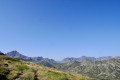
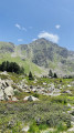
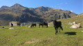
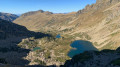
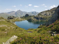
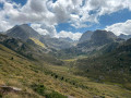
The final stage of the journey. We set off from the refuge to descend back into the valley, passing through spectacular high-mountain scenery whilst following the well-markedGR®10. There are no particular difficulties apart from a few rather tricky scree slopes.

This walk is part of a multi-day hike: D'Ossèse à Mérens-les-Vals

Details

n°1865216
Creation:
Last update:
Last review:
  • Walking
    Activity: Walking
  • ↔
    Distance: 7.75 mi
  • ◔
    Average duration: 4h 45 
  • ▲
    Difficulty: Average

  • ⚐
    Back to start: No
  • ↗
    Ascent: + 1,339 ft
  • ↘
    Descent: - 5,069 ft

  • ▲
    Highest point: 7,982 ft
  • ▼
    Lowest point: 3,448 ft
  • ⚐ Country: France
  • ⚐
    Area: Pyrenees
  • ⚐ City: Ariège (09)
  • ⚑
    Start: N 42.63792° / E 1.726071°
  • ⚑
    End: N 42.65949° / E 1.836943°
  • ❏
    IGN map(s): Ref. 2148ET, 2249OT, 2249OTR
  • Hour-by-hour weather

Photos

Description of the walk

GR® 10 to Mérens-les-Vals

(S) From the Refuge du Rhule, head due east to the Col de Camettes, which is a very easy climb with an elevation gain of just 135 metres.

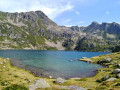
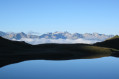
(1) Continue due east. The path remains more or less level before approaching a ‘laquet’ (a small glacial pond), which it skirts to the left, before skirting the Étang Bleu to the right and well above it, over some rather unpleasant scree.

(2) Continue to the Crête de la Lhasse, which you follow for about a hundred metres to the north-east. You will then reach a fork in the path.

(3) Head due south along the hillside, then turn east to descend into the valley; after a long descent ending in a steep slope, you arrive downstream of the Étang de Comte, at the Laquet l’Estagnol.

(4) From there, continue left along theGR®10at the bottom of the valley, on a path that becomes a mule track, often through woodland, to reach, after a long descent, Mérens-les-Vals and its SNCF station (E).

Waypoints

  1. S : mi 0 - alt. 7,188 ft - Refuge du Rulhe
  2. 1 : mi 0.78 - alt. 7,635 ft - Col des Calmettes
  3. 2 : mi 1.72 - alt. 7,169 ft - Scree slope above the Étang Bleu
  4. 3 : mi 2.8 - alt. 7,884 ft - Junction at the Crête de la Lhasse
  5. 4 : mi 4.87 - alt. 5,440 ft - Laquet de l’Estagnol
  6. E : mi 7.75 - alt. 3,461 ft - Mérens-les-Vals. SNCF railway station.

Notes

This final stage takes you to Mérens-les-Vals and its railway station for those wishing to return to civilisation by this very convenient means of transport.

Always be cautious and plan ahead when you're outdoors. Visorando and the author of this route cannot be held responsible for any accidents occurring on this route.

The GR® and PR® markings are the intellectual property of the Fédération Française de Randonnée Pédestre.

Reviews and comments

4.3 / 5
Based on 2 reviews

Reliability of the description
4 / 5
Ease of following the route
4.5 / 5
Route interest
4.5 / 5
jfson12
jfson12

Overall rating : 4.3 / 5

Date of your route : Sep 04, 2026
Reliability of the description : ★★★★☆ Good
Ease of following the route : ★★★★☆ Good
Route interest : ★★★★★ Very good
Very busy route : Yes

This lovely walk is quite long, with plenty of sections over scree and steep descents.
The final section is easy before you reach Mérens.
You should allow a good 6 to 6½ hours, including breaks.

Machine-translated

gypaetus
gypaetus

Thank you, Jean Marc, for your feedback. Indeed, there were no particular difficulties on this section, apart from the rather unpleasant crossing of the scree slope.
Kind regards

Machine-translated

Jean-Marc Sinquin
Jean-Marc Sinquin

Overall rating : 4.3 / 5

Date of your route : Aug 17, 2026
Reliability of the description : ★★★★☆ Good
Ease of following the route : ★★★★★ Very good
Route interest : ★★★★☆ Good
Very busy route : Yes

A walk undertaken at the end of July this year as part of a section of the GR10. No major difficulties.
The highlight of the walk is mainly the first section.

Machine-translated

Other walks in the area

For more walks, use our search engine .

The GPS track and description are the property of this route's author. Please do not copy them without permission.