From the Juclar Refuge to Pas de la Case

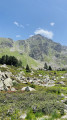
This third stage of the route linking Ax-les-Thermes to Latour de Carol takes you to Pas de la Case… and its hotels and refreshment stops; it is an easy, somewhat long stage that takes place at altitude, mainly along the gentle, grassy ridges of Andorra, but without any difficulty. It is best to tackle this stage in good weather, as landmarks can be misleading, especially if fog sets in.

This walk is part of a multi-day hike: From Ax-les-Thermes to La Tour de Carol

Details

1607257
Creation:
Last update:
Last review:
  • Walking
    Activity: Walking
  • ↔
    Distance: 9.19 mi
  • ◔
    Average duration: 5h 45 
  • ▲
    Difficulty: Moderate

  • ⚐
    Back to start: No
  • ↗
    Ascent: + 1,762 ft
  • ↘
    Descent: - 2,421 ft

  • ▲
    Highest point: 8,566 ft
  • ▼
    Lowest point: 6,850 ft
  • ⚐ Country: Andorra
  • ⚐
    Area: Pyrenees
  • ⚐ City: Canillo 
  • ⚑
    Start: N 42.608049° / E 1.716358°
  • ⚑
    End: N 42.543114° / E 1.735273°
  • ❏
    IGN map(s): Ref. 2148OT, 2148OTR, 2249OT, 2249OTR
  • Hour-by-hour weather

Photos

Description of the walk

(S) Leave the refuge and head down into the valley, following the red and white GRT markings and the yellow markings; after 10 minutes (2,250 m), you’ll come to the first junction with theGRP®. Turn left and continue following the same markings. Carry on down to quickly reach the junction between:
- the red and white GRT, which heads left towards the Siscaro hut,
- and the yellow-marked path leading down into the Val d’Inclès.

(1) Do not follow the clearly marked yellow signposting, otherwise you will have to descend all the way to the Val d’Inclès and then climb back up via the standard route to the Siscaro hut.
Follow the red and white GRT trail closely as it winds along the hillside before descending to the Siscaro hut. You’ll reach the clearly visible junction just before the Siscaro hut.

(2) Do not go all the way to the hut, but bypass the marshy area (Basses dels Basers) on the right, still following the red and white markings, then head due south and, after a grassy climb followed by a turn due west, reach the Étang l’Estany de Baix.

(3) Go round it on the right and continue the climb due south to a first small pass called Pas de Les Vaques (not to be confused with Port Dret).

(4) Follow the ridge line due south for about 15 minutes to reach Port Dret, a clearly marked small pass.

(5) Stay on the red and white GRT, which heads due east, to the left, towards the Portella hut and then towards L’Hospitalet; do not follow it, but continue south-east on theGRP® for 15 minutes until you reach another junction.

(6) Leave theGRP®; it heads off to the right and descends south-west towards Envalira. Continue along a track heading south-east towards the small pass of Ortafà, and reach it.

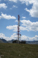
(7) Keep heading south-east along the track leading to Pic del Maïa, which is recognisable by the large aerial towering above it.

(8) Then descend towards the Port d’Envalira along the track, cutting across the grassy slopes. Reach the Port d’Envalira at the junction with the C.G.2 road.

(9) Turn left and follow the road with care as it leads to Pas de la Case, cutting across the hairpin bends where possible. Shortly afterwards, you will reach Pas de la Case (E).

Waypoints

  1. S : mi 0 - alt. 7,536 ft - Juclà Mountain Hut.
  2. 1 : mi 0.33 - alt. 7,395 ft - Encounter on the trail
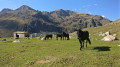
  3. 2 : mi 1.23 - alt. 7,021 ft - Grassy clearing in front of the Siscaro refuge
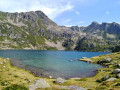
  4. 3 : mi 2.01 - alt. 7,651 ft - Estany de Baix
  5. 4 : mi 2.64 - alt. 8,406 ft - Pas de Les Vaques
  6. 5 : mi 3.04 - alt. 8,412 ft - Port Dret
  7. 6 : mi 3.4 - alt. 8,415 ft - Another fork in the road
  8. 7 : mi 4.15 - alt. 8,323 ft - Collet d’Ortafa
  9. 8 : mi 4.84 - alt. 8,560 ft - Pic del Maïa
  10. 9 : mi 6.43 - alt. 7,907 ft - Port d’Envalira
  11. E : mi 9.19 - alt. 6,850 ft - Pas de la Case.

Notes

There are no water supplies from the Estany de Baix to the Port d’Envalira; make sure you plan ahead as the ridges are exposed to the sun.

(6) This junction is not shown on French maps but is marked on Andorran maps. If possible, make sure you have an Andorran map; this is preferable as French maps are sometimes inaccurate and may lead you astray.

On the descent to Pas de la Case, the proximity to the road is a bit of a nuisance, but it’s the price you pay to reach a comfortable hotel and stock up on food. The hotels in Pas de la Case are inexpensive and welcoming – a guaranteed transition from the great outdoors to consumerist civilisation – but the availability of supplies makes it easier to travel light.

Other walks in the area

For more walks, use our search engine .

The GPS track and description are the property of this route's author. Please do not copy them without permission.